Download
1 / 16
160 likes | 268 Views
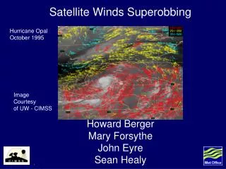
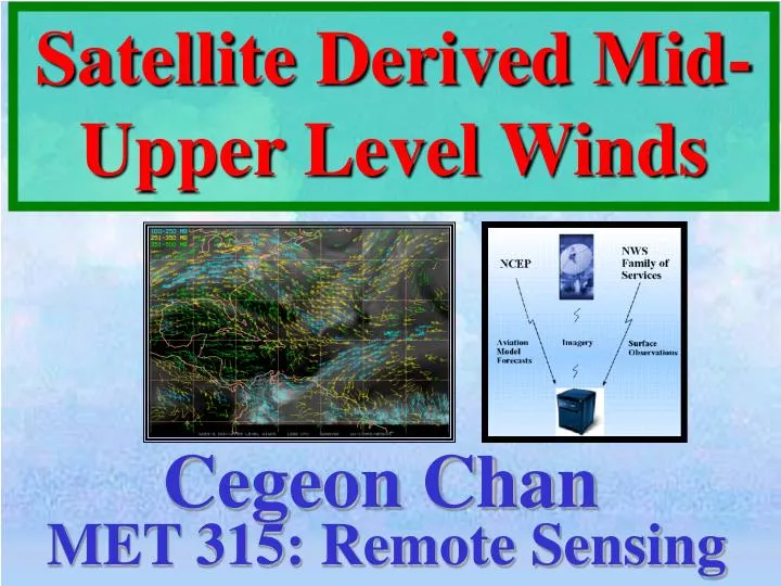
Satellite Derived Mid- Upper Level Winds. Cegeon Chan. MET 315: Remote Sensing. Outline. Importance Instruments Location Tracking Height Assignment Quality Control. http://apollo.lsc.vsc.edu/classes/remote/index.html. Accuracy Summary. Importance. Over oceanic regions

E N D
Satellite Derived Mid- Upper Level Winds Cegeon Chan MET 315: Remote Sensing
Outline • Importance • Instruments • Location Tracking • Height Assignment • Quality Control http://apollo.lsc.vsc.edu/classes/remote/index.html • Accuracy • Summary
Importance • Over oceanic regions • Dvorak Technique • Wind vectors • Numerical Weather Prediction
Different Types • cloud-drift • 2) Water Vapor • 3) Sounder WV • 4) Visible
What does it look like? • Capable of gathering water vapor fields • Measure infrared energy
Imager Sounder • Responsible for NH and SH • Low Frequency • Responsible for the tropics • High Frequency
Tracking Background • Similar to cloud tracking • Algorithm is housed within McIdas! • Very sensitive • Rule: at least 3 images to derive winds to produce 2 vectors • Measures consistency between successive images
Tracking Procedure • Take a small area • Isolate the lowest cloud brightness temperature within a pixel array
Tracking Procedure (cont.) • Compute bi-directional gradients are computed • Cloud-free environments • Generally in moist regimes
Height Assignment • Goal is to ascertain the height level of the feature you tracked • Can be complicated if there are multiple moist layers
Height Assignment (more) • Convert measured radiance into Brightness Temperature • This value is collocated with a model guess temperature S. Velden, Christopher, Christopher M. Hayden, Steven J. Nieman, W. Paul Menzel, Steven Wanzong, James S. Goerss, 1997: Upper-Tropospheric Winds Derived from Geostationary Satellite Water Vapor Observations. Bulletin of the American Meteorological Society: Vol. 78, No. 2, pp. 173–173
Quality Control Algorithm • Slow – using cloud drift winds • Add 8% for 10m/s • Incorporate satellite winds into analysis • Remove those differing significantly from analysis • Yellow = minus satellite • Red = Plus satellite
Accuracy – how good is it? • A particular single level does not represent a layer • Generally good for 50 mb
Sources of Errors • Assumption of clouds and water vapor • Image registration errors • Target identification and tracking errors • Inaccurate height assignment
Summary • Great applications – oceanic analysis, tropical cyclones • Improved numerical weather analysis and prediction systems • Similar to cloud tracking method • Tendency to be slow