Download
1 / 19
200 likes | 456 Views
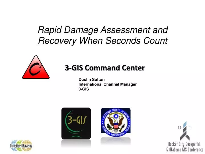
3-GIS Command Center. Rapid Damage Assessment and Recovery When Seconds Count. Dustin Sutton International Channel Manager 3-GIS. Founding Principles for Command Center. We must be prepared for extraordinary events with ordinary measures…else it will fail.

E N D
3-GIS Command Center • Rapid Damage Assessment and Recovery When Seconds Count Dustin Sutton International Channel Manager 3-GIS
Founding Principles for Command Center We must be prepared for extraordinary events with ordinary measures…else it will fail. James Lee Witt, CEO James Lee Witt Associates and former FEMA Director Up-to-date real-time information is a major resource, a critical resource, for effective response to an event. Jim Geringer, Director of Policy and Public Sector Strategies, and former Wyoming Governor True knowledge exists at the edge of the network. OriBrafman, Author, The Spider and the Starfish
Partnership in Progress 3-GIS and JCEMA • Highly Advanced EMA, est1951 • Mapping Users from the beginning • Serving over 8 separate city consumers and many others • Statewide support during crisis events • Reached out to 3-GIS when mobile became a focus of JCEMA • GIS Leader since 2006 • Based on Esritechnology • 2008 & 2011 Esri Business Partner of the Year • Provides solutions to the Gas, Electric, Telecom and Emergency Management Markets • Solutions based on ArcGIS Server, ArcGIS Mobile and FLEX API’s.
Jefferson County EMA The Best of The Best 3-GIS
Key Command Center Usage / Requirements • Storm Assessment & Preparation • First & Second Damage Responders • EOC Communication • Restoration Efforts • Outside Help / Resource Coordination • Public Notification • Post Storm Reporting
The Legacy Building on a Platform of Excellence 3-GIS, Esri, and ESi have teamed together to create the Command Center solution. Command Center provides the functionality to collect information in the field to be used in planning or assessments and react from the field with accurate and timely data . Web access is provided to input, view and analyze data being provide from various sources. Web services are also used to provide simple interfaces and allow ease of data sharing across organizations. The initial version of our Common Operational Picture was released as Mapper, a GIS visualization platform for WebEOC. Mapper is in over 200sitestoday including the Pentagon, the US Senate, Disney World, Delta Airlines and 100s of other sites including utilities, municipalities, private corporation, EMAs, and most branches of the US Government.
Overreaching Value Proposition Command Center Command Center provides tools to aid in recording critical infrastructure(CIP), which provides a basis to develop plans in case of an emergency. Command Center greatly improves the efficiency of understanding the depth of issues while providing the data needed to address the situation in a timely and efficient manner. Command Center provides the platform to allow Utility Companies and Government Agency's to share data in order to address large scale issues as they arise.
Success Stories Jefferson County EMA (Birmingham, Alabama) Jefferson County is a current ESi client. They utilize ESi’sWebEOC and Mapper (3-GIS’ Nx) Products. Command Center was a prototype with JCEMA at the time. In April 2011 the area was hit by an outbreak of tornados. Over 7000homes were damaged with 70% of those homes having major damage of being completely destroyed. Using the Command Center solution, Jefferson County and the city of Birmingham were able to perform/record damage assessments for the 7000 houses in a matter of days. This information was shared amongst the City and County agencies, APCo, Alagasco, Joe Wheeler Electric, FEMA, and Jefferson county EMA. Also Media & Public Portals supported.
Realized Value Proposition The JCEMA ROI “We received our return on investment before the first event happened. By using Command Center to collect much of our Critical Infrastructure and map out areas of greatest concern, we, for one thing, were able to pre-position and avoid dangers thus saving time, money, and equipment. After the tornados, we were able to conduct damage assessments and return the data, reports, and statistics back to FEMA (among others) in record time. We literally cut weeks of the time-to-cash for the victims and allowed us to focus on tangible problems rather than time spent meeting reporting requirements.” Allen Kniphfer Coordinator, JCEMA
Jefferson County The Process Using Field Express and Network Express, users can enter and update Incident and Damage Assessment data from various locations. 1 The Express Solution connects back to Express Server utilizing WebServices. This method provides sharing of data in a more timely manner. Network Express & Nx Web Portals 2 Field Express 1 The data is stored in the Esri Geospatial database allowing the administrators to grant access to other organizations as needed. 3 WEB A WebService will be used to serve up the data for use by the WebEOC Mapper application. 4 2 WebEOC User 4 6 3-GIS custom tools can be used to load Incident and damage assessment data in WebEOC boards as needed. 5 Server Server 5 3 7 Once the Boards are created, standard WebEOC functionality can be used to access and maintain the tabular data. 6 EMA Data base Data base The board data can be accessed by the Mapper application for display and data maintenance. 7
3-GIS Command Center Field Express Network Express ArcGIS Server WebEOC Field Express App Incident Database Geodatabase
Field Data Assessments Resources were trained in a 15 minute session and then were sent out across the area to perform storm damage assessments. The handheld units were self contained and were used to gather data needed for the county’s FEMA reporting. The input forms were modeled after the current FEMA Forms. The field units were GPS enabled to aid in navigation and the integrated camera was utilized to records pictures to document the site inspections. Power outages and issues were also identified for sharing with APCo, et al.
Detailed Data Collected and Published to WebEOC On the left is a WebEOC board used for data input using a web-browser interface. Below is a tablet screen in the field using the data aggregated from all the other sources; ultimately supplying more data to the enterprise directly to and from the field.
APCo – SAFE (Storm Affected Facility Evaluation) Field Express • Retrieve Assigned Work • Review Outages • Record Damage Locations • Add Materials, Activity, Equipment to Location • Review Findings • Save to Central GIS • Mark Work as Completed
Command Center – Data Aggregation Each triangle represents a damage assessment of a building. The findings of the assessment determines the color of the symbol. The status of completely destroyed buildings is red. Over 7000 inspections were completed in less than a week with this solution.
Command Center – Decision Support Network Express • Identify Outage Priorities in conjunction with other Geospatial Events & Limitations • Assign Outages to Work Orders • Assign Crew to Work Order & Coordinate with Agencies • Review Outage Survey Results • Track Resolution & Follow-up Requirements • Generate Required Reports
Command Center – Data Sharing & Reporting Command Center was used to generate reports for each affected area. The report summarized the number of structures, status, and the summary statistics of each municipality.
Recovery Value Proposition • Command Center, using (near) real-time reporting and design tools, can removedaysin service restoration. • Cycle of data-collection and comparison of damage to previously installed plant is instant. No paper to wrestle with. • Work Orders and BOM can be generated during assessments. (Triage) • Repairs can begin in hours…not days. Come by our Booth to see how Recovery really works!
Thank you Network Express Field Express ArcGIS Server WebEOC Command Center: Remove Complexity, ImproveTimeliness, Reduce Error, and IncreaseCommunications