Download
1 / 28
300 likes | 556 Views
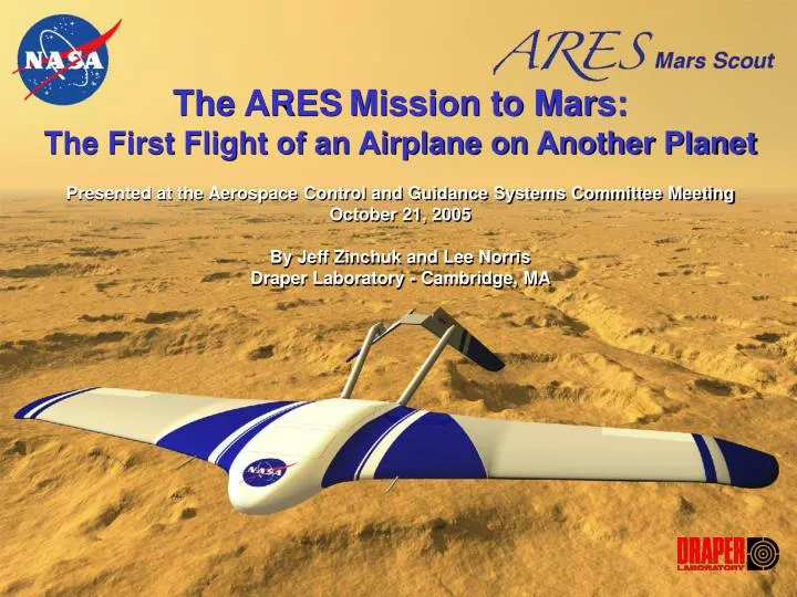
The ARES Mission to Mars: The First Flight of an Airplane on Another Planet Presented at the Aerospace Control and Guidance Systems Committee Meeting October 21, 2005 By Jeff Zinchuk and Lee Norris Draper Laboratory - Cambridge, MA. Topics. Background and Program Overview Science

E N D
The ARESMission to Mars: The First Flight of an Airplane on Another Planet Presented at the Aerospace Control and Guidance Systems Committee Meeting October 21, 2005 By Jeff Zinchuk and Lee Norris Draper Laboratory - Cambridge, MA
Topics • Background and Program Overview • Science • Airplane deployment and ground track • LaRC Planetary Airplane Risk Reduction Activities • Draper Guidance and Navigation Algorithm Activities
ARES Mars Proposal Complements and Extends the Core Mars Program • Exploration of Mars requires gathering scientific and engineering data over large areas of the planet • Airplanes enable exploration of areas inaccessible to rovers with increased resolution over orbiters; blends ground truth of rovers with global measurements of orbiters • Simultaneous in-situ measurements of Mars atmosphere, surface, and interior • Science themes: • Crustal Magnetic anomalies (“where do we come from?”) • Regional atmospheric chemistry (“follow the water”) to determine climate history and ability to support past life * Planetary airplanes are a new platform for planetary science and exploration
Science Themes Builds on Viking, Mars Global Surveyor, and Odyssey discoveries, providing a window into the evolution of Mars atmosphere, surface, and interior Crustal Magnetism • ARES extends MGS-discovered crustal magnetic data to high spatial resolution to understand its nature and origin • An aeromagnetic survey is utilized to characterize the crustal magnetism source structure Near Surface Atmospheric Chemistry • “Follow the water,” chemically-active gases and precise isotopic measurements • Potential gases of biogenic & volcanic origin and atmospheric state variables Underlying Geology & Mineralogy • Geologic understanding of the oldest known crust in the solar system • Understanding mineralogy associated with the crustal magnetic anomalies
Straightforward Mission Architecture Maximizes Use of Proven Technologies and Existing Infrastructure • Short duration, scripted mission minimizes operations complexity • Traverse and measurement techniques similar to those employed on earth • Heritage carrier spacecraft (Genesis/Odyssey) and Entry System (MPF/MER) Launch: Oct-Nov 2011 Flight: August 2012
Head North Science Race Track Science 357.1 km (42.5 min) 302.9 km 36.0 min 28.3 km 3.4 min 5 km 100 km 11.9 min 100 km 11.9 min 100 km 11.9 min 14.1 km 1.7 min 14.1 km 1.7 min N 5 km 0.6 min 800 km total 95.2 min W E 140 km 16.7 min Not to scale! S Approach to Race Track Science Avg ground speed 140 m/s Min turning radius 9 km Avg terrain height 1.5 km 180° W, 45-50° S Flight Path and Navigation Requirements
ARES Status • Draper supported NASA’s Langley Research Center in 2002-3 for a Mars Scout Program Phase A Study “Aerial Regional-Scale Environmental Survey” (ARES) of Mars • Scout Program run on 4-year cycles; complements Mars Exploration Program • ARES one of four proposals (25 submitted) selected for Phase A studies • ARES not selected for implementation (Phases B, C, D) but LaRC will re-propose in ’06 • Phoenix selected; perceived to be low risk • ARES science was rated Category 1 • Some perceived technology development risks (cost/schedule) • ARES Team • JPL - Program management, mission design and operations • LaRC - Atmospheric science and aeronautic • Lockheed - Heritage Genesis-design S/C • Aurora - Airframe subsystems • Draper - Autonomous GN&C and sensors, integrated avionics subsystem (computer/flight software, hardware-in-the-loop simulation (HILSim)
ARES transitions into PARR • During Phase A study, a high altitude drop demonstration (HADD-1) was performed using half-scale model of airplane • Although ARES established viability of airplane-based planetary exploration, implementation risk must be lowered to enable mission selection in ’07 • PARR program objective is to reduce risk in high risk technology areas • Program risk reduction strategy • Use ARES design reference mission and entry system hardware as baseline designs • Demonstrate perceived high risk technology in ground-based tests (HILSim and propulsion components) • Show “system-level” readiness via additional HADDs (2, 3…)
FCS Risk Reduction Tasks for GNC • Develop 6 DOF simulation using airplane performance and environmental models to support analysis and performance characterization of potential GN&C implementations for an airplane flight on Mars • Assess GN&C sensor suites • Assess trajectories • Assess guidance algorithms • Assess navigation algorithms • Develop large Kalman filter for navigation options • Develop guidance algorithms for two types of mission; straight or parallel paths • Incorporate LaRC-supplied control algorithms
Draper Items to Consider • How to improve initial state knowledge (or accommodate large velocity uncertainty) • How to accommodate significant uncertainty in winds • Strategies for altitude determination
PARR Guidance, Navigation, And Control • Mission Data • Nominal Trajectory • ADS Data • Radar Altimeter Data • IMU Data • Initial Condition Data • Other Sensor Data Navigation – determines the position/velocity/attitude state of the aircraft at the current time Guidance – determines the heading and altitude commands necessary to fly the desired path Control – determines the lifting surface and engine commands needed to meet Guidance commands • Position • Velocity • Heading Cmd • Altitude Cmd Control Navigation Guidance • Aileron Cmd • Rudder Cmd • Elevator Cmd • Engine Cmd • Attitude • Body Rates • ADS Data
Aircraft Model And Control System Control System Characteristics • Aircraft model and Control algorithms provided by NASA Langley • Preliminary versions currently in use in Draper 6DOF simulation • Preliminary Navigation and Guidance algorithms are being designed based on this simulation • Primary interfaces to Control are heading command and altitude command • Heading rate command capability may be added at a later date Step Response q 90 deg 60 deg 30 deg t Angular Rate q dot 90 deg 60 30 t
PARR Navigation Baseline Instrumentation Requirements Inertial Measurement Unit (IMU) delta velocity, delta angle • Determine near optimal estimate of current position, velocity, and attitude state of the aircraft for Guidance by blending available sensor data • Estimate the aircraft attitude states needed by Control • Estimate the three components of wind velocity for use by Guidance in implementing the trajectory • Locate previous path points (see below) which can be used in Guidance in implementing a “parallel ground path” trajectory Radar Altimeter • Air Data System (ADS) • Angle Of Attack • Angle Of Sideslip • Airspeed • Barometric Altitude Optional Instrumentation • Camera (Optical Flow) • Sun Sensor • Laser Altimeter • Etc.
PARR Navigation Filter Filter Design State Vector • The Navigation filter blends information from a variety of sensors to form the best estimate of the current state of the aircraft • The relative weightings of the sensor measurements are based on the (statistically expressed) expected qualities of the measurements • A Kalman filter provides the minimum variance linear estimate of the state of the aircraft assuming Gaussian measurement error from the sensors • The Kalman filter estimates not only the aircraft state but also system errors which affect the aircraft state position (3 elements) Rac velocity (3 elements) Vac attitude (3 elements) qac Ab accelerometer errors (9 elements) Asfe Amar Gb gyro errors (9 elements) Gsfe Gmar gravity model error (3 elements) GR wind speed (3 elements) Wned previous path points (12 elements) PPP
Previous Path Points 1.) 2.) • The desired trajectory is nominally oriented with legs 1, 3, and 5 aligned with North • Legs 1, 3, and 5 should be parallel • Legs 1, 3, and 5 are 100 km in length • Legs 2 and 4 are less than 5 km in length 2 • The turns between legs provide observability of the wind • Wind estimates on the first leg will not be precise • As a result, leg 1 may be curved due to unknown wind 5 1 3 1 4 3.) 4.) • Navigation will estimate the location of four points along the first leg • In addition to estimating the current state of the aircraft, Navigation will continue to estimate the location of these four previous points throughout the mission • This allows updating of the estimates when the wind values are better known • The previous path points will be used by Guidance to construct legs 3 and 5 parallel to leg 1
Navigation Results • Relative Navigation error is better than absolute Navigation error • Preliminary covariance analysis indicates relative error of 3 km 1 sigma
PARR Guidance Issues Requirements • Provide heading commands to implement an open loop (non-parallel path) trajectory • Provide heading commands to implement a parallel ground path trajectory • Compensate for the effects of winds along the path for all trajectories • Provide altitude commands to implement the desired altitude profile • The primary issue for Guidance is dealing with the effect of uncertain winds on the groundtrack of the aircraft • The Mars atmosphere is unpredictable and unmodeled • Navigation can accurately estimate a constant wind • The issue is not the speed or direction of the wind, but the degree of variability • If the components of the wind change significantly with time or distance, Guidance will find it more difficult to accurately hold the desired groundtrack
Lateral Channel Guidance • The trajectory will be defined by a series of points along the desired path • These points may be adjusted during the flight to shape the second and third legs to match the shape of the first • Guidance will develop heading commands to lead the aircraft onto the desired trajectory • The heading commands will “look ahead” along the trajectory to anticipate turns • The commanded heading will be adjusted to null the estimated wind so that the desired groundtrack is maintained desired heading d heading command = desired heading + f(d) + f(rate of change of desired heading)
Vertical Channel Guidance Constant Altitude • Three (or more) options exist for the altitude channel as indicated • The requirements for the gravimeter are believed to be “constant altitude” above the ellipsoid • The terrain following approach is most easily implemented using the radar altimeter • The altitude requirements for other science missions are not yet specified • The baseline approach for altitude is modified constant altitude, in which the aircraft flies at a constant altitude unless the distance to the local terrain (as measured by the radar altimeter) goes below a threshold, in which case the aircraft will climb to maintain the threshold Terrain Following Modified Constant Altitude
Guidance Results (Without Wind) • Plot shows a test trajectory used in evaluating Guidance algorithms • Trajectory is the basic shape of the proposed groundtrack for magnetometer studies • Tracking error is least during straight legs • Improved performance is expected as further Guidance development occurs
Guidance And Navigation Trade Studies Alternate Sensors Purpose • At this point the science which drives the mission has not been firmly specified • Several alternative combinations of instruments and trajectories will be evaluated such that when the science requirements are specified, a significant portion of the required design will have been done • The goal is to provide a “catalog” of options which specify the instrumentation and trajectories necessary to meet a variety of objectives • The baseline set of sensors have been evaluated using preliminary covariance analysis and appears to be satisfactory for a variety of missions • Alternate sensors such as a camera with image processing may be required if the trajectory must pass over a specific landmark • Additional sensors may also be required for increased accuracy or redundancy Modified Trajectories Alternate Trajectories • Several non-parallel path trajectories will be assessed (maximum distance North, dogleg, etc.) to support atmospheric science missions • At least one parallel path trajectory will be assessed to support magnetic field studies • New trajectories may arise due to as yet unspecified science requirements • Wind speed and direction are most observable when measurements are made in two orthogonal directions • This implies that wind estimates are generally not accurate until the second leg of a parallel path trajectory • Wind knowledge can be obtained earlier by doing a series of maneuvers prior to initiating leg 1
Program Status • Draper has 6 DOF deterministic simulation up and running • Based on LaRC aerodynamic database and initial control laws • Guidance and navigation algorithms are being integrated to assess navigation performance under various trajectories and sensor suites • Airplane control laws are still being developed at LaRC to incorporate additional control modes for robust deployment and pull out • Focus will be on analyzing absolute and relative navigation performance • 6 month analysis to support science selection and proposal underway • EM model of flight hardware has been procured and is running with first flight software build • GNC code will be embedded in RAD750 flight processor and fly Hardware-in-the-Loop 6 DOF simulation • Processor will be executing airplane flight control, and science data collection, compression, and telemetry