Download
1 / 23
230 likes | 326 Views
Image processing, LiDAR and high resolution 2D interpolation and 3D visualization for data integration. J Ramón Arrowsmith Department of Geological Sciences, Arizona State University, ramon.arrowsmith@asu.edu http://activetectonics.la.asu.edu/GEONatASU/index.htm

E N D
Image processing, LiDAR and high resolution 2D interpolation and 3D visualization for data integration J RamónArrowsmith Department of Geological Sciences, Arizona State University, ramon.arrowsmith@asu.eduhttp://activetectonics.la.asu.edu/GEONatASU/index.htm http://www.geoinformaticsnetwork.org/swgeonet/ With Jeff Conner, Chris Crosby, and Gilead Wurman
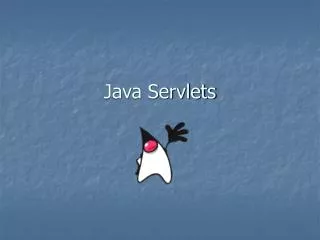
lservlet imsservlet logservlet gservlet Java servlets on ASU GEON NODE
Very useful data, but difficult to locate appropriate scenes, acquire, process and manipulate data for many users. So, we built a system to do “on-the-fly” processing and delivery in a variety of useful formats http://asterweb.jpl.nasa.gov/
ASTER level-1B data have had system radiometric corrections and geometric coefficients applied and are reprojected to a given map projection. 2300 images and counting.
Connection Method • ArcIMS, Java Servlet, Manager Program, Java Implemented Server
Java Servlet – Welcome Screen Display information to user and communicates with the Manager program, relaying relevant information
Java Servlet - Results Screen Display results of IDL processing to user and offer for download processed information (thumbnail and larger *.jpg; *.tar.gz contains full and 8x reduced GEOTIFF [*.tif and *.tfw])
CIR = 3, 2, 1 as Red-Green-Blue (RGB) at 15 m/pixel. Actively photosynthesizing vegetation is red (near-infrared band). Undisturbed bedrock and soils appear as browns, greens, and greys. Built materials and regions typically exhibit blue-green, reddish - purple, and white colors. Downloaded GEOTIFF in ArcScene with DEM base heights.
Users besides ASU: University of New Mexico, University of Nevada Las Vegas, Mesa State University, Texas A&M University, US Forest Service, NASA, University of Arizona, Los Alamos National Laboratory, US Geological Survey, Wisconsin Charter School, University of Nevada Reno Desert Research Institute, Southwest Research Institute +40 in May
LIght Detection And Ranging • Airborne scanning laser rangefinder • Differential GPS • Inertial Navigation System 30,000 points per second at ~15 cm accuracy • $400–$1000/mi2, 106 points/mi2, or 0.04–0.1 cents/point Extensive filtering to remove tree canopy (virtual defor-estation) Figure from R. Haugerud, U.S.G.S - http://duff.geology.washington.edu/data/raster/lidar/About_LIDAR.html
LiDAR data handling and processing - the challenges Hector Mine Earthquake ALSM coverage (Mojave Desert) • Huge datasets: • 8.79 million pts • Files getting larger with higher pulse rate instruments • How do we grid and distribute these data? • ArcGIS can’t handle it easily • Expensive commercial software not an option for most data consumers
GRASS as a processing tool for LiDAR • GRASS: Open source GIS • Interpolation commands designed for large data sets • Splines use local pt density to segment data into rectangular areas for interpolation • Can control spline tension and smoothness • Modular configuration could be easily implemented with in the GEON work flow • EX: User uploads point data to remote site where GRASS interpolation module runs on super computer and returns user a raster file. • Ultimately a gridding utility for all large, computationally intensive data - gravity
What’s next? • Build projection library • Add functionality - TIN, Kriging, “Oskin”-type local plane fits, etc. • More performance testing • Comparison of interpolation algorithms for different landscapes • Migrate to SDSC HP cluster for improved performance • Database import and query • Ties to NCALM and Earthscope • Web-based front end for data distribution San Andreas Laser Scan (Bevis, Hudnut)
Current Architecture Web Services Architecture • JSPs • Socket Connections • Messages passed are a custom Java container class. • Portlets • SOAP • Messages passed are XML Web services become workflow building blocks
Acknowledgements • Colleagues and organizations who have shared data with us. • This work was supported by the US National Science Foundation grants: ITR/IM+AP (GEO) Collaborative research: Creation of a geospatial data system for the transition between the Colorado Plateau and the Basin and Range Provinces (Geoinformatics in Action)--EAR-0112960; and ITR Collaborative research: GEON: a research project to create cyberinfrastructure for the geosciences--EAR-0225543.