Download
1 / 19
190 likes | 337 Views
Bushfires NT. Individual Fire Management Planning Kit. To protect life, property and the environment from the threat of wildfire. Fire in the Tropical Savannas. Darwin. Vernon Fire Control Region. Northern Fire Protection Zone. Katherine.

E N D
Bushfires NT Individual Fire Management Planning Kit To protect life, property and the environment from the threat of wildfire.
Darwin Vernon Fire Control Region Northern Fire Protection Zone Katherine Bushfires NT has 13 brigades in the Vernon region (18 NT wide) with approx 320 volunteers. There are approx 8000 land tenures in the Vernon region, an increase of 25% in 4 years. There were approx 540 fires reported in the Vernon Region in 2005, of which 180 were prescribed burns. The Vernon Region excludes the Wikham Point Gas plant. Vernon Region
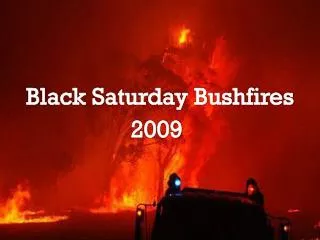
Fire Statistics Darwin River Region 2006 The 2006 dry season saw one of the most destructive wildfires hit the rural area of Darwin River in recent times. As can be seen from the statistics, the fire consumed a large amount of area, destroyed several assets and tied up volunteers and Bushfires NT staff for 3 days. FIRE GROUND 38KM² LAND TENURES BURNT 161 STRUCTURES PROTECTED 113 STRUCTURES LOST 9 ORCHARDS/ HORTICULTURAL FARMS 13 REGISTERED VEHICLES LOST 3 1 LANDOWNER HOSPITALIZED WITH SEVERE BURNS RESOURCES UTILIZED BFNT GFU 23 BFNT TANKERS & HGFU 3 BFNT STAFF VEHICLES 5 VOLUNTEERS PRIVATE VEHICLES 9 NTFRS GFU 1 NTFRS TANKERS 2 HEAVY MACHINERY 4 20,000L TANKER 1 HELICOPTERS 3 BFNT VOLUNTEERS 46 BFNT STAFF 7 NTFRS STAFF 2 NTFRS VOLUNTEERS 4 Vernon Region
Aim of the Kit • To assist landholders to reduce the threat from wildfires to assets, while at the same time protecting life, property and the environment from the threat of Wildfires. • Based on the idea of managing different areas, or zones, on your property in different ways in respect to fire.
Target Group…….you! • Private landholders whose property includes native vegetation • Large or small • Production of bushland retreat
Steps in the Kit • What have you got? This is basically a mapping exercise to assess fire risks and determine how best to manage fire on your property. • Minimise risk to your assets. This step helps you determine where and how to create a low fuel zone around your house and other assets. • Determine how to best manage fire in production areas. For example, where you carry out grazing, horticultural activities, cropping, or hay production. • Identify fire access trails. These are strategically-placed low fuel areas which provide access for fire fighting and/or planned burns e.g. the perimeter of your property and beside fence lines. • Be prepared for wildfire. Bushfires do happen in the Territory, and it’s important to be prepared. • Monitor and Review your plan.
Step 1 What have you got? (a) Assets Mark property boundaries clearly in black. (b) Vegetation types For fire management purposes, these are areas where the primary management objective is conservation of native plants and animals. First, outline these patches on your property in dark green.
Assess fire risks (b) Vegetation Types on your property Sandstone Heath and woodlands Rainforest thicket Paperbark Tall eucalypt forest (Darwin Stringy bark and Darwin Woollybutt-canopy generally taller than 15m. Eucalypt Woodland (Eucalypt canopy generally less than 15m) Creekline vegetation
(c) Fire risks associated with the slopes on your property (d) Fire risks associated with the aspects on your property (e) Considering risk relative to assets (f) Assessing current fuel levels
Step 2 Minimise risk to your assets Keep the area immediately adjoining the house free of fine fuels Remove bushes against house walls; keep lawns short and green; Rake up leaves and twigs. Further out from the house, some trees and shrubs are okay, but: Keep lower branches of trees trimmed; Space shrubs and garden beds to avoid large concentrations of fuel; Slash or mow between trees and shrubs; Remove dead branches; Water gardens and lawns well.
Step 3 Determine how best to manage fire in production areas Keeping fire out of Orchards.Keep fuel loads to a minimum, if slashing, slash should be removed. Have quick fill point at orchard for quick turn around for grass fire units.Remove long grass from base of trees. Burn buffers in the early dry season around orchard if possible. Leave a good sized break against fence lines – make sure branches of trees are not over hanging the fence line. Access to netted orchards is critical for Grass Fire Units, ensure that wires and bracing points allow vehicle access. Guidelines for Hazard Reduction Burns - This should really be discussed with your local fire brigade.
Hypothetical Fire Management Plan Fire Management Plan sheet 1: Property Protection Zone Aim: To minimise risk from wildfire to house garage and shed Fire management strategy: keep fuel loads low through manual and or mechanical removal Production Zone 1 Production activity: Grazing cattle, horses Aim: Maintain grass cover, allow some tree generation Fire management strategy: Burn top of paddock every 2-4 years to encourage fresh grass; only allow every second or third fire to burn to bottom fence, to encourage young trees to grow. Production Zone 2 Production activity: Mango orchard Aim: Allow trees to grow unimpeded, enhance fire safety for shed and house Fire management strategy: Exclude fire, slash between trees every 2 months Bushland Zone 1 Habitat type: Dry eucalypt woodland with shrubby understorey Aim: Maintain diversity of native plants and animals Fire management strategy: Vary intervals between fires from 7 to 25 years. Work with your local fire warden or Bushfires NT staff if prescribed burn becomes necessary
Fire Management Plan sheet 2: Overall task list
Step 4 Determine how best to manage fire in native vegetation areas
(a) Make a note of the fire regimes recommended for the vegetation types on your property.
Step 5 Identify Fire Access trails? A fire access trail is a strategically placed low-fuel area. A fire access trail will not necessarily STOP fire however it can SLOW and REDUCE the intensity of the fire front and provide access for fire fighting. Fire access trails also provide access and boundaries for planned burns. ‘We have used the words “fire access trail” rather than ‘fire breaks” to emphasise that tracks and other low fuel areas should not be relied upon to stop a fire. A ‘fire break” is a fire access trail where all above ground vegetation has been removed down to the mineral earth layer (ie bare ground) or slashed to the height of 25 to 50mm with the slash removed.
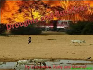
Step 6 Be prepared forwildfire It is essential to be prepared for bushfires at all times, but particularly from April to November, which is recognised as the Top End ‘Fire Season’. A booklet “Don’t Welcome bushfire into your home” – Bushfire prepared Communities is available from Bushfires NT and is a very good guide to precautions that need to be taken by property holders. Preparation and good property maintenance are vital elements in minimising risk to your house and other assets. REMEMBER TO REPORT ALL WILDFIRES! DIAL 89760098
Step 7 Monitor and review your plan. • We strongly suggest you review your fire management plan every year. Although many things will stay the same, others may change. For example, • Are land uses still the same? • Do you have additional assets to protect? • Has experience suggested that fire access trails and protection zones need adjustment? • A yearly review gives you an opportunity to make a new task list for the next 12 months. It will also keep you and your family aware of what to do in the event of a wildfire.