Download

1 / 18
180 likes | 760 Views
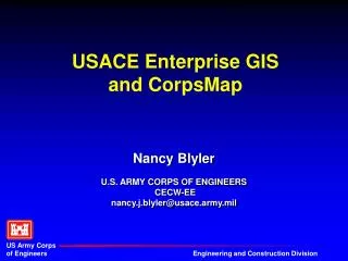
USACE Enterprise GIS and CorpsMap . Nancy Blyler U.S. ARMY CORPS OF ENGINEERS CECW-EE nancy.j.blyler@usace.army.mil. Two Key Issues. The US Army Corps of Engineers is a highly Decentralized Organization. The US Army Corps of Engineers has a very limited mapping mission.

E N D
USACE Enterprise GISand CorpsMap Nancy BlylerU.S. ARMY CORPS OF ENGINEERS CECW-EEnancy.j.blyler@usace.army.mil
Two Key Issues • The US Army Corps of Engineers is a highly Decentralized Organization. • The US Army Corps of Engineers has a very limited mapping mission.
HQ Enterprise GIS Effort • “National” Coverage • Provide standard GIS windows and data for HQ level business applications • Primarily, heavily attributed Point Data • Geolocating business data • Examples • National Inventory of Dams, Digital Project Notebook, Real Estate Corporate Information System, Regulatory Permits, Emergency Management Events, Lock Traffic, Stream Gage Information, Formally Used Defense Sites , etc.
District Level Enterprise GIS Effort • Large Amounts of Spatial Data Collected as a bi-product of Executing USACE mission - Navigation and Flood Control • Primary enabler for Enterprise GIS at District Offices is the Spatial Data Standards for Facilites, Infrastructure, and Environment (SDSFIE)
CorpsMap Vision • View Assets (National, Division, District, Congressional District, State) - CorpsMap • Projects • Infrastructure • Provide standard Maps and Map Interface HQ level business applications (Recruitment, Regulatory Permits, FUDS, Digital Project Notebook, EngLnk. Etc.) - Uses CorpsMap Data and Software • Link CorpsMap to District/Division Enterprise GIS Efforts through Web Mapping Technology
Requirements of Corporate CorpsMap • Accessing Corps Databases Geospatially • Civil, Environmental, Military Projects • Dams, Levees, Waterways, etc. • Databases would be maintained by organizations • USACE Wide .. Keep GUI Simple • Take Advantage of Work Already Being Done - Leverage
HQ Geospatial Committee • Nancy Blyler (DPN) • Eugene Bentz (EngLnk) • Fred Lombardo (REMIS, RECIS, Recruitment Centers) • Julian Chu (FUDS) • Dave Lichy (Waterborne Commerce Data, OMBIL) • Bob Bank (NID and CWMS) • Rik Wiant (Army Installation Management) • Alan Willingham (CI GIS POC) • Terry Patton (P2)
CorpsMap Access • Current Access • Digital Project Notebook (DPN), EngLNK events, National Inventory of Dams (NID), Navigation Data Center River Tonnage Statistics, FUD Sites, Stream Gage • Soon • RECIS, Recruitment Centers, Regulatory Module of OMBIL • A Little Later • P2, Bridge Inventory, Levee Database, Military Projects
GIS-V: Phase I • Identify databases for Corporate Viewer • Enable databases to be viewed (web mapping protocols, geocoding, etc.) • Identify software and hardware requirements • Move whatever data we can to CPC in Oracle • “Build” viewer tool • Make Accessible throughout USACE
GIS-V: Phase II • Look at linking to District/Division Enterprise GIS Databases • Development of a Public CorpsMap Web Site; Different Levels of Security • “Integrating” Project Databases • Identify additional GIS functionality • Packaging Search Tools for quick Location ID • Continue to Identify Databases