Download

1 / 27
320 likes | 914 Views
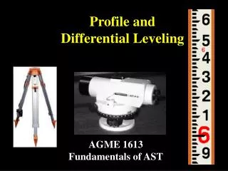
Differential Leveling. Differential surveying is used to determine the difference in elevation between two or more points. It is commonly used to establish the elevation of a benchmark referenced to an existing benchmark.

E N D
Differential surveying is used to determine the difference in elevation between two or more points. It is commonly used to establish the elevation of a benchmark referenced to an existing benchmark. It is also useful for comparing the elevation of several points or objects. Introduction
An example of comparing the elevation of multiple points is setting the top of the forms before placing concrete. In common practice, a backsight would be recorded from the bench mark and the target would be set for the desired elevation of the forms. The rod holder would then place the rod at several point along the forms to determine if they were at the correct height. Differential Leveling Example
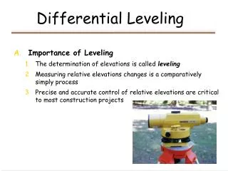
Another use of differential leveling is establishing the elevation of a benchmark. When the existing benchmark and the location of the new benchmark can be seen from one instrument position, the procedure is very simple. The instrument is set up halfway between the points and leveled. A rod reading is taken on the existing benchmark, this is called a backsight. The backsight reading is added to the elevation of the benchmark to establish the instrument height (reference line). Establishing A Benchmark
In this example the benchmark elevation is 850.47 feet and the backsight is 3.56 ft. The height of the instrument is: Benchmark Example-cont.
The instrument is rotated until it is aligned with the second benchmark. A rod reading (foresight) is recorded for the second benchmark. In this example the foresight is 5.21 ft. The rod reading is subtracted from the height of the instrument to find the elevation of the second benchmark. The elevation is: Benchmark Example-cont. BM1 is 1.65 feet higher than BM2.
When both benchmarks cannot be reached from one instrument position, turning points are used. Because a turning point is a temporary benchmark, it must be a stable structure. A backsight is taken on BM1. The 4.31 is added to the elevation of the bench mark to find the height of the instrument (104.31). Benchmark Example TP
A turning point is established and a foresight is recorded (4.92). The foresight is subtracted from the height of instrument to determine the elevation of the turning point (99.39) . Then the instrument is moved to a point between the turning point and the next station. In this example the next station is BM2. Benchmark Example TP-cont.
A backsight is taken on the turning point (4.22). The backsight is added to the elevation of the turning point to find the new instrument height (103.61). The instrument is rotated and a foresight is recorded on BM2. Benchmark Example TP-cont.
The foresight on BM2 (2.35) is subtracted from the instrument height to determine the elevation of BM2 (101.08) Tables are an excellent way of organizing numbers. Surveyors have developed a standard table for differential leveling. Benchmark Example TP-cont.
Differential Leveling Table • Five columns are used. • STA = Station Identification • BS = Backsight • HI = Instrument Height • FS = Foresight • ELEV = Elevation • The table for this example: 101.08 - 100.0 = 1.08 BM2 is 1.08 feet higher than BM1
Benchmark Example TP-cont. • Assuming no errors occurred during the survey, BM2 is 1.08 feet higher than BM1. • This is not a good assumption. • Differential leveling uses three checks for errors.
Three Checks For Error • Closing the loop • Note check • Allowable error check
To close the loop the survey is continued back to the beginning. In the previous example, surveying from BM1 to BM2 resulted in a difference in elevation between the two benchmarks of 1.08 feet. Surveying from BM2 to BM1 should result in the same difference in elevation. Any difference in elevation for BM1 between the initial elevation of BM1 and the closing elevation of BM1 is error. 1. Closing the Loop
Closing the Loop Example • The steps are the same. • The instrument is moved and a backsight is recorded for BM2 (3.27).
Closing the Loop Example-cont. • The instrument is rotated. • A foresight is recorded on TP2 (2.21) .
Closing the Loop Example-cont. • The instrument is moved between TP2 and BM1 • A BS is recorded on TP2 (3.29).
Closing the Loop Example-cont. • The instrument is rotated. • The loop is closed by recording a foresight on BM1 (5.42).
Differential Table • When the closing data is entered into the table the first error check is completed. • The second check for error is called the note check. • The note check uses an equation: • If the equation is true, there is no math error in the notes. • If the equation is not true, the notes have a math error. What should you do if the note check is not true?
2. Note Check BM1i • The note check statement is true. • The 0.01 difference in the elevation of BM1i and BM1c is not caused by a math error in the notes BM1c
3. Allowable Error of Closure • The third check for error is called the allowable error. • Early surveyors realized that the sources of error were so large that it would be impossible to control for all of them. • It is common practice for the agency/individual contracting the work to specify the acceptable level of error. • Professional standards may also specify allowable error. • A simple one is called the allowable error and it is based on an equation:
Allowable Error of Closure-cont. • For the differential example, the distance between BM1 and BM2 was paced and a distance of 1.100 feet was recorded. • A k value of 0.1 is acceptable for general work. Is pacing an appropriate method for measuring distance?
Allowable Error of Closure-cont. The actual error was 0.01 and the allowable error is 0.04, therefore the survey is acceptable.
Allowable Error-cont. • In this example the actual error was less than the allowable error. What should happen if the actual error is greater than the allowable error?
Allowable Error-cont. • What would be the conclusion about the error in the data if a higher standard was used, k = 0.01. 0.01 > 0.004 The data would be unacceptable.