Download
1 / 19
200 likes | 226 Views
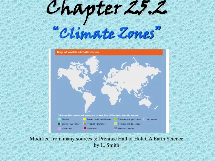
Chapter 25.2 “ Climate Zones ”. Modified from many sources & Prentice Hall & Holt CA Earth Science by L. Smith. CLIMATE = WEATHER. Remember:. CLIMATE = The AVERAGE weather conditions over a LONG period of time. Remember:. CLIMATE = most often described by: AVERAGE TEMPERATURE and

E N D
Chapter 25.2“Climate Zones” Modified from many sources & Prentice Hall & Holt CA Earth Science by L. Smith
CLIMATE = WEATHER Remember: CLIMATE = The AVERAGE weather conditions over a LONG period of time
Remember: CLIMATE = most often described by: AVERAGE TEMPERATURE and ANNUAL PRECIPITATION
Latitude influences angle of sunlight and therefore the temperature of an area.
This also influences the global wind patterns and therefore precipitation.
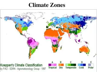
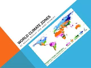
Climate Zones http://www.webquest.hawaii.edu/kahihi/sciencedictionary/images/degreemap.jpg
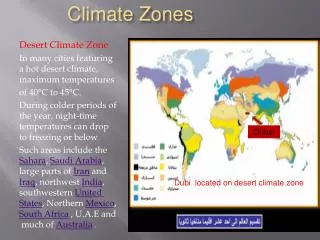
Tropical Zone The tropical zone is between 23.5o north (the tropic of Cancer) and 23.5o south (the tropic of Capricorn) of the equator. The sun’s rays are most intense and the temperatures are always warm. http://www.touristmaker.com/images/tropical/wet-tropical-climate.jpg http://blogs.nature.com/climatefeedback/files/rainforest2.jpg
Temperate Zone The temperate zones are between 23.5o and 66.5o north and between 23.5o and 66.5o south of the equator. The sun’s rays strike Earth at a smaller angle than near the equator. http://www.meteorologyclimate.com/temperate-ireland.jpg http://www.touristmaker.com/images/temperate/autumn-temperate-climate-zone-new-zealand.jpg
Polar Zone Polar zones are between 66.5o and 90o north and south latitudes and the poles. The sun’s rays strike Earth at a very small angle in the polar zones.
Köppen Climate Classification System The most widely used for classifying the world's climates. Köppen divided the Earth's surface into climatic regions that generally coincided with world patterns of vegetation and soils. The Köppen system recognizes five major climate types based on the annual and monthly averages of temperature and precipitation. Each type is designated by a capital letter.
Further subgroups are designated by a second, lower case letter which distinguish specific seasonal characteristics of temperature and precipitation. To further denote variations in climate, a third letter was added to the code These letters usually correspond to information about certain months or about max and min temperature or rainfall.
Local Climates The climate of a small area is called the microclimate. Density of vegetation, elevation and proximity to large bodies of water greatly influence the local microclimate.
Elevation Higher elevations tend to have lower temperatures. \ Precipitation amounts are also influenced by the rain shadow effect.
Large Bodies of Water Water absorbs and release heat slower than land does—moderating temperature variation. Large bodies of water also typically lead to increased precipitation for a region.