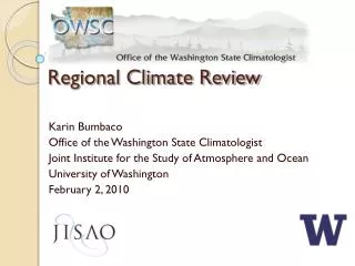
Download
1 / 42
420 likes | 516 Views
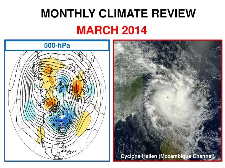
MONTHLY CLIMATE REVIEW. MARCH 2014. 500-hPa. Cyclone Hellen (Mozambique Channel). CONTENTS. * Tropics - ENSO [Neutral] - MJO * Extra-tropics (& Sea Ice) *Verification of JFM & March 2014 Outlooks * Drought * Selected Weather Events * Outlooks (April & AMJ 2014 & MDO). I. The Tropics.

E N D
MONTHLY CLIMATE REVIEW MARCH 2014 500-hPa Cyclone Hellen (Mozambique Channel)
CONTENTS *Tropics -ENSO [Neutral] -MJO *Extra-tropics (& Sea Ice) *Verification of JFM & March 2014 Outlooks *Drought *Selected Weather Events *Outlooks (April & AMJ 2014 & MDO)
850-hPa Wind Recent Westerlies, esp. mid-month
200-hPa Wind H H H
SST & Anomalies Subsurface
SSTA Predictions for Nino 3.4 Region CFSv2 NMME & inputs (6th) CPC/IRI CPC Consolidation
MJO (March 17, 31 Overviews) • MJO remains active with E.P.* entering Indian Ocean; though indicators are increasingly incoherent due to destructive interference with slowly evolving atmospheric and oceanic conditions in western Pacific. • Dynamical model MJO index forecasts diverge considerably for next 2 weeks. Some models weaken MJO as it interacts with the low frequency base state, while others indicate a more robust Indian Ocean MJO event. • Statistical models generally favor continued MJO activity. • MJO favors enhanced (suppressed) convection over western & central Indian Ocean (Maritime Continent and western Pacific) during period; also tending to oppose ongoing convection across the west-central Pacific associated with increasing ocean temperatures. *E.P. = Enhanced Phase
200-hPa Velocity Potential Anomalies (5°S-5°N) Positive anomalies (brown shading) indicate unfavorable conditions for precipitation Negative anomalies (green shading) indicate favorable conditions for precipitation MJO strengthens Faster propagation speeds – atmo Kelvin waves? Indo-Pacific warm pool region Slower propagation speeds Little propagation? Longitude
Ensemble GFS (GEFS) MJO Forecast Yellow Lines – 20 Individual Members Green Line – Ensemble Mean RMM1 and RMM2 values for the most recent 40 days and forecasts from the ensemble Global Forecast System (GEFS) for the next 15 days light gray shading: 90% of forecasts dark gray shading: 50% of forecasts The ensemble GFS forecast indicates no additional eastward propagation of the MJO signal.
Northern Hemisphere 500-hPa SLP
Southern Hemisphere SLP 500-hPa
Global Temperatures King Salmon (52F) March 1 (record high)* *Weekly Weather & Crop Bulletin (April 8)
Global Precipitation Seattle record: 9.44” (254%); previous: 8.40” (1950)* E.P. = Enhanced Phase ITCZ S.P. MJO E.P. MJO S.P. = Suppressed Phase *Weekly Weather & Crop Bulletin (April 8)
Departures clearly related to orography (much more so than PNP) Precipitation Featureless
Hawaiian Rainfall (March 2014) Dry start followed by trade wind strengthening Total PNP (% of normal) + 54 1.9” 3.4” M 4.0” 92 3.8” 160 18.7” ~135 +: 6.46” (March 8-9) Oahu Forest Nat’l Wildlife Refuge Weekly Weather & Crop Bulletin (April 8)
Sea Ice Arctic Antarctic *Annual maximum extent on March 21 2014 Arctic max is 5th lowest in record (1978-2014) *Annual minimum extent on February 23 2014 Antarctic min is 4th highest in record (1978-2014) L -2 -1 https://nsidc.org/arcticseaicenews/
Significant increase in coverage of multi-year ice https://nsidc.org/arcticseaicenews/ http://projects.kmi.open.ac.uk/role/moodle/pluginfile.php/712/mod_page/content/1/u116_2_f004i.jpg
DROUGHT MONITOR March 4 April 1* * Okay, so data cutoff extends 8 hours into April (12z April 1st) !
http://www.wcc.nrcs.usda.gov/ftpref/support/water/westwide/snowpack/wy2014/snow1404.gifhttp://www.wcc.nrcs.usda.gov/ftpref/support/water/westwide/snowpack/wy2014/snow1404.gif
Monthly-Average Stream flow for the month of year Soil Moisture Anomaly CPC NLDAS
Track of Cyclone Gillian Borneo Sumatra PNG E. Timor March 6-26, 2014 10-min winds: 125 mph 1-min winds: 160 mph Highest Gusts: 180 mph Minimum SLP: 937 hPa Java Bali X Christmas Island Gillian also affected search for missing Malaysian Airlines Flight 370 http://upload.wikimedia.org/wikipedia/commons/7/74/Gillian_2014_track.png
Gillian “X” Java Approximate location of Christmas Island (10.5S, 105.6E) X http://upload.wikimedia.org/wikipedia/commons/thumb/0/00/Gillian_Mar_23_2014_0645Z.jpg/459px-Gillian_Mar_23_2014_0645Z.jpg
Track of Cyclone Hellen March 27-April 1, 2014 10-min winds: 145 mph 1-min winds: 155 mph Minimum SLP: 925-hPa Tanzania Mozambique Madagascar http://en.wikipedia.org/wiki/File:Hellen_2014_track.png
Explosive Deepening of Cyclone Hellen over the Mozambique Channel Symmetrical & Intense CDO (150 miles) Eye: 12 mi http://upload.wikimedia.org/wikipedia/commons/thumb/1/1e/Hellen_Mar_30_2014_0720Z.jpg/515px-Hellen_Mar_30_2014_0720Z.jpg
Hazel Landslide/Oso Mudslide in Washington state March 22, 2014 ACIS {1500 feet long, 4400 feet wide and 30-40 feet deep} http://en.wikipedia.org/wiki/File:Oso_landslide_%28WSP%29.png Washington State Patrol
APRIL TEMP APRIL PRCP AMJ TEMP AMJ PRCP
THE END ??! http://roflmouse.com/wp-content/uploads/2010/08/funny-animal-pictures-cute-duckling-scam.jpg