Download
1 / 22
220 likes | 345 Views
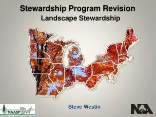
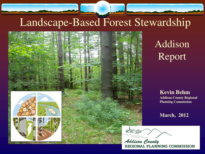
Landscape-Based Forest Stewardship. Addison Report. Kevin Behm Addison County Regional Planning Commission March, 2012. The economic value of forestland in Vermont is substantial.

E N D
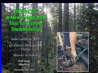
Landscape-Based Forest Stewardship Addison Report • Kevin Behm • Addison County Regional Planning Commission • March, 2012
The economic value of forestland in Vermont is substantial. A recent, 2007, report concluded “the [Vermont]forest provides important jobs and payroll for 13,000 people and an important source of income for forest landowners. The sale of forest products adds $1 billion to the state’s economy. Additionally, the forest attracts millions of visitors to the state for recreation and tourism activities, contributing almost $500 million annually with Christmas trees and maple sugaring accounting for an additional $22 million. Altogether, the contribution of forest based manufacturing and forest-related recreation and tourism to Vermont’s economy is over $1.5 billion.” The Economic Importance of Vermont’s Forests, North East State Foresters Assoc., 2007
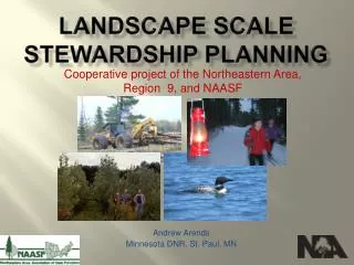
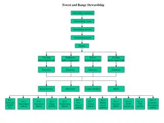
Landscape-Based forest Stewardship Planning – Regional Approach Completed in August 2012 Funded under the USDA’s FY2010 Northeastern Area State and Private Forestry Forest Stewardship Project • Vermont Division of Forests • Addison County Regional Planning Commission • Bennington County Regional Commission • Lamoille County Regional Commission • Two Rivers-Ottauquechee Regional Commission
16 member Steering Committee Private forest landowners (5) (2 large, 3 small) Forestry Consultants (2) Sawmill or Log Yard owners (3) Wildlife or Ecological (3) Municipal or Regional Board (5) Project Tasks Develop and test a GIS-based methodology for forest planning based on a landscape-scale Engage local and regional stakeholders in the process to insure local issues are addressed Identify strategies and develop tools for regions, municipalities and forest landowners to keep forests as forests Develop a process that can be replicated across regions and landscape scales Model a collaborative process across regions and agencies for forest stewardship planning
Forest Characteristics USGS National Land Cover, 2006 USDA, Forest Inventory and Analysis, 2010
Northern Green Mountain Biophysical Region Eastern 1/3 Champlain Valley Biophysical Region Western 2/3 • Lower 95 ft – 2000 ft • Warmer • Drier • Clay soils with outcrops • Oak, hickory, pine, maple, ash • Deer, turkey, bobcat, waterfowl, grassland birds, otter, brown trout • Clayplain forest • Rich clay farm soils • Higher 2000 – 4000 ft • Cooler • Wetter • Acidic geology • Maple, ash, beech, hemlock, spruce, fir • Bear, moose, deer, bobcat, beaver, warblers, thrushes, hawks, brook trout • Low population density
Unfragmented Forest Blocks for Planning Forest Block quality ranking (>20 acre) • Statewide analysis to identify large blocks of forest land. • Excellent for regional and municipal planning to view forested landscape beyond our local boundaries. • Misses locally important Clayplain Forest in Champlain Valley • Ranking based on – • Block size • Road density • Distance to core (>250 acre) areas • Density of aquatic areas • Rare species • Forest Habitat Block and Connectivity Analysis, VT F&W , VT ANR, 2011
Forest Values vs. Threats Invasive Species Fragmentation Air Quality Climate Change Parcelization Natural Disturbances
Parcelization of Forest Land Statewide Loss of Large Lots 2003-2009 • Acres in large lots declined 7,000 acres/yr • Parcels assessed as Woodland (undeveloped) decreased by 4% Alex MacLean, 2008 Informing Land use Planning and Forestland Conservation through Subdivision and Parcelization Trend Information, 2010
Forest Land Change in Addison County A Plug-in Hybrid (PHEV) will fall somewhere in-between depending on the type of driving you do.
Forest Land Change in Addison County A Plug-in Hybrid (PHEV) will fall somewhere in-between depending on the type of driving you do. John Filoon, Middlebury College Intern, 2011
Forest Land Change in Addison County A Plug-in Hybrid (PHEV) will fall somewhere in-between depending on the type of driving you do. John Filoon, Middlebury College Intern, 2011
A Plug-in Hybrid (PHEV) will fall somewhere in-between depending on the type of driving you do. John Filoon, Middlebury College Intern, 2011
Town Forest Policy Review • Conservation/ Forest Reserve District • Planned Unit Development • Subdivision Regulations • Site Development Standards • Ensure Forest Products Industries are allowed in the Community • Forest Practices • Definition of Important or Significant Resources • Education (non-regulatory) • Map and Inventory Forest Lands, Wildlife Corridors (non-regulatory) • Other/Goals Strategies Guide For Forestland and Wildlife Conservation matrix developed by the Vermont Natural Resources Council. John Filoon, Middlebury College Intern, 2011; ACRPC
Conservation/Forest Reserve District • Panton (June 2006 draft) • "The Ridgelands include areas of shallow soils, exposed bedrock and clayplain forests. This area can accommodate additional residential development in or at the edges of wooded sections that is carefully sited and sensitively developed . . . • Monkton (April 2007) • "Conservation District-Prohibited: Uses on this land will be limited to agriculture, forestry, public outdoor recreation, and wildlife refuge . . . The town shall consider whether a conditional use can be granted if sufficient acreage for building lots is found which is not restricted by the above mentioned factors" (p57)
Conservation/Forest Reserve District • Starksboro (October 2011) • "Upland Forest Planning Area: "... consists of many large parcels including the Lewis Creek Wildlife Management Area and the Town Forest......and is characterized by steep slopes and unfragmented forests." "...all available and feasible means should be used to prevent year-round residential development in these areas.“ "Maintain the land base needed to support environmentally sustainable and economically viable farming and forestry in town, thus preserving our rural way of life." (p46)"Starksboro's land use regulations should continue to restrict use of land in the Upland Forest Planning Area to sustainable forestry that meets minimum accepted Vermont management standards, low-impact recreation, sustainable harvesting of non-timber products." (p48)
Planned Unit Development • Waltham (Sept 2009) • " Encourage landowners desiring to develop their property to use PUDs in rural areas to cluster development and to preserve sustainable parcels of open space that are useful for commercial agriculture, forestry or for wildlife habitat or outdoor recreation" (p35); "Encourage new development as PUDs to conserve undeveloped land surrounding residential developments in viable blocks of significant enough size to support commercial farming, forestry or wildlife habitat" (p38)
Ensure Forest Products Industries are Allowed in the Community • Starksboro (October 2011) • "Sustain Starksboro's rural economy, encouraging future generations to continue farming, sugarmaking and forestry in town, thus maintaining these traditional activities as town's primary industry." (p50) • Waltham (Sept 2009) • "Strengthen and protect the town’s agricultural economy, including farming, forestry, and related activities. Encourage manufacturing and marketing of value added agricultural and forest products. Encourage use of locally grown agricultural and forest products" (34); "Preserve the working landscape and the opportunities for farming and forestry that have helped create and preserve Waltham as a small, rural community, providing it with the open space that defines its rural character" (p38)
Forest Practices • Cornwall (April 2005) • "Stove wood is still generally available, but many of the town’s woodlots are jeopardized by increased development and the reinterpretation of old “handshake” agreements regarding access to landlocked parcels" (p41) • Lincoln (June 2010) • "Develop Management Plans for all Town Forests that are long-term and sustainable and do not threaten the non-timber resources of forestland, such as its biological integrity, wildlife habitat, water quality, and its benefits to humans, such as education and wildness" (p21) • Weybridge (2011) • "Minimize fragmentation of large woodlands (160 or more acres of contiguous forest land)" (p25)
Other Policies • Starksboro (October 2011) • "Eight out of ten of this plan's General Goals (see page 46) are directly related to natural resources. Survey results support these goals and encourage both natural resource protection and wise use. Residents see value in land-based enterprise (farming, forestry, sugar making), but also in recreation, tourism, local energy, and other ecosystem services (clean water, flood control, biological diversity) - all of which are provided by these resources. The objectives below attempt to balance these goals and describe policies that can help achieve them. Any mapping or inventorying suggested can only be accomplished with landowner permission...(p59)
Follow-up Contract • Develop a web platform for forestry data. • Stewardship reports developed by 4 additional RPCs. NWRPC, WRC, SWRPC, CVRPC • Public/private outreach on stewardship plans. • Work on implementation with 2 communities.
THANK YOU! Kevin Behm, Assistant Director and GIS Data Manager: kbehm@acrpc.org, 388-3141 Addison Stewardship Report on our website: http://www.acrpc.info/naturalresources/forest