Download
1 / 35
471 likes | 1.07k Views
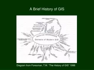
History of GIS. “The human activity of graphically translating one's perception of his/her world is now generally recognized as being a universally acquired skill [all peoples, all cultures] and one that pre-dates virtually all other forms of written communication.” - J. Siebold.

E N D
History of GIS “The human activity of graphically translating one's perception of his/her world is now generally recognized as being a universally acquired skill [all peoples, all cultures] and one that pre-dates virtually all other forms of written communication.” - J. Siebold
History of GIS • Characteristics of early maps: • Sometimes just a rough but serviceable schematic • Sometimes “realistic” with respect to the relative size, shape, and distance and orientation between map features. • Sometimes purposeful distortion to make features fit/align with mapmakers’ world view. • In general, you find better detail and more “true” • representation of spatial relationships the more “local” the data, or at least in the (usually) central “known world” area of the map. Our knowledge of old maps is limited primarily by their lack of preservation…
Wall drawing of Catal Hyük, in Anatolia, Turkey, showing a city plan and erupting volcano visible from the city, (ca. 6200 B.C.) Images courtesy of HenryDavis.com
Babylonian Clay Tablet map (and reconstructed drawing) from Ga-Sur, northern Iraq (ca. 2500 B.C.) Images courtesy of HenryDavis.com
“Turin Papyrus” map by Amennakht, royal scribe, showing a portion of Wadi Hammamat in eastern Egypt, prepared for one of King Ramesses IV’s quarrying expeditions (ca. 1150 B.C.) - Egyptian Comparison between Turin Papyrus (left) and modern topographic and geologic maps (right). Images courtesy of James A. Harrell, University of Toledo
Reconstruction of Ptolemy’s “Septima Asiae Tabula”, map of portion of Asia east of the Caspian Sea (ca. 90-168 A.D.) – Roman Egypt Map from Mawang Dui Tombs, Western Han dynasty, China (ca. 2nd century B.C.) Image courtesy of Hong Kong Baptist University Image courtesy of Lombard Maps
Map of Coastal towns in the Caspian Sea Region according to Abuzeide Balkhi, during the Abassid Caliphates (ca. 888 A.D.) Map image courtesy of NASA Image courtesy of Tirdâd Gorgâni (David Gorgan)
Medieval cartographers and scribes copying and drawing out maps by hand based on 2nd-hand data (written accounts, field measurements, complete fantasy) and storing them in a repository archive (later collected as bound atlases after the printing press). T-O style Mappa Mundi from ca. 1130, and T-O diagram from 1472 printing by Guntherus Ziner
details from the “Mapa de Cuauhtinchan”, produced by a Chichimec community from Cuauhtinchan as part of a legal dispute over land with the Spaniards and another Indian community, showing theological beginnings, historical migrations, and the founding of Cuauhtinchan during the twelfth to the fifteenth centuries. (ca. 1580s A.D.) Images courtesy of Washington University in St. Louis, the Mesoamerican Research Foundation, and Harvard University.
Marshall Islanders’ Stick Chart for Navigation (reproduction) showing islands and wave swell refraction and interference patterns Marshall Islanders’ Stick Chart for Navigation showing islands and wave swell and interference refraction patterns Image courtesy of Smithsonian “Ocean Planet” exhibit and NASA’s SeaWifs program. Image courtesy of the Mariners Museum
Section of the Tabula Peutingeriana, detail: Rhodes & detail: Greece, Crete, Turkey (1598 copy of a 12th century MS) Original (lost) copy by Castorius circa 1st century A.D. early road map [painted itinerary] of the imperial highways of the Roman world Images courtesy of HenryDavis.com
History of GIS Up through the 18th and 19th centuries, trend towards inclusion of greater and greater detail as well as more ornate and more artistically elaborate appearances of the maps.
Reconstruction of the World map according to Pomponius Mela (ca. 37 A.D.) - Roman Image courtesy of HenryDavis.com
Portolan Chart of the Mediterranean World. by Mateus Prunes (ca. 1559) - Majorca Image courtesy of the Library of Congress
“Edo yori Nagasaki made yadotsuke,funamichi meisho kyseki” (Edo to Nagasaki, Inns and Historic Sites), showing main land route from Edo to Osaka, and the land-sea routes from Edo to Nagasaki, including inns and historic sites. (ca. 1660-1736) - Japan Image courtesy of the Library of Congress
“Huang He Wan Li Tu” (Pictorial Map of Yellow River), showing the Yellow River in true proportions, with houses representing population of villages (1 house = 100 families) China, early Ming Dynasty, facsimile of 1368-1378 original. Image courtesy of the Library of Congress
N “Leo Belgicus de Noort” A map showing the Low Country [the Netherlands, Belgium, Luxemburg, and part of northern France] portrayed as a Lion ( ca. 1611) – Amsterdam Image courtesy of the Library of Congress
“Captain John Smith’s Map of Jamestown” ( ca. 1612) Image courtesy of the Library of Congress
History of GIS Trends reverse in 1800s to today with trend towards less ornate and more simplified/utilitarian appearances of the maps, standardized symbology and projections, and explicit often standardized scales to facilitate manual tracing and overlay of data from one map to another.
Political World Map (Winkel-Tripel projection) from National Geographic (2005)
Detail of VA/MD/DE 1:500,000 map by Raven Maps, Inc. (2006)
Edge matched portions of Chalottesville, VA – East and …– West 7.5 Minute 1:24,000 Quadrangle maps from USGS (1996) Image courtesy of UVA’s Institute for Advanced Technology in the Humanities (IATH)
Washington, D.C., Metro Map Detail of Rivanna River Water Trail Map
History of computers +GIS Post 1960s = computerized systems of cataloging and analyzing datasets, including geographic data, begin to be developed and used, but are still small, post-hoc, agency-specialized, not wide available, or still in their infancy. (ex. MIMO (Map In-Map Out) by W. Tobler, 1959) (ex. CGIS (Canada G.I.S) by Government of Canada, 1963) *first true GIS (ex. Harvard Lab for Computer Graphics, 1964) training & research (ex. GBF/DIME (Geographic Base File using Dual Independent Map Encoding) of US Census, 1967) (ex. GIRAS (Geographic Information Retrieval and Analysis System) by USGS, 1973) (ex. SLDB (Swedish Land Data Bank) early 1970’s) (ex. LAMIS (Local Authority Management Information System), UK, early 1970’s) (ex. JIS (Joint Information System), UK, early 1970’s)
History of computers +GIS Early 1970’s: new satellites (ex. LandSat) pointing back at Earth and monitoring the surface and atmosphere start generating huge amounts of data for analysis and continue to spur development. Late 1970’s/early 1980’s: development of integrated software or computer code in publicly or commercially available packages ex. McIDAS (1973) by U.Wisc. - SSEC ex. ERDAS (1978) by Leica-Geosystems ex. ArcInfo by ESRI (1981/82), Intergraph (?) * * these started circa 1970 as consulting firms ex. GRASS by US Army Corp (1982/1985) ex. MAPINFO (1986) ex. IDRISI (1987) by Clark Univserity, MA
History of computers +GIS Continued development to this day… … including incorporation of GIS functions within other types of primarily non-GIS software ex. MATLAB, SAS, Auto-CAD, etc. Current push towards Open-Source GIS platforms, GIS data servers, and/or adoption of more “standard” data formats ex. Open GISs: Quantum GIS, GAIA, uDig ex. Geoserver + Geonetwork, Mapserver, Deegree ex. ISO/OGC Standards for Geo-information, PostgreSQL/PostGIS data catalogs/services
History of ArcInfo/ArcGIS First commercial release by ESRI of ArcInfo in 1981/82. “It combined computer display geographic features, such as points, lines, and polygons [the ARC part], with a database management tool for assigning attributes to these features [the INFO part]. Originally designed to run on minicomputers [mainframes], ARC/INFO offered the first modern GIS. As the technology shifted to UNIX and later to the Windows operating systems, ESRI evolved software tools that took advantage of these new platforms. This shift enabled users of ESRI software to apply the principles of distributed processing and data management.” - ESRI website So originally a merger of the geographic coordinates, shapes, and topology (in highly standardized data formats: Arc) with an early relational database (Info) to handle the attribute information and that could be easily modified to handle whatever kinds of ancillary data were necessary. Components: Arc (command line main module/program workhorse) ArcEdit (command line editor w/ simple graphic display) ArcPlot (command line module for generating maps) Info (command line interface to the Info databases) Ability to work with simple 1-layer raster data (grids) and vector-based 3-D surfaces (tins) came soon afterwards.
History of ArcInfo/ArcGIS ArcView introduced in early 1992. Limited functionality. Primarily meant for the display of pre-existing datasets, principally those created with ArcInfo, and the production of printed maps. Basically an end-user product. BUT it did have a decent graphical users interface (GUI) that worked well in the Windows PC environment with the point-and-click mentality. (Much much better than the clunky ArcTools interface attempt for ArcInfo at this time!) Mid 1990’s: later versions of ArcView expand the capabilities with new data editing and analysis functions BUT lacks the vast full functionality of ArcInfo (and the editing and new resulting data-structures are nowhere near as precise and accurate as they are in ArcInfo… at least for shapefiles… grids ARE ArcInfo grids but require special software “extensions”).
History of ArcInfo/ArcGIS ArcGIS8.0 introduced in 2001. ( 9.0 in 2004, 9.3 in 2008 ) Re-design/Re-engineering of earlier stand-alone products (though the data was [mostly] interchangeable). Combines the look and feel of earlier ArcView versions (up to 3.4) and its GUI and menuing options with the underlying “engine” and full functionality of ArcInfo. BUT *still* subdivided into a series of components/levels/products with corresponding limits on the functionality… From basic --> full functionality (and $$ --> $$$$$) : ArcReader (free) ArcView (“new” ArcView) ArcEditor ArcGIS desktop with Workstation ArcInfo ArcIMS - integrated (?) with ArcGIS but stand-alone features for providing customized maps and databases over the Internet.
Components of ArcGIS Desktop/ArcInfo ArcCatalog - for managing datasets. ArcMap - for displaying data, creating maps, and analysis. ArcTools - stand-alone (non-graphic) analysis and data conversion. * (now part of the toolbars of the other programs) ArcScene - 3-D display tool. ArcGlobe - 3-D display tool displayed onto a spherical globe. Workstation ArcInfo - same good old underlying program that actually runs most of the manipulation and analysis (?) that you ask the other parts of ArcGIS to do thru their GUIs. Still with the same command line driven subunits (ArcEdit, Grid, Info). Note: ArcGIS runs only in the Windows NT/2000/XP environment, but ArcInfo is still available “stand-alone” on multiple platforms, including Unix.