Download
1 / 18
180 likes | 617 Views
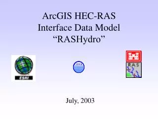
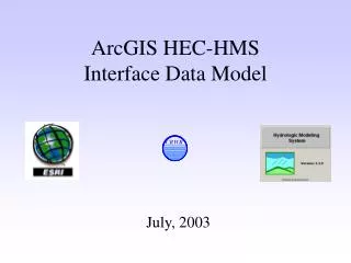
ArcGIS HEC-RAS IDM and Interface Tools. By Oscar Robayo. The University of Texas at Austin Center for Research in Water Resources. August, 2004. ArcGIS Interface Data Models. Engineering Models. GIS. I nterface D ata M odels. HEC-HMS. Geo Database. Arc Hydro data model. HEC-RAS.

E N D
ArcGIS HEC-RAS IDM and Interface Tools By Oscar Robayo The University of Texas at Austin Center for Research in Water Resources August, 2004
ArcGIS Interface Data Models Engineering Models GIS InterfaceData Models HEC-HMS Geo Database Arc Hydro data model HEC-RAS Flood Impact Analysis
CrossFeature • LateralFeature • AreaFeature • Control • Output • PreProcess • PostProcess Main Components: ArcGIS HEC-RAS IDM
XML-Based Data Exchange • Platform Independent • Application Independent • Ready to share with many third party applications • Updates do not require code recompilation
GIS Advantages of XML Approach • GDB content will have shape-geometry after GIS import (implicit geometric definition) • Transfer of geometric vertices goes to shape • Faster Transfer operations of dense geometries • Geometric structure includes X, Y, Z, and M • Import to GIS goes to a new or existing GDB
Current Issues with GIS Transfer • Current development only for ArcGIS 8.3 • Only Spatial Extent is defined, Not full projection information (define projection after transfer) • Import to GIS goes to existing GDB w/o projection • Relies on Model’s exposure of complete Geospatial definitions
GIS Import/Export Data Exchange (Water Resources Team at ESRI)
XML Transformations Input XML to be Transformed Input XSLT stylesheet (template rules) XSLT Processor • HTML pages • XML docs • Text files External Apps
Metadata Definition for Scenario Management System Header, RunID, and ProfileID Tables with corresponding relationships to components in geodatabase IDM Import Model related Metadata with expanded versioning elements: created and last modified dates, ProjectID, ScenarioID, Description, Author, Owner, purpose, Source Location, etc.
Scenario Management System (Continued) File Name & File Title
Acknowledgements • Dean Djokic at ESRI • Zhumei Qian at ESRI • Zichuan Ye at ESRI • Xinnong Zhou at ESRI