Download
1 / 39
390 likes | 619 Views
Alaska DEM Workshop. George Y. G. Lee Anchorage, Alaska July 2008. Outline . Why elevation is important to USGS National Digital Elevation Program (NDEP) The National Map and elevation data Lidar activities and Lidar for the Nation Alaska requirements and National Elevation Plan.

E N D
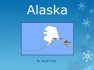
Alaska DEM Workshop George Y. G. Lee Anchorage, Alaska July 2008
Outline • Why elevation is important to USGS • National Digital Elevation Program (NDEP) • The National Map and elevation data • Lidar activities and Lidar for the Nation • Alaska requirements and National Elevation Plan
Importance of Elevation Data to the Nation • USGS responsibility as A-16 data category • Value of nationally, consistent elevation data set • Importance to the Digital Orthophoto Program, including Urban Area data for Homeland security • Importance of elevation data to the commercial satellite companies • Importance of higher resolution elevation data to USGS science programs, especially climate change studies
USGS Data Requirements • A-16 responsibilities (hydro, elevation, orthoimagery, and names) • The National Map needs • Other USGS Discipline missions (Geology, Water Resources, BRD) • Science Program (i.e., climate change)
USGS Elevation Data Acquisition • Ancient past (completion of 1:24K series and DOQ first coverage) • Recent past (10-meter DEM partners) • Current priorities (Hazards, 10-meter partners, Urban Areas) • Future priorities (data maintenance, hi-res DOQs, other agency needs and partnerships, emergency response, and science programs)
NDEP • Established to promote the exchange of accurate digital land elevation data among government, private, and non-profit sectors and the academic community and to establish standards and guidance that will benefit all users • Federal (11 agencies), State (NSGIC Rep) • Open Invitation to participate • Organization - Steering Committee, Technical Subcommittee, Project Coordination Subcommittee
National Digital Elevation Program BLM USFWS NGA FEMA NASA NOAA NSGIC www.ndep.gov NRCS USACE USFS USGS US Census A consortium of agencies coordinating the collection and application of high-resolution, high-accuracy elevation data
NDEP Goals • Enhance data sharing among Federal, State, and local agencies; the private sector; and academia • Minimize redundant data production • Leverage resources to satisfy multiple requirements • Develop flexible standards that meet the needs of most users • Ensure the availability and accuracy of digital topographic data
Technical SubcommitteeDean Gesch, USGS • Forum for information exchange • Standards development • Technology assessment
Standards Development • USGS 30-meter DEM standard • Guidelines for digital elevation data – best practices • Inventory of agency-specific specifications and standards • USGS • FEMA • NOAA • Others • Framework Elevation Standard • ASPRS Lidar Guidelines
Project Coordination SubcommitteeBryon Ellingson, USGS • Project Tracking System http://hazards.fema.gov/metadata/NDEP/ • Project Information Form Minimal Elevation Specific Metadata set Viewer View w/ Query tools GOS Harvestable (supports Module 3), Link with RAMONA and FEMA MIP activity
ROMONA • FEMA supported, Paul Rooney • NSGIC pockets of interest • Is it being used? • Why and why not?
NDEP Mode of Operation • Signed Charter • NDEP Organizational Structure, Chairperson, Executive Secretary • Meetings and telecons • Public website update and maintenance • Quickplace website for internal communications
New Directions for NDEP • Focus on coordinated elevation data acquisition and maintenance of a national database • Support new budget initiatives • Develop National Elevation Plan
USGS Research and Applications Activities • Limited basic research • Limited applications within Geography and GIO • Limited multi-discipline cooperative research • Limited development and testing with Corp of Engineers • Research primarily in support of data acquisition, derivative products, and production systems development • Accuracy and comparison of new acquisition methods • No other recall of any cooperative research with other agencies
Agency Issues and Concerns • Lack of data maintenance program • Not meeting needs of other Federal agencies • Lack of National Elevation Program Plan • Lack of adequate funding • Licensed data model • Lack of quality assurance guidelines for sensors and data acquisition
The Nation Map • Elevation • Geographic Names • Hydrography • Land Cover • Orthoimagery • Boundaries (Government Units) • Structures • Transportation
Vintage of Elevation Data Age of USGS topographic maps in the National Elevation Dataset (NED) • Terrain data in USGS topographic maps are on average 35 years old
Multi-Resolution NED 1 arc second 1/3 arc second 1/9 arc second
The National Map Needs: • The National Map needs higher resolution elevation data • The National Map needs up-to-date elevation data • The National Map needs lidar data to map other map category features • Not “Lidar for the Nation” but rather “National Elevation Program”
National Lidar Mapping Initiative: A Medium-Altitude Advanced-Technology Implementation Concept David J. Harding NASA Goddard Space Flight Center david.j.harding@nasa.gov
National Academy of Sciences Recommendations: FEMA Floodplain Mapping & Earth Sciences Decadal Survey Two NRC Committee Reports Issued in January, 2007 Floodplain Mapping Technologies Commissioned by Congress to Advise FEMA Earth Science and Applications from Space to Advise NASA, NOAA and USGS Elevation for the Nation LIDAR Surface Topography (LIST) Nationwide, seamless, consistent, public-domain, elevation data set created using airborne laser swath mapping (ALSM) Contours: 1 ft (low relief), 4 ft (high relief) Global topo & vegetation structure 5 m spatial resolution 0.1 m vertical precision for ground Launch time frame: 2016-2020 Update 10 m & 30 m NED Update 30 m & 90 m SRTM
Land Cover Carbon / Biomass A Wealth of Information Derived from Lidar Volcano Monitoring State-wide lidar mapping completed or in progress Earthquake Faults Hydrologic / Hydraulic Urban Response Coastal Inundation Wildland Fires
Approaches to Accomplish National Lidar Mapping Invest to Advance Capabilities Utilize Existing Capabilities ± Low Altitude (1 to 2 km) Imposing Narrow Swath (~ 1 km) Local (<20 km) Kinematic GPS INS+GPS Attitude (0.01°) Single Beam and Detector Incomplete Reference Frame Ad Hoc Error Analysis Current Geoid for Ortho Heights High Altitude (e.g. 15 km) Enabling Wide Swath (e.g. 10 km) Regional (e.g. 1,000 km) PPP GPS INS+StarCamera Attitude (0.001°) Multiple Beams and Detectors Rigorous Reference Frame Systematic Error Analysis Concurrent Aerograv for Better Geoid
Potential Scenarios to Accomplish National Lidar Mapping Scenario 1: compete coverage by existing capability no use of advanced capability Scenario 2: complete coverage by existing capability continental datum tie-lines using advanced capability Scenario 3: logistically easier areas mapped by existing capability logistically challenging areas mapped by advanced capability Scenario 4: Conterminous U.S. mapped by existing capability Alaska mapped by advanced capability Scenario 5: local high-resolution mapping by existing capability complete coverage by advanced technology capability Increasing Role for Advanced Capability
Decision Factors for National Lidar Mapping + • The selection of an implementation scenario should be driven by which maximizes total benefit for the nation: • Quality and uniformity of the resulting data and products • Time-frame over which the job is completed • Cost to complete the job • Capabilities and infrastructure established while doing the job • Advancement of the U.S. mapping and remote sensing industries • Suitability for continued mapping for change detection and map updating
National Lidar Mapping Initiative Concept: Potential Partner Roles • USGS: • project leadership and management Local, state and federal agencies: • requirements and standards for lidar data & DEM products meeting their mandates • NASA: • integrate and test medium-altitude airborne lidar instrumentation • implement data processing methods & infrastructure • provide instrumentation and infrastructure for operation by commercial sector • Commercial Sector: • acquire and process medium-altitude, nation-wide data • acquire and process low-altitude, higher-resolution data for high-priority areas and for QC/QA • produce derived parameters using classification & feature extraction procedures • produce DEM products TINs, DSMs, DTMs, canopy structure, building shapefiles • create and market value added products NASA and USGS: • QA raw data, derived parameters and DEM products USGS: • archive and distribute raw data, derived parameters and DEM products Local, state and federal agencies: • use derived parameters, DEM products & value added products to meet their mandates
Partners interested in National Coverage • The concept of a national Lidar survey was explored at a September 2006 meeting • NASA, USGS, NOAA, Association of American State Geologists • NASA, USGS, USACE, NOAA, NGA, FEMA, NRCS, Forest Service, and other Federal agencies already collect Lidar data • Growing interest in a full return Lidar baseline dataset for the nation to meet multiple requirements
Next Steps for the Lidar Effort • Establish USGS Advisory Committee • Define strategy • Provide periodic review • Invite other agency participation • Define requirements • Propose national program plan • Define specifications
Proposed FY 2010 Budget • Good news is: • $$ M for mapping and integration • Includes $ M for Liar • Bad news is: • Mapping is only part of $$$ M over target initiatives within DOI
Need for a National Elevation Plan • GeoLOB Bureau Data Resource (data call): Impact on Federal agencies • A-16 Performance Reporting for National Spatial Data Infrastructure Data Themes • Lidar for the Nation (Background, Workshop Summary, Future Plans) • Development of National Elevation Plan
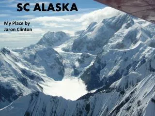
Summary • Alaska needs good elevation data • Alaska needs DOQs • Alaska seems to be neglected • Alaska IS different • Not a single solution • Complex project management and QA issues • Alaska elevation needs should be a part of the National Elevation Plan • Public domain is still a general requirement
Thanks • Questions???
Contact information: • George Lee, 650-329-4255, gylee@usgs.gov