Download
1 / 9
90 likes | 248 Views
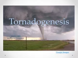
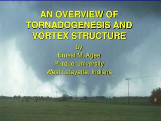
Tornadogenesis lab. Jeff Trapp National Severe Storms Laboratory and National Center for Atmospheric Research Presented at COMAP 99 Thursday, 9 September 1999. INTRODUCTORY REMARKS.

E N D
Tornadogenesis lab Jeff Trapp National Severe Storms Laboratory and National Center for Atmospheric Research Presented at COMAP 99 Thursday, 9 September 1999
INTRODUCTORY REMARKS • tornadogenesis (TG) definition: formation of a tornado-scale vortex (diameter nominally ~ 100 m) within a parent vortex such as a columnar mesocyclone (supercellular) or misocyclone (nonsupercellular) • assumes that the parent vortex already has been generated • given convergence that’s sustained over ~10-15 min, TG should occur as in a tornado chamber (i.e., near conservation of “ambient” angular momentum) • the definition omits intensification, through, e.g., interaction of vortex with ground, and, subsidence warming
OBSERVING TORNADOGENESIS • consider radar data only (reliable satellite signature of TG has yet to be demonstrated, although hi-res satellite data are invaluable for assessing storm tendencies, interactions, etc.) • precursors • tornadic vortex signature (TVS) • low-level convergence, at close range, below rotation signature (Burgess and Magsig 1998, SLS Conf.) • hook echo: current theory by Davies-Jones (1999, JAS) suggests that hook echo is the “instigator” of near-ground rotation rather than its manifestation • BWERs, vaults, storm-top divergence, ascending reflectivity maxima: show strong updrafts conducive to TG, but not necessarily TG itself; similar comment for correlation of updraft and mesocyclone
OBSERVING TORNADOGENESIS • precursors (cont’d) • others: radar-derived horizontal vorticity (J. Janish and E. Rasmussen); radar-indicated boundaries and their interaction with storms (Markowski et al. 1998, MWR; Rasmussen et al. 1999, MWR) • “tornadogenesis failure”: lack of tornado formation within a low-level mesocyclone (of adequate strength and duration), despite strong indication of precursors (Trapp 1999, MWR) • research versus operational platforms: comparison between WSR-88D, airborne Doppler radar, DOW, and mm-wavelength radar
TORNADOGENESIS AND THE WSR-88D • caveats and limitations: • AWIPS display of data (resolution dependent on range and also product type; e.g., for SRM, max velocity of 4 consecutive 250-m range gates is displayed over the 4 range gates). See: PUP to AWIPS Functionality and Product Comparison (www.osf.noaa.gov/otb/otb.htm) • radar sampling: • beam broadening, aspect ratio • horizon effect • beam center/vortex center offset (e.g., Wood and Brown, 1997, W&F) • storm-top tendencies (Howard et al. 1997, W&F)
TORNADOGENESIS AND THE WSR-88D • TVSs • diagnosed and displayed now via the Build 10 TDA, philosophically different than previous algorithm. Also, can be manually identified: it’s more than an icon - the signature has a physical basis and is 4D! • useful for assessing “mode” of tornadogenesis (Trapp and DJ, 1997, JAS) • concept of “descending” versus “nondescending” TVSs: the first represents the TG expected with Great Plains supercells; the second may represent supercellular TG, nonsupercellular TG, TG within squall lines, etc. Both can occur with equal frequencies (Trapp et al. 1999, W&F)
Results from Trapp et al. 1999: Of 52 TVSs analyzed, 52% were classified as descending, and 48%, non-descending (at 99% CI, margin of error~19%, statistically significant)
ANCILLARY In a recent editorial in the online publication WeatherZine(www.dir.ucar.edu/esig/socasp/zine/), C. Doswell asks the question “Are warning lead times the most important issue in tornado events?” i.e., what is more important: lower false-alarm ratios, or, longer lead times? He muses: “...it’s possible that longer lead times would be less effective because they wouldn’t convey a strong enough sense of urgency.” Your comments? Doswell also suggests a probabilistic approach to warnings. These concepts will be considered in the following lab exercise.
EXERCISE You will be given locations and genesis time blocks for several different tornado events, and, using WATADS, will be asked to: 1. identify the TG time (or, volume scan within which TG occurred) 2. list the signatures and precursors present (the justification for the tornado warning ), and, the amount of theoretical lead time that they would have provided 3. attach an uncertainty, or, probability to the tornado warning 4. assess the TG mode, or, TVS characteristic In items 1-4, assume that the mesoscale environment is conducive to tornado development but that storm-spotter information is unavailable, ignore political influences, assume that the tornado report is accurate, and take as much time as needed to fully interrogate the data.