Download
1 / 27
270 likes | 392 Views
To observe the earth … and visualize the future. John D. Moore 2009 -2011 Albert Einstein Distinguished Educator Fellow New Jersey, United States mr.moore.john@gmail.com. SPACE-EARTH EARTH-SPACE. Integrated “SEES” Model Students now have the ability to

E N D
To observe the earth … and visualize the future John D. Moore 2009 -2011 Albert Einstein Distinguished Educator Fellow New Jersey, United States mr.moore.john@gmail.com
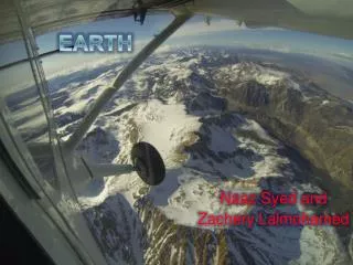
SPACE-EARTH EARTH-SPACE Integrated “SEES” Model Students now have the ability to examine a geo-referenced location from the top-down and bottom-up
“SEES” Model • Examines a geo-referenced location from the top-down and bottom-up • Fosters Geospatial Thinking • Identifies geo-referenced data points/sources • Incorporates Real-time Data
Geographic Information Systems (GIS) • Visual representation of Data Sets • Layers (Themes) • Geo-referencing (GPS) • Analyze (Query) Geospatial Data • Geospatial Thinking
MONITORING LOCAL ENVIRONMENTAL CHANGE … GLOBE DATAfromthe Burlington County Institute of Technology, Medford New Jersey USA Monitoring Air Temperature Changing Temps impact Green-up/down Using Satellite Imagery and Aerial Photography to document Land-Use change. How much change can occur before the MUC changes? Surface H20 Temperature vs. pH Changing Land-Use may alter runoff. The Pinelands are pH sensitive
A new ERA of OBSERVATIONS … to Observe the Earth and Visualize the Future CUBESAT
The BLUECUBE Enterprise • Ultimate aim: create new paradigm: BLUE CUBE • Build Launch Utilize Educate with CubeSats • To better promote STEM and Career and Technical Education to middle and high school students by… • Building, testing, and validating the flight readiness of student built CubeSats • Launching CubeSats to LEO by commercial carriers • Tasking these ‘picosats’ by teachers to conduct data collection (upper atmospheric sensing and ground observations) • Downloading the acquired data to ground stations and amateur radio operators • Uploading acquired data to a web-based interface • Utilizing that data requested by the teacher in the classroom
EXPANDING THE RESEARCH ENVIRONMENT ENVELOPE Bench work (1G) Balloon Flights Zero G Flights (sec. mgrav) Orbital Flights (mgrav) Suborbital Flights (minutes mgrav) Build - Launch - Utilize - Educate
Who’s Saying What? “How do you get these [CubeSat] ideas into the classroom?” Dr. Eric Lander, Co‐Chair of the President’s Council of Advisors for Science and Technology, January 7, 2011 “This is the new era of observations....There is a leaky STEM pipeline...” Dr. Suresh, Director of the National Science Foundation, February 2011 “Its technology development... we have something now called... small satellites ... Even secondary students are getting involved... they can be involved in space exploration.”Charles Bolden, NASA Administrator before Congress, March 2, 2011
Towards the Future • Promoting the study of the Earth as a System • Applications of Real Time Data in the Classroom • Project Based Learning model … Science as Inquiry • Focuses on Career and Workforce Development • STEM oriented experiences • Engagement of the K-12 Community • 21st Century Workforce Skills