Download
1 / 9
90 likes | 95 Views
Explore new features for estuary modeling using NOAA CAF's estuary list and redefine coastal delineation around Barataria Bay. Consider including artificial paths for water flow modeling and determining outfall/discharge locations. Revisit guidance on polygon_zm features based on Jim's work. Connect barrier islands to create the coastline east of Barataria Bay. Remove existing coastline where necessary. Consider incorporating Bay Names from GNIS.

E N D
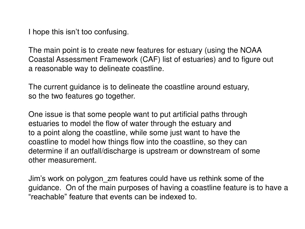
I hope this isn’t too confusing. The main point is to create new features for estuary (using the NOAA Coastal Assessment Framework (CAF) list of estuaries) and to figure out a reasonable way to delineate coastline. The current guidance is to delineate the coastline around estuary, so the two features go together. One issue is that some people want to put artificial paths through estuaries to model the flow of water through the estuary and to a point along the coastline, while some just want to have the coastline to model how things flow into the coastline, so they can determine if an outfall/discharge is upstream or downstream of some other measurement. Jim’s work on polygon_zm features could have us rethink some of the guidance. On of the main purposes of having a coastline feature is to have a “reachable” feature that events can be indexed to.
Existing NHD Barataria Bay Lake/Pond Stream/River Coastline Sea/Ocean
NOAA CAF Tidal Fresh Zone NOAA CAF Mixing Zone Selected Coastline features from NHD Sea/Ocean from NHD
Like everything else in this part of the world, it is a little unusual. The area to the east of Barataria Bay (non-purple) is NOT considered to be an “estuary” by NOAA CAF, presumably because of the barrier islands, it is not really open to the ocean. In the current NHD the water is classified as sea/ocean, but NOAA CAF classifies this drainage area as “land”.
Lake Salvador X X X X X X X X X X Delineate the coastline around Barataria Bay (purple area) all the way up to Lake Salvador. Connect the barrier islands to create the coastline east of Barataria Bay. Remove coastline where X’s are.
Another Option Create the NHD Coastline by connecting the barrier islands