Download
1 / 57
600 likes | 820 Views
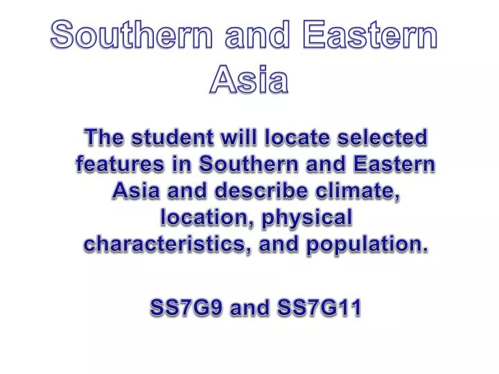
Southern and Eastern Asia. The student will locate selected features in Southern and Eastern Asia and describe climate, location, physical characteristics, and population. SS7G9 and SS7G11. Asia. Locate on your map the following places: Ganges River Huang He (Yellow River) Indus River

E N D
Southern and Eastern Asia The student will locate selected features in Southern and Eastern Asia and describe climate, location, physical characteristics, and population. SS7G9 and SS7G11
Locate on your map the following places: Ganges River Huang He (Yellow River) Indus River Mekong River Yangtze (Chang Jiang) River Bay of Bengal Indian Ocean Sea of Japan South China Sea Yellow Sea Gobi Desert Taklimakan Desert Himalayan Mountains Korean Peninsula
Ganges River The Ganges River runs for 1,560 miles from the Himalayas all the way to the Bay of Bengal. It is more than just flowing water. This river is life, purity, and a goddess to the people of India. People come to bathe in the river because they believe that anyone who touches these purifying waters will be cleansed of all sins.
Huang He (Yellow River) The earliest civilization in China settled on the banks of the Huang He. Ever since, the river has been a source of life and death (in the form of new soil and floods). The river has flooded so often that is has become known as the River of Sorrow. Known as the mother river by all the Chinese people, it runs 3,395 miles. The Yellow River is the second longest river in China after the Yangtze River . Research the flood of 1931
Indus River The Indus River valley is home to one of humanity's earliest civilizations and runs through the heartland of modern Pakistan Fun Fact:The world's first great civilizations developed in or around river valleys. The four great river valley civilizations were the Nile River Valley, the Tigris-Euphrates River Valley, the Huang-He River Valley, and the Indus River Valley.
Mekong River The Mekong River is an important source of water for irrigating farm lands. The power of the river is also harnessed to produce hydroelectricity. The river has many rapids and waterfalls as it leaves the Tibetan Plateau traveling southeast to the South China Sea. Because of this, the river is not navigable until it reaches Laos.
Yangtze (Chang Jiang) River The Yangtze also passes through the Three Gorges (Qutang, Xiling, Wu), a beautiful region that has been known more recently for a series of dam projects that have created controversy and struggles between developers and environmentalists. The Yangtze is the world's third-longest river at 3,917 miles. It is very important to Chinese farmers, providing water and nutrients for half of China’s agriculture.
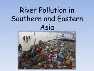
Weather conditions are often harsh in the Bay of Bengal as the area is hit by heavy monsoon rains, both summer and winter. Destructive cyclones are common in the spring and fall months, bringing high winds and severe flooding. Because of it's low-lying land, southern Bangladesh is often hit by these storms. Many large river systems drain into the Bay of Bengal, including the Ganges and Irrawaddy.
Indian Ocean The Indian Ocean is the third largest of the world's oceanic divisions, covering about 20% of the water on the Earth's surface. It stretches more than 6,200 miles from the southern tip of Africa to the coast of Australia.
There is a dispute over using the name "Sea of Japan" to refer to the sea bordered by Russia, Japan, North Korea, and South Korea. North Korea proposes the "East Sea of Korea" and South Korea proposes the "East Sea", instead of, or as a name concurrent with, "Sea of Japan". Cold, dry winter winds cause snow and crashing waves to hit the west coast of Japan from December to March.
South China Sea Many ships travel across the South China Sea carrying food, oil, and other goods. Throughout the year, monsoons (strong storms involving high winds) blow across the sea affecting agriculture production.
The Yellow Sea lies between China and the Korean Peninsula. Its name comes from the color of the silt-laden water that runs into it from some of China’s major rivers.
Gobi Desert Mongolian: Говь Chinese: 戈壁(沙漠) is the largest desert region in Asia and the fifth largest in the world. Most of the Gobi is made up of bare rock rather than sand.
Takla Makan Desert (Taklimakan Desert) The Taklimakan is China's largest, driest, and warmest desert.It is also, the world's largest shifting-sand desert, eighty-five percent (125,000 square miles) of this region consists of sand dunes that support very little or no vegetation.
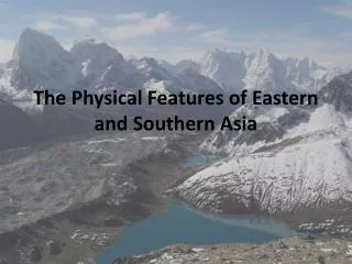
The Himalayas form the planet's highest mountain region, containing 9 of the 10 highest peaks in the world. They were given the name Himalaya which means "home of snow", because snow never melts on their high peaks. Himalayan Mountains
Korean Peninsula The Korean Peninsula is a peninsula in East Asia. It extends southwards for about 684 miles from continental Asia into the Pacific Ocean and is surrounded by the Sea of Japan (also called the East Sea) on the east, the East China Sea to the south, and the Yellow Sea to the west. Until the end of World War II, Korea was a single country whose territory roughly coincided with the Korean Peninsula. Since the end of the Korean War in 1953, the country was divided in half between the countries of North and South Korea. Peninsula – a piece of land surrounded by water on three sides.
Locate on your map the following countries: China India Indonesia Japan North Korea South Korea Vietnam.
Peoples Republic of China Capital - Beijing Currency - Renminbi (¥) (CNY) Official languages - Standard Mandarin (spoken) Simplified Chinese (written) China has the largest population in the world. China is officially an atheist country. China is one of the most important trading nations in the world. They import and export many goods all over the world. Entrance to the Forbidden City.
Impact of location, climate, physical characteristics onCHINA The same variety of climates found in India are also found in China. A country as large as China has nearly every type of climate. High mountain ranges to the south cut China off from India and the moisture that might come from the Indian Ocean. (i.e. monsoons) The Gobi and Taklimakan desert regions in the center of the country are harsh and dry.
Impact of location, climate, physical characteristics onCHINA Mongolia to the north is semi-arid, and the areas to the east and south are humid and even tropical. Most of China’s one billion people live in the areas of the country that have the milder climates. It is also where one finds the great river valleys and most of China’s fertile farmland.
Impact of location, climate, physical characteristics onCHINA Two great deserts are located in northern China: the Gobi and the Taklimakan. Few people live in these regions, and many of those that do live as nomads or animal herders. Other parts of northern and eastern China have climates that are more moderate and some farming is possible.
Impact of location, climate, physical characteristics onCHINA The northeast, along the route of the Yellow River, is China’s most heavily populated region. Beijing is located here. While agriculture is common, this region of the country is also China’s industrial center. Farming is the most common occupation of the Chinese who live in the southeastern part of the country.
Impact of location, climate, physical characteristics onCHINA Here the Yangtze River flows to Shanghai, China’s largest seaport. This region of the country is the site of the Three Gorges Dam. This large hydroelectric project was designed to bring electricity to China’s rural areas. For Chinese workers, rapid industrialization has meant many have left their rural homes and found work in overcrowded cities.
India Capital - New Delhi Currency - Indian rupee (₨) (INR) Official languages: Hindi and English India has the second largest population in the world (after China). The lowlands around the Deccan Plateau are where most of India’s agriculture is grown. The two major religions in India are Hinduism and Islam. The people and industries of India manufacturer many goods.
Impact of location, climate, physical characteristics onINDIA A large desert borders Pakistan, while the Ganges Plain is humid and almost tropical. The Deccan Plateau in the center of the country is more moderate, with a subtropical coastal plain along the Indian Ocean. Most of India’s people rely on farming and other agricultural work, so most of the people live along the great rivers in fertile river valleys.
Impact of location, climate, physical characteristics onINDIA Some of India’s largest cities are also located along the Ganges River and/or near the coast. Fewer people live in the Deccan Plain in the higher center of the country. The climate of India is shaped by seasonal winds known as monsoons. These winds blow hot, dry air across the continent from the northeast during the winter.
Impact of location, climate, physical characteristics onINDIA In the spring and summer, the winds come from the opposite direction and bring heavy rains from the ocean. These monsoon winds can be a blessing when they bring much needed rain. On the other hand, monsoon rains can cause destructive flooding. The monsoons are very unpredictable.
Impact of location, climate, physical characteristics onINDIA India is separated from the rest of Asia by three mountain ranges: the Hindu Kush, the Himalayas, and the Karakoram. Because of this India is often called a subcontinent (a division of a continent). Just south of the large mountain ranges, most of India is made up of a broad plain between the Indus River and the Ganges River.
Impact of location, climate, physical characteristics onINDIA The land in this plain is very fertile, because the rivers provide tons of silt to enrich the soil. South of this great plain is an area of higher plateau called the Deccan Plateau. Even further south, the land gives way to a narrow strip along the coast of the Indian Ocean.
Impact of location, climate, physical characteristics onINDIA India’s mountains have sometimes stopped invaders from the north who wanted India’s fertile river valleys to the south. At other times, invaders have been able to use natural passes through the mountains to make their way into the heart of India and establish new rulers and customs.
Impact of location, climate, physical characteristics onINDIA Most Indians live in the major river valleys, particularly the Ganges. People are moving into the cities from rural areas in large numbers looking for work and better opportunities for their families or future. The rivers provide transportation, trade routes, water for irrigation, and water to supply the people living in the cities.
Impact of location, climate, physical characteristics onINDIA The rivers have become the easiest means of disposing of human, animal, and industrial waste. As a result nearly all of India’s large cities have problems with over-crowding, air and water pollution.
Indonesia Capital - Jakarta Currency - Rupiah (IDR) Official language: Indonesian The country of Indonesia is made up of thousands of islands. Most of the large islands are volcanic mountains covered in tropical forests. There are many ethnic groups in Indonesia. The Papuans maintain a primate lifestyle based on ancient customs and have very little contact with the rest of the world.
Japan Capital - Tokyo Currency - Yen(JPY) National language: Japanese Japan is one of the world’s leading producers of motor vehicles, steel, and high-tech goods. While most of the countries of southeast Asia are poor, Japan is the second wealthiest country in the world. Japanese citizens are well educated. Cherry blossoms and Mount Fuji
Impact of location, climate, physical characteristics onJAPAN Japan, an island nation on the far eastern edge of East Asia, has a climate affected by ocean currents. The Japan current coming from the south brings warm water to the southern and eastern coasts of Japan, while the Oyashio current coming from the north cools the northern coast.
Impact of location, climate, physical characteristics onJAPAN The warmer parts of the country are able to have longer growing seasons for farmers, while those living in the cooler north rely on fishing. Japan experiences monsoon rains and even tropical hurricanes called typhoons. Almost 80% of Japan is covered with mountains. This leaves a small percentage of land suitable for farming.
Impact of location, climate, physical characteristics onJAPAN The Japanese have created farmland out of these mountains by building terraces, putting in irrigation channels, and using different fertilizers and farming techniques. Even so, Japan has to import food for its growing population. There are many volcanoes in Japan. These volcanoes are often caused by earthquakes. Japan has more earthquakes every year than any other place in the world.
Impact of location, climate, physical characteristics onJAPAN The Japanese people have adjusted to the threat of earthquakes, even though many cause a lot of damage. Some parts of the country have developed hot springs around the volcanic areas, and others use the heat to warm water for people to use.
Impact of location, climate, physical characteristics onJAPAN Because Japan has so little farmland, the Japanese depend on fishing for much of their food. The country has a very highly developed industrial economy, but no gas or oil. They therefore depend on the world market for their petroleum (oil) products.
North Korea Capital - Pyongyang Official language: Korean Currency: North Korean won (₩) (KPW) North Korea has recently begun firing rockets toward the United States (the island of Hawaii) in a demonstration of military strength.
South Korea Capital - Seoul Official languages: Korean Currency: South Korean won (₩) (KRW) Tension between the two Koreas has caused South Korea some concern. Picture of Seoul downtown
Impact of location, climate, physical characteristics onNORTH KOREA North Korea shares a border with China and has short summers and long, cold winters. The land is mountainous and not as heavily populated as South Korea.
Impact of location, climate, physical characteristics onSOUTH KOREA South Korea has fewer mountains and a milder climate than North Korea, primarily due to the warm winds that come from the ocean. South Korea also has a larger population than North Korea. The country’s largest city is it’s capital Seoul. Farming is more widely practiced here than in mountainous North Korea.
Impact of location, climate, physical characteristics onNORTH KOREA The mountains of North Korea have meant that it has had less success with agriculture than many other countries in the region. There are fast-flowing rivers in the mountains where North Korea have developed hydroelectric plants. The country earns a profit from mining coal and other minerals like iron and copper. Most people live along the western half of the country where the mountains slope down to the sea and farming is more successful.
Impact of location, climate, physical characteristics onSOUTH KOREA South Korea is less mountainous and a large part of the country is excellent farmland. The population is greater than North Korea with about 25% of the people living in and around the capital city, Seoul.
Vietnam Capital - Hanoi Currency: đồng (₫) (VND) Official languages: Vietnamese Ban Gioc Waterfalls on the Chinese-Vietnamese border in Northern Vietnam
Impact of location, climate, physical characteristics onVIETNAM Country’s further to the southeast like Vietnam are warmer and tropical. Here climate and geography join to create rich farmlands where 90% of the world’s rice is grown.