Download
1 / 17
180 likes | 412 Views
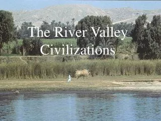
The rate of flood water spreading in the river valley substrate. Monika Ćwiklińska Piotr Kuźniar Politechnika Warszawska. Purpose of the presentation. to present the results of field tests carried out in the flooding period in July 2000 ,

E N D
The rate of flood water spreadingin the river valley substrate Monika Ćwiklińska Piotr Kuźniar Politechnika Warszawska
Purpose of the presentation • to present the results of field tests carried out in the flooding period in July 2000, • to confirm the hypothesis about strict connection between the Vistula waters and underground waters in the areas adjacent to the river.
Plan of the presentation • Introduction. • Study area. • Interpretation of the data collected. • Conclusions.
Introduction Retention – the phenomenon of temporary water hold-up in river catchment: • surface retention, • riverbed and valley retention, • lake and basin retention, • terrain surface retention, • underground or ground retention.
Study area Characteristic of the area of the Gniewoszowsko-Kozie-nickaValley: • km 383 in Regów is the end of the Małopolska Vistula Gap in which mean width of the river valley is 3 km, • km 383 in Regów is the beginning of the Middle Vistula Valley reaching 9 km in width,
km 425 Gniewoszowsko-Kozienicka Valley km 385 Fig. 1. The map of the study area
Study area (2) • km 425 near Świerże Górne is the end of the Gniewoszowsko-Kozienicka Valley, • the entire segment (Regów – Świerże Górne) is 42 km, • the surface area is about 130 km2, • covered by a layer of very well permeable alluvia.
Interpretation of the data collected The measurements of the water level were done: • in 54 farm wells, • during the passage of a small high waterin July 2000.
Interpretation of the data collected (2) The results were presented in: • charts, • the maps of hydroisohypses.
Conclusions • The hydrogeological and hydrological measurements performed showed the existence of a correlation between the Vistula water stage and the under-ground water levels. • The correlation between the distance and the volume of changes or the delay in time from the fluctuations in the Vistula water stages does not occur everywhere.
Conclusions (2) • A comparison of hydroisohypse maps helped to find a change in river type of Vistula. • The fast rate of underground water propagation is a good factor in the process of flood wave reduction; however, it may represent a risk in a crisis situation related to the propagation of pollutants.
Contact Department of Hydraulic EngineeringInstitute of Water Supply and Hydraulic EngineeringFaculty of Environmental EngineeringWarsaw University of TechnologyNowowiejska Str. 20 ph. 6605335, fax 6213370, monika.cwiklinska@is.pw.edu.plpiotr.kuzniar@is.pw.edu.pl