Download
1 / 58
580 likes | 617 Views
Rural Land Degradation. Sahel. Senegal The Gambia Mauritania Mali Burkina Faso. Niger Nigeria Chad Cameroon Sudan. Countries of the Sahel. Senegal. The Gambia. Conditions of the Sahel. Two hot seasons – approx Feb-April, and Sept-Oct Short rainy season between May-Aug

E N D
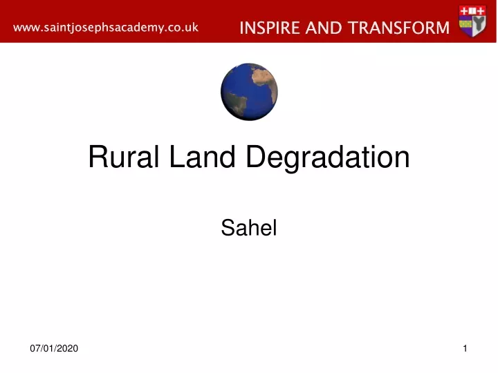
Rural Land Degradation Sahel
Senegal The Gambia Mauritania Mali Burkina Faso Niger Nigeria Chad Cameroon Sudan Countries of the Sahel
Senegal The Gambia
Conditions of the Sahel • Two hot seasons – approx Feb-April, and Sept-Oct • Short rainy season between May-Aug • During Dec and Jan the Harmattan, a wind from the desert, brings cooler weather and thick dust • Annual rainfall is variable and unpredictable – recent years ave between 100-200mm • Since the 1960’s rainfall has been gradually declining
Cont. • The Sahel’s memory of the 20 year long drought that killed thousands between the 1960’s and 1980’s still lingers • Though recent rainfall patterns are considered normal, desert creep is an ongoing threat • Since the 1930’s the Sahel has lost 30% of its trees to cutting for fire wood or new grazing lands
Cont. • Without trees, rainfall loosens and soil erodes more easily from wind and water • Irrigation is not viable in all areas, so windbreaks and strict rules on grazing offer some solutions
Landscape • The Sahel’s most distinctive feature is its flat, barren plains • This sandy, scrubby land stretches roughly 2,400 miles across Africa from the Gambia to Chad • It contains the fertile delta of the Niger, one of Africa’s longest and most powerful rivers • Other notable bodies of water include the Senegal, Gambia and Nil and Lake Chad, straddling Chad, Cameroon, Nigeria and Niger
Using NASA satellite images, two researchers at the University of Wisconsin-Madison measured the surface area of the freshwater lake It measured 10,000 square miles (25,000 square km) in 1963, compared with 839 square miles (1,350 square km) today.
Human Activity in the Sahel – Arable Farming • A wide variety of crops e.g. barley, sorghum and vegetables are grown together with drought resistant species e.g. millet • Trees are retained and/or planted amongst the crops – these provide protection form wind erosion by acting as a windbreak, binding the soil together and by shading the ground (this reduces evaporation
Cont. • The trees will also provide a source of fuel for cooking and fruit/nuts for the farmer • Farmers leave sections of their land fallow for up to 20 years to allow it to rejuvenate • It is important to grow a variety of crops in order to avoid the impact of monoculture, i.e. relying on only one crop, and exhausting the soil by removing the same nutrients year after year
Cont. • The removal of these nutrients destroys the soil structure and leaves the sol more susceptible to wind and water erosion • The other advantage of growing a variety of crops is that if a crop is affected by disease or pests the farmer still has other sources of food for his/her family • In this way the farmer is able to provide as mixed diet for the family as well as retaining the productivity of the soil by varying crops grown
Human Activity in the Sahel – Pastoral Farming • Livestock rearing of cattle, goats and sheep is also practiced in the Sahel • The majority of these pastoral farmers are nomadic, moving from one area to the next following the rains, to find fresh pasture for their animals
Cont. – the success of this type of farming depends on: • Avoiding overgrazing an area, leaving the soil vulnerable to erosion, as the vegetation no longer offers any protection • Finding sources of water for animals to drink e.g. wells, rivers, lakes • The ITCZ providing sufficient rainfall for vegetation to grow in the areas traditionally used by nomadic pastoralists • Maintaining herd sizes at a level which is sustainable
Cont. • In many regions of the Sahel, the size (not the quality) of an individual’s herd is a measure of his status within a tribe • It is a hard but highly adapted way of life • Some tribes such as the Samburu of northern Kenya are able to survive for long periods on what their cattle can provide e.g. they drink a mixture of blood and milk, eat the meat and wash in the urine.
Causes of Land Degradation in the Sahel • The causes of rural land degradation cannot be attributed to any one factor, but the interaction of a wide range of both physical and human variables
Physical Factors • Droughts are now occurring in the Sahel with greater frequency than has been experienced in the past • This has major implications for the growth of vegetation and the formation of soils • As the vegetation struggles to survive in the drought conditions, the soil becomes exposed and the topsoil (the most fertile part) is blown away by the wind or washed away by flash floods caused by tropical downpours
Cont. • The unpredictability of the Sahel climate is illustrated by the fact that Burkina Faso’s cotton crop was destroyed by flash floods in 1994, and in 1996-97,67,000 tonnes of emergency food aid were required by Burkina Faso to deal with food shortages caused by drought
Human Factors • Reduced death rates due to improved health care means rapid population growth in the Sahel • The result is more mouths to feed - greater pressure is placed on the finite resources available to produce more food • In countries such as Burkina Faso, Chad, Mali and Mauritania populations are increasing at a rate of 2.5% per year – compared with food increase of 1% a year
Human Factors - Overcultivation • Arable farmers are forced to increase yields from their land – the fallow periods allowed for the soil to regenerate are reduced and the sol becomes depleted of its nutrients • Increasingly unreliable rainfall means crops often fail and the soil is degraded • Rising populations have also forced farmers to increase the amount of land utilised for arable farming
Cont. • This has led to the cultivation of marginal areas e.g. on the fringes of the Sahara • These areas are not a viable option in terms of sustained crop production and as a result cultivating them accelerates the process of desertification
Human Factors - Overgrazing • The rise in population has brought about an increase in the size and number of the herds grazing in the Sahel • This places greater pressure on grazing areas particularly around the wells, boreholes, lakes and rivers where the animals are taken to drink • The concentration of herds within these areas results in the vegetation being stripped down to the roots, leaving soil exposed
Cont. • In addition, compaction of the soil by trampling reduces the infiltration capacity of the soil and increases run off (and therefore water erosion) • As a result farmers are forced to graze increasingly marginal areas • Land degradation follows rapidly allowing the desert to expand
Human Factors - Deforestation • Rising population puts extra strain on woodland with constitutes the main source of domestic fuel • Since 1900, 90% of forests have been cleared from the Ethiopian Highlands • Deforestation removes the binding effect of tree roots, the protection afforded by the foliage and the ability of the trees to reduce wind speeds
Cont. • The shortage of fuelwood means that more families are having to resort to animal dung and crop residues for their domestic energy requirements • The dung and crop residues would normally be used as fertiliser so the soil is further degraded as it is deprived of essential nutrients – in the long term this will affect crop yields
Human Factors - Urbanisation • As people move from rural areas in search of jobs, the urban population increases – higher standard of living and better education opportunities • The population of Niger’s capital, Niamey, rose from 207,000 in 1980 to just under 1 million in the year 2000 • Growth and development of small settlements in rural areas has also increased
Cont. • All of these settlements create a growing demand for firewood, so large areas of forest are cut down and the wood sold in the settlements • Much of the fuel is sold as charcoal because it is lighter, not as bulky and therefore cheaper than wood to transport • Wood is transformed into charcoal by burning it slowly in earthen pits
Cont. • This process is extremely inefficient and half the energy of the wood is lost during conversion • It is estimated that 1.3 billion people worldwide are consuming fuelwood resources at a rate which is not sustainable
Human Factors – Growth of cash crops • During the twentieth century some farmers in the Sahel moved away from traditional techniques and began growing cash crops such as cotton and rice • This resulted in monoculture, which rendered the soil infertile • This was often accompanied by inappropriate farming techniques such as flood irrigation
Cont. • In Niger, for example, water is pumped out of the River Niger to irrigate fields of rice • The flood irrigation can lead to salinisation of the soil and as a result it becomes degraded
Irrigation • The four main methods used today to irrigate fields are flood, furrow, sprinkler, and drip, or trickle, irrigation • Flood irrigation is used for close-grown crops such as rice and where fields are level and water is abundant • A sheet of water is allowed to advance from ditches and remain on a field for a given period, depending on the crop, the porosity of the soil, and its drainage.
Answer the following questions: • What is desertification and why does it affect the Sahel? • a) Make your own copy of fig 2.44 then use this diagram to describe the features of climate in the Sahel that make it susceptible to desertification b) The climate graph does not tell us anything about rainfall reliability. Why is this information crucial in being able to understand why the Sahel is affected by desertification?
Continued: • Explain why the traditional agricultural techniques practiced in the Sahel have been successful for many centuries and have not resulted in the long term damage of the Sahel’s ecosystem. • ‘Urbanisation is the main cause of land degradation in the Sahel’. Do you agree or disagree with the statement? Justify your answer. • The promotion of cash crop agriculture presents a conflict of interests for countries in the Sahel. Discuss the arguments for and against increasing the cropland area given over to cash crops.
Consequences of Land Degradation – Physical Impacts • The increased frequency of drought periods, the farming of marginal arras along the northern boundary of the Sahel and deforestation have led to the southward expansion of the Sahara desert • In the last 50 years, 65 million hectares of the Sahel have turned to desert and in Sudan the Sahara has advanced by 100km in 17 years • Desertification is now estimated to be spreading at a rate of 1.5million hectares per year in the Sahel
Rills and Gullies • The exposure of soil leaves it open to the intense tropical downpours of the ITCZ • As a result overland flow removes topsoil and cuts into the land forming rills and gullies • This is also a problem where soil has been compacted by the trampling of animals