Download
1 / 132
1.32k likes | 1.32k Views
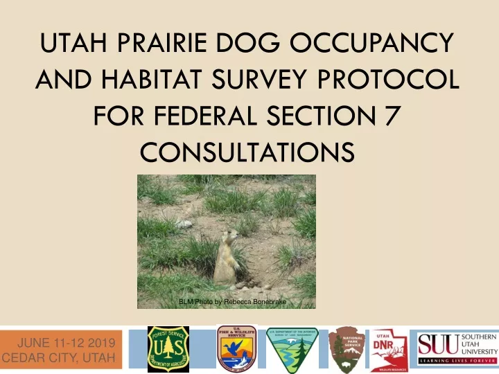
UTAH PRAIRIE DOG OCCUPANCY AND HABITAT SURVEY PROTOCOL FOR FEDERAL SECTION 7 CONSULTATIONS. BLM/Photo by Rebecca Bonebrake. June 11-12 2019 Cedar City, utah. Introduction. BLM/Photo by Rebecca Bonebrake.

E N D
UTAH PRAIRIE DOG OCCUPANCY AND HABITAT SURVEY PROTOCOL FOR FEDERAL SECTION 7 CONSULTATIONS BLM/Photo by Rebecca Bonebrake June 11-12 2019 Cedar City, utah
Introduction BLM/Photo by Rebecca Bonebrake Purpose: Determine if Utah prairie dogs inhabit, or ever have inhabited, a proposed project area. BLM/Photo by Rebecca Bonebrake
Introduction BLM/Photo by Rebecca Bonebrake Why/What info are we trying to obtain? • To be in compliance with the Endangered Species Act. • Determine the status of Utah prairie dogs and their habitat in relation to a proposed project. • Provide information necessary to devise and implement actions that will avoid and/or minimize impacts to Utah prairie dogs.
Introduction BLM/Photo by Rebecca Bonebrake Adaptability • Our knowledge is continuously developing and changing. • This protocol is a work in progress and will be modified as new information becomes available. (Please note 2018 modifications) • Special conditions might dictate that surveys be conducted differently in rare instances. • Any deviation from the approved survey protocol MUST be approved by Utah Ecological Services Field Office AND the Authorizing Federal Agency prior to survey activity.
Surveyor Qualifications All Surveyors must be certified. Certified = Successful completion of a USFWS approved UPD Training. Survey results from non-certified surveyors will not be used for assessing impacts to UPD’s.
Surveyor Qualifications • Successfully complete training course every four years. • Protocol changes may require early re-certification. • Must carry training cards when surveying.
Pre-Survey Coordination Authorizing federal agency Federal nexus Action area Mapped habitat GRAMA Private land access Don’t miss this critical step: Pre-Survey Coordination! This section of the protocol contains important directions for conducting a survey. We will discuss them in the following slides. Please follow these steps in order.
Pre-Survey Coordination Example Authorizing Federal Agents USFWS BLM, USFS, etc. Prior to conducting surveys Certified Surveyors must coordinate with the Authorizing Federal Agency
Authorizing Federal Agency For projects on federal lands; the authorizing agency is the agency which administers the lands where the proposed project occurs and from whom a permit or other authorization is needed before the project may be implemented. Examples of Authorizing Federal Agencies: BLM, USFS, NPS
Pre-Survey Coordination The role of the authorizing agency is to determine what areas need to be surveyed and what areas would be exempt from surveys; they are also responsible for validating the survey results and ensuring that the protocol is followed during data collection. DON’T ASSUME YOU KNOW WHAT NEEDS TO BE DONE – CONSULT WITH THE AUTHORIZING FEDERAL AGENCY PRIOR TO STARTING SURVEYS!!
Authorizing Federal Agency If the authorizing federal agency is not a land management agency, coordinate all survey details with the U.S. Fish and Wildlife Service. For projects on private lands with a federal nexus, the authorizing federal agency is the federal agency connected to the private lands action.
What’s a Federal Nexus??? A. A newly discovered galaxy.
What’s a Federal Nexus??? A. A newly discovered galaxy. B. A hair-care product.
What’s a Federal Nexus??? A. A newly discovered galaxy. B. A hair-care product. C. Any private actions that are: federalized for purposes of NEPA through a key federal decision and considered as a connected action and included within the scope of the federal agency’s decision making.
What’s a Federal Nexus??? A. A newly discovered galaxy. B. A hair-care product. C. Any private actions that are: federalized for purposes of NEPA through a key federal decision and considered as a connected action and included within the scope of the federal agency’s decision making. D. A luxury sedan.
What’s a Federal Nexus??? A. A newly discovered galaxy. B. A hair-care product. C.Any private actions that are: federalized for purposes of NEPA through a key federal decision and considered as a connected action and included within the scope of the federal agency’s decision making. D. A luxury sedan.
Federal Nexus: A “federalized” project is one for which the agency has discretion to authorize or permit the action, or proposes to contribute substantial funds, equipment or staff to implement.
To Determine Authorizing Agency: Ask Yourself: Does the project involve private, state, or federal lands? 2. Does the project have any federal funding or permits? 3. Is this a private or federally sponsored project?
What is an Action Area? ACTION AREA: • The entire right-of-way or exterior boundary of a proposed action plus the appropriate Buffer Type: • 1000-foot bufferfor projects that do or do not permanently alter or substantially impact habitat, or include surface occupancy, extending from the proposed project footprint. (2018 change)
What’s my buffer? The buffer type will be determined by the authorizing federal agency in coordination with the U.S. Fish and Wildlife Service.
How large of a buffer? Photo by Transcon Environmental Photo by Transcon Environmental For projects with large permanent surface or buried structures that may substantially alter Utah prairie dog habitat or behavior, or extend into the following breeding season, the buffer zone extends outward ½ mile from the proposed project right-of-way or exterior boundary.
How large of a buffer? BLM Photo BLM Photo 2018 Change Highlighted Below! Gravity survey For projects that temporarily impact Utah prairie dog habitat (do not extend into the following breeding season and the habitat can feasibly be restored), or those projects with small permanent surface or buried structures that do not substantially alter prairie dog habitat or behavior, the buffer is an 1000 foot zone extending out from the proposed project right-of-way or exterior boundary.
Pre-Survey Coordination The authorizing federal agency may provide additional maps of suspected Utah prairie dog habitats. The authorizing federal agency can also identify areas that will be exempt from surveys based on habitat suitability. Mapped habitat within the Action Area can be obtained from UDWR. You must submit a Government Records Access and Management Act (GRAMA) request.
Rules for Private Land Access: • Private Land Access: • Written permission from the legal landowner or lessee is required to legally access privately owned lands. • If access cannot be obtained to privately owned lands in the Action Area, the surveyor must use other accessible vantage points, optics, aerial photos, audio cues, other technology, and interviews of knowledgeable land managers and agency biologists to assess prairie dog occupancy and extent of suitable habitat.
Rules for Private Land Access: • Private Land Access: • If other survey methods are not available on inaccessible private lands or do not provide adequate data for the federal authorizing agency to make a conclusive decision concerning occupancy, then the inaccessible land in question must be assumed occupied by Utah prairie dogs.
Summary/Key Points: Prior to conducting surveys, certified surveyors must coordinate with the authorizing federal agency of the land parcel.
Summary/Key Points: Prior to conducting surveys, certified surveyors must coordinate with the authorizing federal agency of the land parcel. A project that occurs on private land, but is being funded by a federal agency, requires Section 7 consultation.
Summary/Key Points: Prior to conducting surveys, certified surveyors must coordinate with the authorizing federal agency of the land parcel. A project that occurs on private land, but is being funded by a federal agency, requires Section 7 consultation. The Action Area is defined as "the entire right-of-way or exterior boundary of a proposed action plus the appropriate Buffer Type.”
Summary/Key Points: Prior to conducting surveys, certified surveyors must coordinate with the authorizing federal agency of the land parcel. A project that occurs on private land, but is being funded by a federal agency, requires Section 7 consultation. The Action Area is defined as "the entire right-of-way or exterior boundary of a proposed action plus the appropriate Buffer Type.” The two sizes of project buffers, based on project type, are 1000 feet and ½ mile. 2018 Change
Summary/Key Points: • Prior to conducting surveys, certified surveyors must coordinate with the authorizing federal agency of the land parcel. • A project that occurs on private land, but is being funded by a federal agency, requires Section 7 consultation. • The Action Area is defined as "the entire right-of-way or exterior boundary of a proposed action plus the appropriate Buffer Type.” • The two sizes of project buffers, based on project type, are 1000 feet and ½ mile. 2018 Change • If written permission from the legal landowner or lessee to access privately owned lands cannot be obtained to conduct a survey, the area must be assumed to be occupied by Utah prairie dogs.
What must be surveyed? Utah prairie dog surveys. Are they required throughout the State of Utah?
What must be surveyed? Are surveys required throughout the Historic Range of the Utah prairie dog? Juab Sanpete Millard Sevier Beaver Piute Wayne Iron Garfield Washington Kane
Surveys required within the Section 7 Survey Areas; agency discretion outside of these areas Blue line = historic range Green lines = county boundaries Green polygon = <5 miles from mapped habitat = high intensity surveys Purple polygon = ≥5 -10 miles from mapped habitat = low intensity surveys
What must be surveyed? The U.S Fish and Wildlife Service requires surveys of all suitable habitat within the Section 7 Survey Areas. BLM/Photo by Rebecca Bonebrake
Suitable Habitat BLM/Photo by Rebecca Bonebrake Habitat capable of supporting Utah prairie dogs includes: - grassland or low density sagebrush sites - agricultural fields - vacant lots - other areas as identified by the authorizing Federal agency. Habitat previously mapped by the Utah Division of Wildlife Resources must be treated as suitable, and occupancy status must be determined regardless of current vegetative status.
Unsuitable Habitat Photo by Rebecca Bonebrake Unsuitable habitat is so obvious that it does not need to be surveyed or mentioned further. FALSE Any habitat that you think is unsuitable must be documented as to why (shrub canopy cover transects, soil survey data, etc) and must be mapped as unsuitable. Otherwise, survey it!
Suitable habitat examples Sagebrush habitat/Public rangelands BLM/Photo by Rebecca Bonebrake BLM/Photo by Rebecca Bonebrake
Suitable habitat examples Weedy Rangelands BLM/Photo by Rebecca Bonebrake Photo by Cirrus Ecological Solutions, LC
Suitable habitat examples Public Rangelands BLM/Photo by Rebecca Bonebrake BLM/Photo by Rebecca Bonebrake
Suitable habitat examples Recreation Areas Bryce Canyon National Park/Photo by Sarah Haas
Suitable habitat examples Ponderosa Pine Parks US Forest Service/Photo by Jake Schoppe
Suitable habitat examples Agricultural Fields UDWR Photo
Suitable habitat examples Sagebrush habitat/Private lands UDWR Photo
Suitable habitat examples Agricultural Fields UDWR Photo
Suitable habitat examples Undeveloped/abandoned lands UDWR Photo
Suitable habitat examples Urban Areas UDWR Photo
Suitable habitat examples Grassland/ Pasture/Private lands UDWR Photo