Download
1 / 32
360 likes | 734 Views
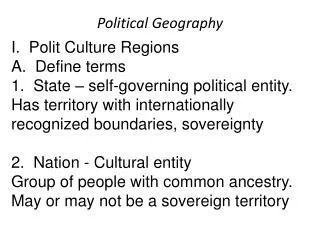
Political Geography . I. State and Nation. A. state: political unit (can be used interchangeably with country) B. nation: refers to a tightly knit group of people (usually having similarities: culture, language, religion, etc.) e.g. Yugoslavia is a state but not a nation.

E N D
I. State and Nation • A. state: political unit (can be used interchangeably with country) • B. nation: refers to a tightly knit group of people (usually having similarities: culture, language, religion, etc.) • e.g. Yugoslavia is a state but not a nation. • nationalism - loyalty to a nation/ sense of inclusion
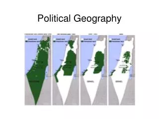
Stateless Nations - Have no national Territory • e.g. 1990 Palestinian Arabs • 6.5 million (Israel, Jordan, Lebanon, Syria) CIA Factbook. online
Kurdistan • 20 million Kurds • Turkey and Iraq very volatile relationship • Kurds desire territory or at least autonomous control of land in Iraq and Turkey Fellmann 343
Concept: Nation-State • Ideal built on homogeneity of territory and culture • Politically organized • Sovereignty: final authority over territories political & military affairs • Example - Japan • Ethnic Groups in Japan Japanese 99% Picture Here CIA Factbook. online
A. Territory Size-micro vs macro • Does Size =Power? No • Greater land area may equal greater resources • Could also lead to problems with regulating area (communication & transportation) CIA Factbook. online Vatican Map Micro State - Vatican Map
Size is not necessarily an indicator for success • Russia • Land Area: 6,550.7 square miles • Purchasing Power Parity $9700 (2002) • United States • Land Area: 3,787.4 • Purchasing Power Parity $36,300 (2002) CIA Factbook. online
B. Territory Shape Fellmann 423
1. Compact State: (circle shape) • the distance from any point of the country to its center is about the same. • supposed to provide the most geographic stability • e.g. Poland, Iceland, Democratic Republic of the Congo, Zimbabwe
2. Fragmented State • consisting of 2 or more pieces • can make some interactions within the country more difficult • e.g. Philippines
Hello down there! 3. Elongated • Can create separatist areas due to distance from center or core • Vietnam, Chile, Norway
Prorupt States • An area that extends from a compact area • Can create room for factions geographically • Southern Thailand
Perforated State • broken by another country • 1. exclaves: separated from the state by another state • e.g. Azerbaijan • 2. enclaves: surrounded by another state • e.g. Christian Armenia • e.g. South Africa-Lesotho US question next slide
Practice Analysis of Shape • What US state is an exclave? • The same state is also a prorupt state. • What shape best describes California? Elongated
Big Theme • Territory size & shape can influence political stability, but can not determine social, political, or economic well being.
What is a boundary? • Boundary: a vertical plane that cuts through the airspace and ground to determine ownership
Problems Boundaries • Lack of knowledge of underground resources when boundaries were created • 1990 Kuwait vs. Iraq: Rumaylah oil reserves • created International conflict
Who Controls Airspace? • When boundaries were created there was a lack of knowledge of importance of airspace • a. airline traffic • b. satellite space?
How are Boundaries Created? • Defined - usually legally by someone who is not directly involved (written) • Delimitation - mapped • Demarcation - marked with posts, walls, fences, etc.
Types of Boundaries • Geometric boundary: straight line boundary totally unrelated to physical features • e.g. United States border with Canada
Types of Boundaries • Physical-political/ or natural-political boundaries: boundaries which conform to physical features • e.g. United States border with Mexico along the Rio Grande
Types of Boundaries- genetic boundaries • A. antecedent boundary: some boundaries were defined and delimited before humans settled • e.g. Malaysia • B. subsequent boundaries: boundaries which developed according to the cultural landscape • e.g. Vietnam/ China
Types of BoundariesGenetic continued • C. superimposed boundaries: forcibly drawn boundaries across a culturally unified landscape • e.g. Papau New Guinea/ Indonesia • d. relict boundary: border that has ceased to function imprints still evident in cultural landscape. N-S Vietnam
IV. Boundary Disputes • A. Territorial / Definitional • -Whose Land is it? Focus on legal language of the agreement • B. Positional / Locational => 1991 • 1. focus on delimitation and demarcation of the border • 2. the interpretation of the definition is the dispute • 3. Saudi Arabia vs. Yemen (oil rich border not covered in the treaty)
IV. Boundary Disputes • C. Functional / Operational Border Dispute • 1. way boundary should function • 2. how should each side handle cross-border migration • D. Resources / Allocational Border Dispute • 1. dispute over boundary due to location of resources • 2. water supplies - Colorado River
Boundary Disputes • D. Allocational Border Dispute • 1. dispute over boundary due to location of resources • 2. water supplies - Colorado River nasa
Various boundary disputes - what type are they? • Botswana has built electric fences to stem the thousands of Zimbabweans who flee to find work and escape political persecution. • Eritrea and Ethiopia agreed to abide by 2002 Ethiopia-Eritrea Boundary Commission's (EEBC) delimitation decision, but despite international intervention, mutual animosities, accusations, and armed posturing have prevented demarcation; Ethiopia refuses to withdraw to the delimited boundary until claimed technical errors made by the EEBC that ignored "human geography" are addressed, including the award of Badme, the focus of the 1998-2000 war. • All of the Spratly Islands are claimed by China, Taiwan, and Vietnam; parts of them are claimed by Malaysia and the Philippines; in March 2005, the national oil companies of China, the Philippines, and Vietnam signed a joint accord to conduct marine seismic activities in the Spratly Islands. Functional Territorial and Positional Resource Source: http://www.cia.gov/cia/publications/factbook/fields/2070.html
Mari-time Boundaries • UN Convention on Law of the Sea Source: http://en.wikipedia.org/wiki/Image:Zonmar-en.svg
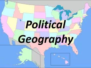
Changing political power in US • 4 level analysis Which regions of the country are gaining / losing representation? • How will this influence future elections? • Who is gaining / losing influence?