Download
1 / 21
260 likes | 548 Views
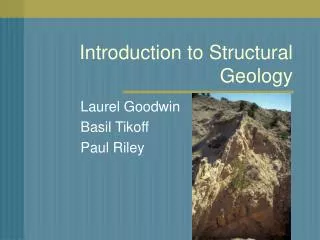
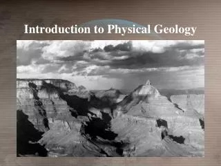
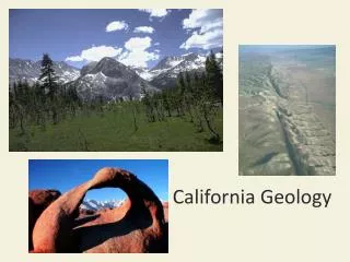
Introduction to California Geology. Plate tectonics geological history of a the State of California Mountains, valleys, faults, volcanoes, and glacial deposits relate to the formation of landscapes and their history. Land Forms. Owens Valley. Long Valley. Sierra Nevada. Mojave Desert.

E N D
Introduction to California Geology • Plate tectonics geological history of a the State of California • Mountains, valleys, faults, volcanoes, and glacial deposits relate to the formation of landscapes and their history
Land Forms Owens Valley Long Valley Sierra Nevada Mojave Desert You are Here
Earth History of Southern California Long Valley Owens Valley You are Here 3
Continental Margin • There are four recognized types of ocean-continent margin. California has been all four, at various times in the past billion years. • Atlantic-type: a passive margin, not a plate boundary • Andean-type: subduction close to shore, arc volcanoes built on continental basement • Japanese-type: subduction offshore, with a marginal sea between the arc and the mainland • Californian-type: transform fault, no subduction, no spreading 4
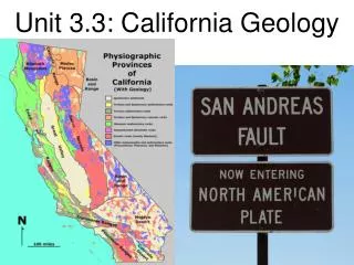
Geologic History of the Californian margin • A rifting event in the latest Pre-Cambrian • Two orogenies, the Antler (Devonian) and the Sonoma (Permian-Triassic): collisions of offshore arcs with North America; • Initiation of continental margin subduction with trench in today’s western Sierra foothills (Triassic-Jurassic); • Interruption of subduction by Late Jurassic Nevadan orogeny ; Andean trench-gap-arc system at Franciscan-Great Valley-Sierra location; • Cenozoic subduction of Pacific-Farallon ridge leading to growing no-slab zone, Laramide orogeny in Rocky Mountains, then initiation of basin-and-range extension and San Andreas Fault 5
Prior 700 Million Years • In the Proterozoic, the west coast of North America was attached to some other continent • Beginning around 800 million years ago, this other continent rifted away • Established a stepped western boundary of the continent. 6
700-400 Years Ago: Atlantic-type Passive Margin • Through mid-Devonian time, this remained a stable passive continental margin (Atlantic type) and deposition of clastic and carbonate sediments up to several km thick. • The miogeocline is the part of this system on the continental crust, inboard of the continental slope. • These Proterozoic-Paleozoic sediments still make up much of the exposed rock in the Western U.S.
400-250 Million Years Ago: Japanese-type Offshore subduction The ocean offshore widened and aged until it became unstable to subduction zone • The situation like Japan today, where subduction is occurring on both sides of the arc, with the Pacific plate and the Japan Sea both subducting under Japan. 8
400-250 Years Ago: Japanese-type Offshore subduction In the late Devonian, this offshore arc ran up against the North American margin in the Antler orogeny The arc ended up connected to the continent, overlying the miogeocline across the Roberts Mountain Thrust Fault
400-250 Million Years Ago: Japanese-type Offshore subduction the Early Triassic Sonoma orogeny, bringing a new sequence of oceanic rocks on top of the miogeocline and the Antler rocks. The island arc deposits forms the basement for the western Sierra Nevada batholith
250-50 Million Years: Andean-type subduction After Triassic time, the polarity of subduction remained “normal Andean-type continental margin arc formed, built on basement of Pre-Cambrian North America, Paleozoic miogeocline, and the arc terranes formed in the Antler and Sonoma events. 11
250-50 Million Years: Andean-type subduction • In the late Jurassic, another island arc terrane, riding on the subducting Farallon Plate, collided with the North American continent in the Nevadan orogeny. • The New subduction system that lasted through the Cretaceous and generated the still clearly recognizable sequences of Franciscan trench, Great Valley forearc, and Sierran arc • The Sierra Nevada batholith is the deep assemblage of plutonic rocks that formed under the arc volcanoes.
~50 Million Years Ago: End of subduction In the Cenozoic, the slab became completely horizontal, probably due to progressive decrease in age of the subducting Farallon Plate as the ridge approached the trench. Results include end of volcanism, major compressive orogeny far inland (Laramide orogeny of the Rocky Mountains) and formation metamorphic schists under Southern California 13
The flat-slab event due to increasing buoyancy of the slab as the Pacific-Farallon ridge approached the continent The next tectonic arrangement leads to transform motion between Pacific and North American plates Less than 50 Million years ago: San Andreas Fault 14
Modern Californian Margin Subduction of the Cascade margin and south of the Rivera triple junction (Mexican Volcanic Belt). large scale extension of the Basin-and-Range province, forming the characteristic topography of the Great Basin, and perhaps also the Rio Grande Rift. 15
Topographic Expression of Extension in Western U.S. Basin and Range Owens Valley Rio Grande Rift 16
Modern California: Basin and Range Extension Eastern California is the westernmost edge of the Basin and Range extensional province. (Owens Valley is a Basin; the Sierra Nevada and White-Inyo Mountains are Ranges). Extension is accommodated by normal faults.
Modern California: Strike-Slip tectonics There is evidence of strike-slip motion across the surface rupture of the 1872 Lone Pine earthquake. This air-photo of the San Andreas Fault shows a somewhat clearer an offset drainage.
Modern California: Post-arc magmatism • Long Valley is a Caldera, an elliptical hole formed by collapse of the roof of a magma chamber along a ring-shaped normal fault. It formed in a single catastrophic eruption 760,000 years ago, ejecting the Bishop Tuff.
Pleistocene California: Valley Glaciers • There is considerable evidence of the action of Valley Glaciers that descended from the High Sierra during the Pleistocene ice ages. • Glacial deposits are unsorted debris from glacial outwash is called till. • Mounds of till pushed by glaciers or dropped at locations where the ablation front of the glacier stalled for a time are called moraines: • lateral moraine • medial moraine • terminal moraine • recessional moraine
Summary • California has been all four Plate Boundaries, at various times in the past billion years. • California current costal boundary is Less than 50 Million years ago: San Andreas Fault • Northern California was subjected to valley glaciers activity during the last Ice age.