Download
1 / 22
230 likes | 421 Views
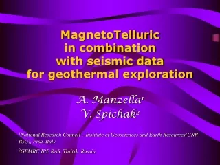
MagnetoTelluric in combination with seismic data for geothermal exploration. A. Manzella 1 V. Spichak 2. 1 National Research Council – Institute of Geosciences and Earth Resources(CNR-IGG), Pisa, Italy 2 GEMRC IPE RAS, Troitsk, Russia. Why resistivity?.

E N D
MagnetoTelluricin combination with seismic data for geothermal exploration A. Manzella1 V. Spichak2 1National Research Council – Institute of Geosciences and Earth Resources(CNR-IGG), Pisa, Italy 2GEMRC IPE RAS, Troitsk, Russia
Why resistivity? Geothermal waters have high concentrations of dissolved salts which provide conducting electrolytes within a rock matrix The conductivities of both the electrolytes and the rock matrix are temperature dependent in a manner that causes a large reduction of the bulk resistivity with increasing temperature.
The resulting resistivity is also related to the presence of clay minerals, and can be reduced considerably when the clay minerals are broadly distributed. From Anderson et al., WGC2000 From Pellerin et al., 1996
Resistivity should be always considered with care. Experience has shown that the apparent one-to-one correlation between low resistivity and the presence of fluids is not correct, since alteration minerals produce comparable, and often higher reduction of resistivity with respect to fluid flow. From Flovenz et al., WGC2005 Moreover, although the geothermal systems have an associated low-resistivity signature, the converse is not true.
Why MT? • Easy, light (now) field layout with respect to geolectrical soundings • obtains a MT transfer function, from which not only resistivity as a function of depth may be computed, but also the maximum and minimum resistance (anisotropy) as f.d. • allows estimation of electromagnetic strike • may penetrate at any depth, provided the necessary frequency • Disadvantage: being based on a weak natural signal it cannot be used everywhere (EM noise problem). Modern data processing is required
Various targets can be imaged by MT and seismic geophysical methods • Regional structure (geothermal system) • Fracture detection • Monitoring
Regional exploration Magnetotelluric Advantages • cheap • recognize fluid filled volumes Disadvantages • difficulty to distinguish alteration clays from actual fluid circulation (frozen condition) • poor geometrical resolution (volume sounding). Improved with dense spacing Seismic (reflection more often used) Advantages • good geometrical resolution of main lithological units Disadvantages • expensive • small response from more permeable zones
Regional exploration:MT examples MinamikayabeGeothermal field, Japan Takigami Geothermal Area, Japan From Spichak 2003 Highly conductive areas with apparent resistivity values not exceeding 6 Ohm⋅m From Ushijima et al., WGC 2005 “the low resistivity zone in the northeastern part is intensive and shallower than that in the southwestern par, in good agreement with the geological feature”
Las Tres Virgenes Geothermal Area, Mexico Mt. Amiata Geothermal Area, Italy From Volpi et al., 2003 The interpretation revealed a good correlation between the feature of the geothermal field and the resistivity distribution at depth From Romo et al., WGC 2000 The results suggest the presence of a highly attenuating and conductive zone along El Azufre Canyon, which corresponds with the production interval of wells LV-2 and LV-3/4. A graben structure is outlined. Ogiri geothermal zone, Japan From Uchida, 2005 3-D view of the resistivity model, from south. Shallow blocks to a 200m depth are stripped out and approximate locations of three faults are overlaid.
Fracture/fault detection Seismic (2D and 3D reflection more often used) Advantages • good geometrical resolution • advanced techniques developed for oil exploration Disadvantages • very expensive • small response from productive fracture • high cost/effective
Fracture/fault detection Seismic (advanced methodology) • Amplitude Versus Offset (AVO) • Amplitude Variation with Azimuth and offset (AVAZ) • shear wave splitting
Fracture/fault detection Magnetotelluric Advantages • cheap • resistivity changes are sensible • EM strike direction may define azimuth Disadvantages • low geometrical resolution (lateral resolution improved when using short site spacing)
Fracture/fault detection:MT examples Takigami Gothermal Area, Japan Mt. Amiata Geothermal Area, Italy From Tagomori et al., WGC 2005 “the large lost circulation occurred at the depth of 1300 m BSL for the well TT-14R (90 t/h) when the well crossed through the electrical discontinuity Fb” From Fiordelisi et al., WGC 2000 Note the very steep conductor and its correspondence in location to the fault defined by seismic reflection data.
Seismic It is very effective for gas or for oil investigation (water flood). Very expensive Not so easy to manage for geothermal since resolution is lower (VP and VS change is smaller than for oil) Monitoring
Magnetotelluric Phase change of pore fluid (boiling/condensing) in fractured rocks can result in resistivity changes that are more than an order of magnitude greater than those measured in intact rocks Production-induced changes in resistivity can provide valuable insights into the evolution of the host rock and resident fluids. No examples or applications found in literature Some examples from SP (electric field) showing interesting results: is it possible to use the same kind of information in MT? To be defined Monitoring
SP monitoring Monitoring From Marquis et al., 2002 “the correspondence between the start (and the end) of the stimulation and the increase (and decrease) in ΔV suggests a casual relationship between the two”
Integration of seismic and MT data It can be done • quantitatively (joint inversion) • qualitatively (by comparison and separated inversion constraining the a priori conditions) • semi-quantitative (joint interpretation)
Example of joint inversion When resistivity and VP changes depends on the same effect (e.g., permeability/porosity change) a resistivity-velocity cross-gradients relationship can be established and incorporated in a joint inversion scheme. This approach requires a strong assumption: could be valid only for limited volumes and depths From Gallardo and Meju, 2004 “Evolution of the joint inversion process. Shown are the resultant resistivity and velocity models for each iteration. Note the gradual development of common structural features in both sets of models during the process.”
Example of using constrained a priori model in MT inversion Travale Geothermal Area, Italy Quality of inversion results improves when external data are used. Here we show inversion results using an homogeneous a priori model (above) or a detailed a priori model where shallow lithological units have been identified from a resistivity point of view. The resulting models appear like out-of-focus in the first case, whereas it provides useful information for comparison with known geological structure in the second case.
Joint interpretation by post-processing simulation Needs: • geological data • seismic inversion data (VP, VS) • MT inversion data (true resistivity) • rock physics data joining VP, VS, resistivity to lithology, temperature, pressure, permeability... The key element in the joint interpretation is the use of geothermal reservoir simulators to obtain a final model complying with all available data, both geophysical and thermo-hydraulic. To be evolved!
Conclusions MT provides a useful contribution to geothermal exploration and exploitation, through careful data acquisition, processing, modeling and interpretation. Its integration with other geological and geophysical data, in particular seismic, will improve the imaging of static and dynamic processes of geothermal systems.