Download
1 / 19
190 likes | 304 Views
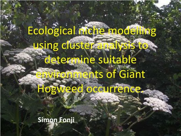
Ecological niche modelling using cluster analysis to determine suitable environments of Giant Hogweed occurrence. Simon Fonji. Presentation Outline. Background Objective Research questions Methods Results Conclusion. Giant Hogweed General Physiology: Why is it such a successful

E N D
Ecological niche modelling using cluster analysis to determine suitable environments of Giant Hogweed occurrence. Simon Fonji
Presentation Outline • Background • Objective • Research questions • Methods • Results • Conclusion
Giant Hogweed • General Physiology: • Why is it such a successful • Invader in Latvia? • Mature height of 6 to 21 feet makes it • taller than any other herbaceous plant or • grass in Latvia • - Leaves up to 1.5 meters across • on lower 1/3 of stalk readily shade out • competitors in the understory • - Compound umbel (flower) can • reach 2 meters in diameter and • produce up to 100,000 seeds with over 90% • viability rate • Huge taproot serves as nitrogen storage • device and provides tremendous • regenerative potential
Problems: Human Health Risk Extreme Phototoxic Dermatitis
Native Region: The Caucasus Includes: SW Russia Georgia NE Turkey Armenia Azerbaijan Northern Iran
Introduction to Latvia In the 1960’s, Giant Hogweed was planted in Latvia in places like Madona and Cesis as a silage crop to feed cattle
Objective • use cluster analysis to group the most common classes of conditions where Giant Hogweed is present • use the results from cluster analysis to create a Giant Hogweed suitability map • Determine priority areas for conservation planning
Research Questions • Can cluster analysis be used to accurately predict where Giant Hogweed will likely grow?
Data • Two Landsat TM images obtained in the summers of 1992 and 2007. • PPGIS data and other GPS data of Giant Hogweed • Latvian demographic data from 1992 & 2007 • Digital topographic layers and municipal boundaries.
Methodology • Use presence-only data to group cluster of conditions of environmental variables • Hierarchical-cluster analysis was used to determine the number of clusters • K-cluster analysis was used to group the most common classes of conditions where Giant Hogweed is present. • Variables used in cluster analysis are: slope, elevation, distance to roads/rivers/urban centers, land cover, land cover change, population density.
Hierarchical-cluster and K-cluster analyses Results Hierarchical cluster results K-cluster results K-cluster results
Four clusters were produced from K-cluster analysis characterized by specific environmental conditions • Examples of conditions: • Cluster 1: • Elevation ≥64 and ≤183 meters • Slopes ≥0 and ≤0.89 degree • In agricultural areas • Near low population centers • Cluster 4: • Elevation ≥46.8 and ≤172.5 meters • Slopes ≥3.8 and ≤12.4 degree • Near urban centers • In high population centers • These conditions were used to build a Giant Hogweed suitability map
Combine cluster For each cluster find range of variable values where the majority of Giant Hogweed pixels fall map shows all pixels whose environmental variables resemble any of the four clusters, and are therefore likely candidates for future Giant Hogweed colonization.
Habitat suitability map For each cluster, this shows the area where all 13 of the utilized variables fall between the 10th and 90th percentile. 27% of the Giant Hogweed testing points fall within this zone. 85% of the Giant Hogweed testing points fall with the zone where at least 12 of the 13 utilized variables fall between the 10th and 90th percentiles.
Results • Cluster 1 occurs in mostly agricultural areas where the population density is low. These areas are mostly rural areas where agricultural abandonment is common. • Cluster 2: occurs mostly in urban areas close to roads and urban centers. This is probably near big cities where urban expansion is taking place and where people have gardens or small farms in their compounds. • Cluster 3: occurs near urban centers where land cover type and land cover change to forest. These are probably remote areas near cities that are far from roads and along forest edges. • Cluster 4 occurs mostly in urban areas near roads where the population density is high. These are most likely small farm areas and gardens in big cities. Cluster 4 is very similar to cluster 2.
Conclusion • Cluster analysis can be used as an effective tool to select sites with favourable conditions for Giant Hogweed occurrence based on environmental factors • LULCC, demographic and geographic factors influence the spread of Giant Hogweed in Latvia. • Giant Hogweed suitability map to predict potential spread • useful for managing and controlling Giant Hogweed in Latvia • Applicable to other regions with high Giant Hogweed occurrence: • Larger Baltic region and Russia • Central and Western Europe • Northern USA and Canada