Download
1 / 103
1.06k likes | 1.29k Views
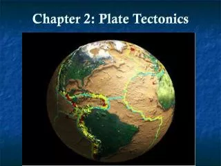
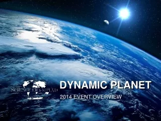
Chapter 2: Global Tectonics Our Dynamic Planet . Introduction. Each rocky body, whether planet or moon, started with a hot interior. Each has been kept warm over time by energy released by the decay of radioactive isotopes .

E N D
Introduction • Each rocky body, whether planet or moon, started with a hot interior. • Each has been kept warm over time by energy released by the decay of radioactive isotopes. • Despite radioactive heating, rocky bodies have cooled considerably since their formation, so that their outer layers have stiffened into lithospheres (岩石圈).
Introduction (2) • The interior of Earth remains hot and geologically active. • The mantles of Earth loses internal heat by convection (對流), the slow flow of solid rock. • Hot rock rises upward to near the surface. • Earth’s stiff lithosphere is broken into a collection of near-rigid plates.
Introduction (3) • Most large-scale geologic events, like earthquakes or volcanic eruptions, originate within Earth’s interior. • Many other processes in the Earth system, such as the hydrologic and biogeochemical cycles, are profoundly affected byplate tectonics (板塊運動).
Plate Tectonics (板塊學說):From Hypothesis to Theory • Plate tectonics is a scientific theory that explains two centuries of often puzzling observations and hypotheses about our planet Earth. • The continents are drifting very slowly across the face of our planet. • Continental drift (大陸漂移)is a concept with a long history.
Plate Tectonics:From Hypothesis to Theory (2) • A century ago geologists puzzled over the fit of the shorelines of Africa and South America. • They noted that fossils of extinct land-bound plants and animals, glacial deposits (冰河沉積), and ancient lava flows (熔岩流) could be matched together along coastlines that today are thousands of kilometers apart. • Coal was found in Antarctica. • Coal forms in tropical climates, implying that Antarctica has moved in the past.
Plate Tectonics:From Hypothesis to Theory (3) • Alfred Wegener proposed the most comprehensive early hypothesis for “Continental Drift (大陸漂移假說)” in 1912. • His theory was widely rejected because: • Ocean floor was too strong to be plowed aside. • Wegener had not proposed a plausible force that could induce the continents to drift.
Plate Tectonics:From Hypothesis to Theory (4) • After many years of scientific observations, the theory of Plate Tectonics was born in 1960. • Plate tectonics is the process by which Earth’s hot interior loses heat. • Nowadays, we can measure the slow drift of plates worldwide using satellite navigation systems. • The basic premises of plate theory are secure because they can be tested against a wide variety of observations.
Continental Drift versus Plate Tectonics
What Earth’s Surface Features Tell Us • The rocks beneath our feet are solid, but they are not rigid. • Topography: the relief and form of the land above sea level. • Bathymetry: topography on the ocean floor. • Earth bulges around its equator and is slightly flattened at the poles.
Isostasy: Why Some Rocks Float Higher Than Others • The continents average about 4.5 km elevation above the ocean floor. They stand notably higher than the ocean basins because the thick continental crust (大陸地殼) is relatively light (average density 2.7 g/cm3). • The thin oceanic crust (海洋地殼) is relatively heavy (average density 3.0g/cm3). • The lithosphere(岩石圈)floats on the asthenosphere (軟流圈).
Isostasy (地殼均衡說)-similar to Principle of Archimedes' applied to the earth-first noted when French Bouguer in the 18th century surveyed the shape of the earth
Isostasy (2) • The principle of isostasy governs the rise or subsidence. • All parts of the lithosphere are in a floating equilibrium. • Low-density wood blocks float high and have deep “roots,” whereas high-density blocks float low and have shallow “roots.” Fig. 2.2
Earth’s Surface: Land Versus Water • The ocean covers 71 percent of Earth’s surface. • Sea level fluctuates over time. • When climate is colder and water is stored as ice: • Sea level falls. The shoreline moves seaward. • When climate gets warmer: • The ice melts. • Sea level rises. • The shoreline advances inland.
Fig. 2.1 Fig. 2.3
Earth’s Surface: Land Versus Water (2) • Undersea mid-ocean ridges form a continuous feature more than 60,000 km long. • Mid-ocean ridges mark where two oceanic plates spread apart. • New lithosphere forms in the gap.
Fig. 2.4 Continental shelves and slopes (light blue) take ~25% of the mass of the continental crust. Fig. 2.5 Topography across the northern Atlantic Ocean. The Atlantic coastline is a typical example for passive continental margin.
Earth’s Surface: Land Versus Water (3) • The continental shelf(大陸棚)steepens slightly at 100-200 meters below sea level. • The continental slope(大陸斜坡)is the flooded continental margin. • The continental rise(大陸隆起)descends more gently from the base of the continental slope
Earth’s Surface: Land Versus Water (4) • Ocean trenches(海溝)occurs where oceanic lithosphere and continental (or oceanic) lithosphere converge at the boundary between two plates (e.g., Ryukyu trench, Mariana trench). • Because oceanic lithosphere is the denser of the two, it descends under the active continental margin and sinks into the deeper mantle. • The large, flat abyssal floors (深海海床) of the open ocean lie 3 to 6 km below sea level.
What Earth’s Internal Phenomena Tell Us • Heat conduction (熱傳導) and convection (對流). • Conduction is dominant when the temperature gradient in rocks is large. (earth’s surface and core-mantle boundary) • Rocks are poor conductors of heat, so the internal heat is transferred by moving the rock itself. The circulation of hot rock is maintained bymantle convection (地涵對流或地幔對流).
oceanic trench mid-ocean ridge Fig. 2.6 mantle convection that shapes the earth’s surface. Heat source comes from cooling of the earth itself since 4.55 Byr and decay of radioactive elements.
Heat Conduction (熱傳導) • Conduction is the process by which heat moves through solid rock via molecular collisions. • It’s a diffusive (擴散) process wherein molecules transmit their kinetic energy to other molecules by colliding with them. • Heat is conducted through a medium in which there is a spatial variation in the temperature or a steep temperature gradient. • The loss of the earth’s internal heat through oceanic crust and lithosphere is largely controlled by conduction.
Mantle Convection (1) • Earth’s heat can move in a second process calledconvection (對流). • Convection can happen in gases, in liquids, or, given enough time, in ductile solids. • A prerequisite condition for mantle convection is the thermal expansion (熱膨脹)of hot rock. • Convective heat is transported with the motion of ductile rock.
Mantle Convection (2) • Rock expands as its temperature increase, and its density thereby decreases slightly. • The hot rock is buoyant relative to cooler rock in its immediate neighborhood. • A 1 percent volume expansion requires an increase of 300-400oC and leads to a 1 percent decrease in density. • Viscosity(黏滯係數) represents the tendency of rock to ductile flow (延展性流動). Unit: Newton.second/meter2
Rock Deformation:Elastic versus Viscous • For an elastic solid, stress is linearly proportional to strain, • In general, 300-1000 atmosphere pressure (1 atm ~ 1 bar = 105 Pascal =N/m2) is required to compress a rock by 1/1000. • Viscosity (m): measures the resistance of a solid or fluid to ductile flow. • Ductile deformation becomes important at larger depth, where rocks are hot and less rigid. • 100 atm is estimated to cause the mantle rocks beneath the plates to deform at a steady rate of 1/106 per year.
Mantle Convection (3) • Rock does not need to melt before it can flow. • The presence of H2O encourages flow in solid rock. • Convection currents bring hot rocks upward from Earth’s interior.
Geothermal Gradient (地溫梯度) of the Lithosphere • Heat moves through the lithosphere primarily by conduction. • The lithosphere-asthenosphere boundary is 1300-1350oC, depending on depth. • Oceanic lithosphere is about 100 km thick. • The average geothermal gradient in oceanic lithosphere is about 13oC/km. • Average continental lithosphere is 200 km. • The average geothermal gradient in continental lithosphere is about 6.70C/km.
AdiabaticExpansion (絕熱膨脹) of Rock • Adiabatic expansion means “expansion without loss or gain of energy.” • Rock is compressed and reduced in volume by increasing pressure with depth; it is also heated by the work done by the pressure force during the compression. The associated temperature rise causes adiabatic expansion.
AdiabaticExpansion (絕熱膨脹) of Rock (2) • In convective mantle, the mean temperature increases with depth along an adiabat (絕熱線). • The adiabatic thermal gradient (絕熱溫度梯度)in the mantle is the rate of increase of temperature with depth as a result of compression of the rock by the weight of the overlying rock; it is approximately 0.5oC/km.
Earth’s Convection: Driven From the Top • Below the lithosphere, rock masses in the deeper mantle rise and fall according to differences in temperature and buoyancy. • Earth’s convection is driven mainly by colder material sinking from the top.
Earth’s Convection: Driven From the Top (2) • The densest lithosphere is most likely to sink back into the asthenosphere and the deeper mantle while lighter continental lithoshere drifts across the earth’s surface. • Ocean floor and the continents are slowly moving (up to 12 cm/yr).
Plates and Mantle Convection • When continents split apart, a new ocean basin forms. • The Red Sea was formed this way 30 million years ago. • Subduction: the old lithosphere sinks beneath the edge of an adjacent plate.
Global Positioning System • In the 1960s, the U.S. Department of Defense established a network of satellites with orbits that could be used for reference in precisely determining location. • The Global Positioning System (GPS) detects small movements of the Earth’s surface. Fig. 2.9 C. surface motion from GPS measurement
Global Positioning System (2) • It is accurate within a few millimeters. • Two measurement methods: • A GPS campaign: researchers establish a network of fixed reference points on Earth’s surface, often attached to bedrock. The position is re-measured every few months or years. • Continuous GPS measurement: the receivers are attached permanently to monuments, and position is estimated at fixed intervals of a few seconds or minutes.
Four Types of Plate Margins and How They Move • The lithosphere currently consists of 12 large plates. • The seven largest plates are: • North American Plate. • South American Plate. • African Plate. • Pacific Plate. • Eurasian Plate. • Australian-Indian Plate. • Antarctic Plate.
Fig. 2.9 A. Present-day plat motion based on many geological data, including lineation of magnetic anomaly on seafloor, relative motion along the strike of transform faults, earthquake slip direction and displacement, etc.. Red dots mark the location of significant earthquakes since 1965. Fig. 2.9 B. Surface motions from continuous GPS measurements. Fig. 2.9
Plates have four kinds of boundaries or margins (板塊邊界) • Divergent margin/spreading center(分離板塊邊界/擴張中心) (e.g. East Pacific Rise, Mid-Atlantic Ridge). • Convergent margin/subduction zone (聚合板塊邊界/隱沒帶) (e.g. Japan Trench, Aleutian Trench). • Convergent margin/collision zone (聚合板塊邊界/碰撞帶) (e.g. Indo-Himalaya collision zone). • Transform fault margin (轉型斷層邊界)
Seismology and Plate Margin • Earthquakes occur in portions of the lithosphere that are stiff and brittle. • Earthquakes usually occur on pre-existing fracture surfaces, or faults. • There are distinctive types of earthquakes that correlate nicely with motion at plate boundaries.
Fig. 2.11 Four types of plate margines Fig. 2.12 three types of faults
Type I: Divergent Margin • Where two plates spread apart at a divergent boundary, hot asthenosphere rises to fill the gap. • As it ascends, the rock experiences a decrease in pressure and partially melts. • The molten rock from such pressure-release partial melting is called magma (岩漿).
Type I: Divergent Margin (2) • Oceanic crust is formed at mid-ocean ridges within 1-2 km of the ridge axes. • Found in every ocean. • Form a continuous chain that circles the globe. • Oceanic crust is about 6-8 km thick worldwide.
Animation of Seafloor SpreadingSource: CD of the textbook Pressure-release partial melting Seafloor spreading and magnetic chron
Birth of the Atlantic Ocean (1) • When a spreading center splits continental crust: • A greatrift (裂谷) forms, such as the African Rift Valley (東非裂谷). • As the two pieces of continental crust spread apart: • The lithosphere thins. • The underlying asthenosphere rises. • Volcanism commences. • The rift widens and deepens, eventually dropping below sea level. Then the sea enters to form a long, narrow water body (like the Red Sea).
Birth of the Atlantic Ocean (2) Fig. 2.13 • The continents that now border it were joined into a single vast continent that Wegener named Pangaea which means all lands. • About 200 million years ago, new spreading centers split the huge continent. • The Atlantic continues to widen today at 2-4 cm/yr.
Characteristics of Spreading Centers (1) • Earthquakes at midocean ridges occur only in the first 10 km beneath the seafloor and tend to be small. • Volcanic activity occurs at midocean ridges and continental rift. • The midocean ridges rise 2 km or more above surrounding seafloor.The principle of isostasy applies: lower-density rock rises to form a higher elevation at ridges and the cooling results the subsidence of seafloor
Characteristics of Spreading Centers (2) • If the spreading rate is fast: • A larger amount of young warm oceanic lithosphere is produced, and the ridge will be wider. • A slow-spreading ridge will be narrower. • The Atlantic Ocean spreads slowly (2-4 cm/yr). • The Pacific spreading center (East Pacific Rise) is fast by comparison: 6-20 cm/yr. The Pacific Ocean basin is shrinking because …