Download
1 / 22
230 likes | 398 Views
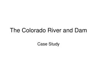
Passaic River at Dundee Dam at Clifton NJ. PROJECT MANAGER/HISTORIAN: Kristen Sabestinas SUPERVISOR: Amanda Makowski HYDROLOGISTS/RESEARCHERS: Jaclyn Cassidy Kristina Pesco Sarah Fischer. Watershed: Passaic Watershed Outlet Flow Gage: Passaic River at Dundee Dam at Clifton, NJ

E N D
Passaic River at Dundee Damat Clifton NJ PROJECT MANAGER/HISTORIAN: Kristen Sabestinas SUPERVISOR: Amanda Makowski HYDROLOGISTS/RESEARCHERS: Jaclyn Cassidy Kristina Pesco Sarah Fischer
Watershed: Passaic Watershed Outlet Flow Gage: Passaic River at Dundee Dam at Clifton, NJ Rain Gages: North Arlington, Fair Lawn, Jersey City, Little Falls
Facts • 3.94 mile(s) away from Little Falls rain gage • 15.19 mile(s) away from Jersey City rain gage • 8.57 mile(s) away from Fair Lawn rain gage • 8.05 mile(s) away from North Arlington rain gage • The drainage area: 805 miles2 • 450-foot long dam • Extends across the Passaic River from Division Avenue, Garfield, to Randolph and East Clifton Avenues in Clifton. • Constructed over a red shale rock foundation of the original dam. • The Dundee Dam is the terminus of the ocean tide.
Past Flood Precautions Before this flood in April 2007 Past recommendations to prevent floods: • The construction of large structural flood control projects • New flood control dams and reservoirs • The construction of levees and floodwalls • Channel modifications and improvements • The construction of a flood tunnel, and various limitations on development within the floodplain. Unfortunately none of the proposed dams, reservoirs, or other structural projects that were recommended in these plans to control the flood waters were never constructed.
Flood Description On April 18th 2007, the Passaic River basin was struck by a 24 hour nor’easter event that left nearly nine inches of rain idle over multiple towns. • Caused: • Significant flooding • $729 million in damages (in October 2009 dollars) • The evacuation of about 5,000 people • Loss of life. • Many local towns bordering the river saw homes, cars and public property awash in flood waters.
New Flood Precautions • Federal and State Floodway and Floodplain Property Acquisitions • Structure Elevations in Floodplains • Federal Open Space Acquisition and Preservation • Improved Operation of the Pompton Lakes Dam Floodgates • Desnagging and Shoal Dredging • Feeder Dam Removal • State Adoption of National Flood Insurance Program Regulations • Expedited NJDEP Permit Process to allow towns to clear trees and repair river walls and shoals • Improved Effectiveness of County and Local Emergency Response Plans • Enhanced Passaic River Flood Warning System • Inundation Mapping • Enhanced Public Involvement, Information and Outreach for Flood Response • Reevaluation Request to U. S. Army Corps of Engineers • Updated Flood Risk Mapping • Moratorium on All New Development within the Floodplain
Name: Karolyn Ferris Location: Little Falls, NJ Interview • Can you remember the flood of April 2007? Yes. • May you please provide details of where you live. I live on a hill and our house is located right next to the woods were a tiny creek is located. Down the street is Passaic River. • Where were you on April 18th 2007? At work. • Was it already raining when you were going home? Yes, and it was already beginning to flood. Because of the flooding, I could not use my car so I called my cousin over to drive me from the train station to my house. He has a SUV, while I had a small Ford Focus. • Did that plan work out for you? NO! So he picked me up and we headed towards y house. Luckily, most of the streets we traveled were leveled and were only slightly flooded, and not closed off yet. Then we got to my street. The Passaic River flooded down the road working its way up the hill, and the creek created a waterfall flowing down the hill. It was madness. My cousin, with an SUV, could not drive up that hill. His truck would be ruined by water damage and probably would have been stuck there. So, I got out and walked my way up to my house. My pants were soaked, my shoes were ruined, my hair was a mess, and all because the Passaic River was being flooded. • What was the aftermath? Well my pants stayed wet for 3 days!!! But more seriously, our garage had water damage, and our lawn was totaled. Luckily, insurance covered it. But the town, the roads, they were horrible. Gravel, debris, cracks, pot holes, everything you can imagine occurred on those streets, and the town took days to repair them. • How soon were you able to leave your house? It took about two days for it to be safe to leave. The water level was out of control, you walked out the front door and the stairs were under water of the houses down the street of mine. • What would you recommend for future flood control? Well first off they should clean the river. All that crap is probably one of the reasons why the dams, and flood plans that existed then didn’t work. They need to create a better alert system to notify town’s people of what to expect. All I have to say is I feel bad for those people that had their cars sunken in water!
Current Problems • The new proposed flood precaution plans focuses too much on problems in the upper and central basin. • Does not specifically address problems that are unique to communities in the lower basin. • Issues directly affecting South Bergen towns on the river and other towns on the lower 17-mile stretch of the river from Dundee Dam in Garfield to Newark Bay were overlooked, and the problem they faced in April of 2007 has been forgotten and pushed aside.
Works Cited • http://news.webshots.com/album/558783986fjagfz • http://nj.usgs.gov/publications/adr/adr2007/PDF/01389890.2007.pdf • http://www.northjersey.com/news/116794528_Plan_could_ease_Passaic_flooding_.html • http://www.nj.gov/dep/passaicriver/docs/passaic-report201101.pdf • http://www.garfieldnj.org/content/62/250/default.aspx • http://www.dredgingtoday.com/2011/02/24/group-pushes-for-passaic-river-anti-flood-project-usa/ • http://climate.rutgers.edu/njwxnet/dataviewer-netpt.php?yr=2010&mo=12&dy=1&qc=&hr=10&element_id%5B%5D=24&states=NJ&newdc=1