Download

1 / 16
160 likes | 465 Views
A Discussion of Groundwater Modeling and Climate Change By Leslie Llado. Introduction. Discuss importance of incorporating groundwater into climate models Existing groundwater and climate modeling methods Review of three coupled groundwater-climate models Problems and suggested modifications.

E N D
A Discussion of Groundwater Modeling and Climate ChangeBy Leslie Llado
Introduction • Discuss importance of incorporating groundwater into climate models • Existing groundwater and climate modeling methods • Review of three coupled groundwater-climate models • Problems and suggested modifications
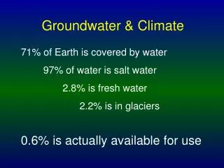
Why include groundwater in climate change models? • Although groundwater accounts for small percentage of Earth’s total water, groundwater comprises approximately thirty percent of the Earth’s freshwater • Groundwater is the primary source of water for over 1.5 billion people worldwide and over fifty-percent of the U.S. population • Depletion of groundwater may be the most substantial threat to irrigated agriculture, exceeding even the buildup of salts in soils • (Alley, etal, 2002)
Groundwater Modeling Methods Most commonly use MODFLOW software - 3-D finite difference groundwater flow modeling Factors emphasized vary due to: • Politics • Sustainability requirements • Location and aquifer characteristics • Natural and Urban groundwater recharge mechanisms (Pierrehumbert 2002)
“Natural” Groundwater Recharge Natural groundwater recharge accounts for: Components of the hydrologic cycle: precipitation, evaporation, transpiration, sublimation, runoff, infiltration, recharge, and baseflow Heterogeneity of geological structures, local vegetation, and weather conditions (Alley etal, 2002)
“Urban” Groundwater Recharge Urban Recharge = Natural Factors + Human Influences Anthropogenic activities affect groundwater availability: • Increased Pumping • Increased Impervious Cover • Diversion of groundwater (Sharp 2006)
LSM and GCM Models • Land Surface Model (LSM) • Consider a surface heat balance equation, a surface moisture equation, and a variable to represent snow cover • Accounts for land topography, but does not consider groundwater conditions • In locations where groundwater is close to the land surface, soil moisture is higher, resulting in a cooler land surface • Global Climate Model (GCM) • When coupled with LSM, can simulate soil moisture conditions, humidity, and precipitation changes • Cannot assess the relationship between changing soil, vegetation, and topography • By incorporating an aquifer system into the model, the interaction between global climate systems can be interpreted based on specific watershed parameters • (Hartmann 264)
Integration of Groundwater Modeling into existing LSMs • CLASP II Simulation - York, etal 2. Three-layer Variable Infiltration Capacity Model (VIC-3L) - Liang and Xie 3. Soil Hydrological Model - Chen and Hu
CLASP II Simulation • ATMOS • Atmospheric model • Single data column using historical atmospheric data • VOS • Vegetation-overland flow-soil model • Represents soil vegetation zones with MODFLOW • Allows for specification of types of soil and vegetation • MODFLOW • Groundwater modeling program issued by USGS • Aquifer properties are simulated by incorporating numerical aquifer characteristics and the equations for heterogeneous, anisotropic media Coupled aquifer-land surface-atmosphere model to show decadal impact of climate change on aquifer using 9 years of historical data
CLASP II (continued) Results • Reproduced monthly and yearly trends for precipitation, evapotranspiration, and stream discharge • Low calculated soil moisture • 5 - 20% of evapotranspiration drawn from aquifer • Forty-year drought produced 15 m water table decline • Aquifer response time of ~200 years
Three-layer Variable Infiltration Capacity Model (VIC-3L) • Modifications on existing VIC-3L LSM: • Include infiltration excess runoff mechanism by considering effects of subgrid spatial soil heterogeneity • Account for effects of surface-groundwater interactions on soil moisture, recharge rate, and evapotranspiration • Accounts for: • One vegetation layer with bare soil evapotranspiration • Upper soil layer where soil moisture is derived from rainfall • Lower soil layer that accounts for seasonal soil moisture
Three-layer Variable Infiltration Capacity Model (VIC-3L) (continued) • Results: • Successfully simulated the groundwater table position and total runoff • Correctly represented water budgeting among the soil layers, evapotranspiration, and recharge rate • Showed that when surface-groundwater interactions are considered, evapotranspiration will be higher
Soil Hydrological Model using NCAR MM5 Considers the water exchange between the unsaturated zone and groundwater using a soil-surface model where soil water is the result of groundwater and precipitation Four soil layers at 0.1, 0.15, 0.25, and 0.5 meters from the surface with diffusive fluxes between layers Saturation hydraulic conductivity varies in a vertical distribution, accounting for the decrease in soil permeability with increasing depth
Soil Hydrological Model (continued) • Average evaporation almost double the evaporation for a model of the same area without groundwater • In the first meter from the surface, soil moisture content in the model that included groundwater was twenty-one percent higher than soil moisture content in the model without groundwater • With a lower groundwater table, the influence of groundwater on soil moisture decreases
Conclusions • Effects of groundwater can significantly change LSM results, especially when aquifer is close to land surface • Groundwater is an important resource and must be considered in climate change studies • Large data sets (200+ years) needed to accurately show groundwater response to climate change • Extreme climate conditions are useful in groundwater modeling • LSMs that include groundwater more accurately simulate actual land surface conditions • With advances in technology, it may be possible to incorporate aquifer systems into GCMs
References “Agenda 21”. <http://www.un.org/esa/sustdev/documents/agenda21/index.htm>, October 31, 2006. Alley, W.M., Healy, R.W., LaBaugh, J.W., Reilly, T.E., 2002, Flow and Storage in Groundwater Systems. Science, p. 1985-1991. Hartmann, Dennis L., 1994, Global Physical Climatology. Academic Press: San Diego, CA, 411 p. Liang, X., and Xie, Z., 2003, Important factors in land-atmosphere interactions: surface runoff generations and interactions between surface and groundwater. Global and Planetary Change, p. 101-114. Pierrehumbert, R.T., 2002, The hydrologic cycle in deep-time climate problems. Nature, p. 191-198. Sharp, J. M., Jr., 2006, Hydrogeology Notes: Department of Geological Sciences, The University of Texas at Austin, Austin, Texas, 352 p. York, J.P., Person, M., Gutowski, W.J., Winter, T.C., 2002, Putting Aquifers into atmospheric simulation models: an example from the Mill Creek Watershed, northeastern Kansas. Advances in Water Resources, p. 221-238.