Download
1 / 17
170 likes | 262 Views
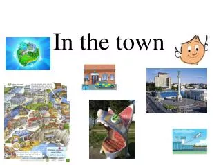
Implementing GIS in the Town of Peacock, Ontario. By Andrew Trollope. Benefits of a Geographic Information System (GIS). Enhances people’s ability to do their jobs; Increases efficiency; Provides better customer service; Strengthens partnerships with data and service providers;

E N D
Implementing GIS in theTown of Peacock, Ontario By Andrew Trollope
Benefits of a Geographic Information System (GIS) • Enhances people’s ability to do their jobs; • Increases efficiency; • Provides better customer service; • Strengthens partnerships with data and service providers; • Generates more revenue.
Why is GIS Neededin the Town of Peacock? • Within the next decade, rapid population growth is expected, which must be carefully managed; • The Town must work to retain existing business and attract new business; • The Town must increase its public profile to lure more tourists and the revenue they generate; • Information about municipal services, such as recreation, must be distributed more efficiently to town residents.
Potential Applications of a GIS • Building Permit Systems • School Enrollment Projection Systems • Development Application Tracking Systems • Asset Management and Work Order Systems • Emergency Response and Dispatch Systems
1. Building Permit Systems • Municipal governments issue building permits for new construction, additions, and home improvement projects. • Building permits can be tracked by property or address. • The link to GIS is simple, using a unique property identifier stored in the database.
2. School Enrollment Projection Systems • School planning uses several data sets, including Census data, birth rates, and enrollment. • This demographic data needs the geographic link of a GIS, in order to match the location of children to the location of schools.
3. Development Application Tracking Systems • Tracking new development is important when planning for services like water, roads, schools, transit, and emergency services. • Since a parcel of land is the basis for new development, a tracking system should be based on land parcels, using a roll number as an identifier. • With a GIS, the new development can be located on a map, and related to other geographic features.
4. Asset Management and Work Order Systems • Managing assets is vital to ensure adequate services. • In a GIS, asset management means maintaining all property that has a geographic location on the map: land, buildings, roads, fences, signs, and so on. • Maintaining a database of these assets, with a link to the GIS, assists in asset management.
5. Emergency Response and Dispatch Systems • The ability of fire, ambulance, and police to respond to emergencies is essential. • The key to effective emergency response is an accurate and up-to-date single line street network file. • When an address is entered into the dispatch system, a direct search is triggered on the street network file. • The address is located with the GIS, and crews are dispatched to the scene.
Distributing GIS Data • Many municipalities provide packages of digital data to the public as a one-time purchase or as a subscription. • Pre-packaging data is more efficient than dealing with many requests individually. • With a GIS, The Town of Peacock could produce and distribute street maps, topographic maps, parcel maps, and ortho-photo maps.
Evaluating and Selecting a GIS The following criteria were considered in our selection of a Geographic Information System: • Conformance to standards • Computing speed / performance • Data conversion • GIS functionality • Ease of use – menu interface, on-line help, map generation. • Ease of customization for non-standard functions • Scalability • Licensing and maintenance costs
The GIS Solution for Peacock The recommended software is: • Arc / Info and Map Objects, at a cost of U.S. $3000 and $5000, respectively. The recommended hardware includes: • A GIS file server; • A GIS Database Management (DBMS) server; • GIS workstations, with digitizing tables; • Printers, colour plotter, and scanner.
Conclusion • Many municipalities across North America have experienced the benefits of a GIS. • The Town of Peacock has important challenges that must be addressed: population growth, the economy, tourism, and recreation. GIS will contribute to a solution. • There are many potential applications of a GIS, and the benefits are great. • Training, financial assistance, and geospatial data are all readily available.