Download
1 / 2
20 likes | 194 Views
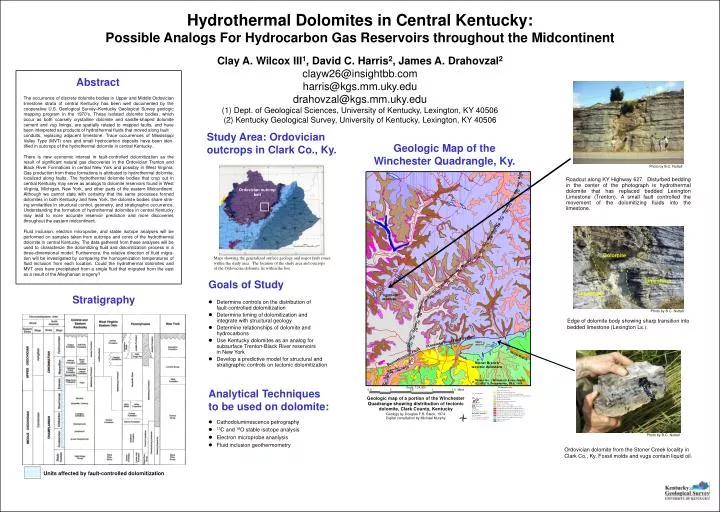
Stratigraphy. Units affected by fault-controlled dolomitization. Hydrothermal Dolomites in Central Kentucky: Possible Analogs For Hydrocarbon Gas Reservoirs throughout the Midcontinent. Clay A. Wilcox III 1 , David C. Harris 2 , James A. Drahovzal 2 clayw26@insightbb.com

E N D
Stratigraphy Units affected by fault-controlled dolomitization Hydrothermal Dolomites in Central Kentucky: Possible Analogs For Hydrocarbon Gas Reservoirs throughout the Midcontinent Clay A. Wilcox III1, David C. Harris2, James A. Drahovzal2 clayw26@insightbb.com harris@kgs.mm.uky.edu drahovzal@kgs.mm.uky.edu (1) Dept. of Geological Sciences, University of Kentucky, Lexington, KY 40506 (2) Kentucky Geological Survey, University of Kentucky, Lexington, KY 40506 Abstract The occurrence of discrete dolomite bodies in Upper and Middle Ordovician limestone strata of central Kentucky has been well documented by the cooperative U.S. Geological Survey–Kentucky Geological Survey geologic mapping program in the 1970’s. These isolated dolomite bodies, which occur as both coarsely crystalline dolomite and saddle-shaped dolomite cement and vug linings, are spatially related to mapped faults, and have been interpreted as products of hydrothermal fluids that moved along fault conduits, replacing adjacent limestone. Trace occurrences of Mississippi Valley Type (MVT) ores and small hydrocarbon deposits have been iden-tified in outcrops of the hydrothermal dolomite in central Kentucky. There is new economic interest in fault-controlled dolomitization as the result of significant natural gas discoveries in the Ordovician Trenton and Black River Formations in central New York and possibly in West Virginia. Gas production from these formations is attributed to hydrothermal dolomite, localized along faults. The hydrothermal dolomite bodies that crop out in central Kentucky may serve as analogs to dolomite reservoirs found in West Virginia, Michigan, New York, and other parts of the eastern Midcontinent. Although we cannot state with certainty that the same processes formed dolomites in both Kentucky and New York, the dolomite bodies share strik-ing similarities in structural control, geometry, and stratigraphic occurrence. Understanding the formation of hydrothermal dolomites in central Kentucky may lead to more accurate reservoir prediction and more discoveries throughout the eastern midcontinent. Fluid inclusion, electron microprobe, and stable isotope analyses will be performed on samples taken from outcrops and cores of the hydrothermal dolomite in central Kentucky. The data gathered from these analyses will be used to characterize the dolomitizing fluid and dolomitization process in a three-dimensional model. Furthermore, the relative direction of fluid migra-tion will be investigated by comparing the homogenization temperatures of fluid inclusion from each location. Could the hydrothermal dolomites and MVT ores have precipitated from a single fluid that migrated from the east as a result of the Alleghanian orogeny? Study Area: Ordovician outcrops in Clark Co., Ky. Geologic Map of the Winchester Quadrangle, Ky. Photo by B.C. Nuttall Roadcut along KY Highway 627. Disturbed bedding in the center of the photograph is hydrothermal dolomite that has replaced bedded Lexington Limestone (Trenton). A small fault controlled the movement of the dolomitizing fluids into the limestone. Ordovician outcrop belt Dolomite Maps showing the generalized surface geology and major fault zones within the study area. The location of the study area and outcrops of the Ordovician dolomite lie within the box. Goals of Study Limestone Limestone • Determine controls on the distribution of fault-controlled dolomitization • Determine timing of dolomitization andintegrate with structural geology • Determine relationships of dolomite andhydrocarbons • Use Kentucky dolomites as an analog forsubsurface Trenton-Black River reservoirsin New York • Develop a predictive model for structural andstratigraphic controls on tectonic dolomitization Photo by B.C. Nuttall Edge of dolomite body showing sharp transition into bedded limestone (Lexington Ls.). Analytical Techniquesto be used on dolomite: • Cathodoluminescence petrography • 13C and 18O stable isotope analysis • Electron microprobe ananlysis • Fluid inclusion geothermometry Photo by B.C. Nuttall Ordovician dolomite from the Stoner Creek locality in Clark Co., Ky. Fossil molds and vugs contain liquid oil.
Trenton/Black River Subsurface Gas Reservoir Glodes Corners Road Field, Steuben Co., NY Coring of tectonic dolomites in Kentucky Map courtesy of Columbia Natural Resources As part of the study, Triana Energy will drill 2 continuously-cored boreholes in 2 of the dolomite bodies in central Kentucky. Cores will be cut through the Trenton (Lexington Ls.), Black River (High Bridge Group), into the top of the Knox Group, to about 1,200 ft (400 m) total depth. The cores will provide lithologic data and sample control vertically within the dolomite bodies. Petrographic and geochemical data collected from the cores will document any vertical trends in dolomite texture or chemistry, which may help constrain a model. Gas field is a linear fault-bounded graben, with dolomite distribution controlled by faults Diagram courtesy of Columbia Natural Resources North-south cross section through the Trenton/Black River interval in the Glodes Corners Road Field, Steuben County, N.Y., showing fault-bounded graben, and fault-controlled distribution of tectonic dolomite. Trenton-Black River discovery well, Cottontree Field, Roane Co., West Virginia Dolomite outcrops as analogs for Trenton-Black River gas reservoirs • Ordovician dolomite outcrops in central Kentucky can provide analogs • for subsurface Trenton-Black River gas reservoirs in the Appalachian Basin: • Key features to be compared with New York reservoirs: • Degree of stratigraphic (facies) control on dolomitization • Timing of dolomitization • Relationship of dolomitization to hydrocarbon migration/source • Regional extent of tectonic dolomitization in the Middle and UpperOrdovician in the Appalachian Basin Summary This two-year project will involve field and laboratory characterization of fault-controlled Ordovician dolomites in central Kentucky. These dolomites have many similarities with dolomitized subsurface natural gas reservoirs in upstate New York in the same stratigraphic interval. We hope to develop a model for fault-controlled dolomitization in central Kentucky that will help refine exploration models for these reservoirs in the subsurface. We gratefully acknowledge research funding from the New York State Energy Research and Development Authority (NYSERDA), the U.S. Department of Energy, and Triana Energy, Charleston, WV. We also appreciate the cooperation of the New York State Museum and Geological Survey.