Download
1 / 10
100 likes | 189 Views
Calgary Regional Partnership. Regional Geographic Information Systems Service Proposal. Background—Key Business Drivers. One of the major mandates of the CRP is to work together to position the Region as a major player.

E N D
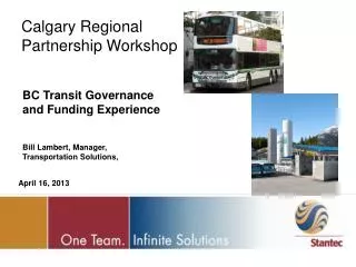
Calgary Regional Partnership Regional Geographic Information Systems Service Proposal
Background—Key Business Drivers • One of the major mandates of the CRP is to work together to position the Region as a major player. Easily accessible regional data is one of the critical factors in this endeavor. RGISS can provide the platform to: • Provide the information to plan cross-border initiatives, such as infrastructure, sewer and water and other planning activities. • Support economic development initiatives (e.g. site locators) that put the CRP “on the map”. • Provide the data at a regional level to attract larger amounts of funding and investment to the Region (e.g. federal, provincial and private funding). • Provide a governance structure that ensures the various GIS initiatives are prioritized, and continue to be delivered as a service to the membership.
Background—Key Business Drivers • There is unprecedented growth and demand on existing applications, particularly Emergency Response Mapping. A model is needed to manage and meet the needs of all stakeholders of the ERM and Watershed applications. • The demand for initiatives that require regional collaboration and the systems that support them continues to grow. Previous success has led to higher demand.A more formal structure is needed to identify, prioritize and develop strategic initiatives that continue to enhance and positively position the CRP. • Regional pathways; • Orthophoto initiatives; • Watershed management, water/sewer initiatives; • Economic development initiatives; etc.
Background—Key Business Drivers • There is a need to provide an opportunity for all members to participate in GIS related regional initiatives. This will facilitate greater information sharing in a more efficient and effective manner. This project provides an opportunity to identify the major strengths from a GIS perspective and develop a model that enhances existing capabilities (i.e. economies of scale associated with purchasing existing datasets, etc.). • Regional GIS has been recognized by a number of Regions as a major pillar in enhancing municipal delivery. Regions who currently have major initiatives underway to exploit these opportunities include: • Alberta Capital Regional Alliance. • ORISA (Oldman River Region).
Proposal Overview--Objectives • Develop and implement a sustainable business model for existing applications (e.g. emergency response mapping, watershed management, etc.). • Determine the feasibility of RGISS for the Calgary Regional Partnership. • Pilot the model to ensure the intended benefits are achieved amongst the partnership. • Have a clear “go/no-go” decision point where the partnership chooses to endorse the initiative, and on-going commitments are clearly identified.
Proposal Overview--Process 2006 2007 2005 AMA Decision & Review • Initiate Project • Steering Committee • Project Manager • Resources • Stream 1 – Sustainability • ERM, Watershed Scope • Financial Model • Agreements • Pilot Phase • Setup governance, operating and financial model • Pilot several applications • Stream 2 – Business Plan • Needs Assessment • Prioritize • Governance & Operating Model • Financial Model • Host/ Provider? Stop No Decision to Proceed Yes Request Implementation Grants
Lessons From Other Regions • ACRA • Exploration grant funding of $400,000. (Full) • Substantial work has been completed. • Projects: • Project 1: Steering Committee and Governance. • Project 2: Overall needs assessment across the Region, including preliminary governance, risks and prioritization. • Project 3: Site Locator Tool feasibility study. Included actual governance, operating and financial models of the RGIS initiative. Go-no go pertaining to RGIS. • Project 4: Select host and implement RGIS (Site Locator first application). • Projects 1 – 3 completed over a three year timeframe. • Currently on Project 4.
Lessons From Other Regions • Start small and keep the initiative simple. Learn to work together relative to this kind of project. • Ensure municipal champions, at a senior level, are identified and involved. They need to collectively work together to champion and advance this initiative – especially in the exploratory stage. • Keep an open mind to both the benefits and the costs. Not all benefits are clear cut – a number of intangible. These need consideration too. • Focus on the major benefit – regional information sharing.
Your Commitment • This initiative will need your commitment. • Commitment may mean: • Championing this project. • Municipal staff time for interviews and feedback. Attendance at workshops, etc. • Participation on the Steering Committee, or other governance mechanisms. • Assessing and evaluating each step of the way, so when the decision to proceed comes you are ready to provide direction. • Enthusiasm! (Mandatory)
Final Thoughts—Vision of the Future Infrastructure Planning and Management Tools Environmental Management Tools Site Locator Tools Links to Sites Across the Region (P and D?)