Download
1 / 16
260 likes | 538 Views
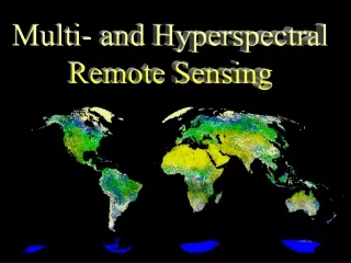
Hyperspectral remote sensing - Sensors. Contact: mirza.waqar@seecs.edu.pk. Mirza Muhammad Waqar. Contents. Hyperspectral Instruments AVIRIS (Airborne Visible Infrared Imaging Spectrometer) CASI‐2 (Compact Airborne Spectrographic Imager‐2) Hyperion HyMap CASI.

E N D
Hyperspectral remote sensing - Sensors Contact: mirza.waqar@seecs.edu.pk Mirza Muhammad Waqar
Contents • Hyperspectral Instruments • AVIRIS (Airborne Visible Infrared Imaging Spectrometer) • CASI‐2 (Compact Airborne Spectrographic Imager‐2) • Hyperion • HyMap • CASI
Hyperspectral Instruments • AVIRIS (Airborne Visible Infrared Imaging Spectrometer) • MODIS (Moderate Resolution Imaging Spectroradiometer) • CASI‐2 (Compact Airborne Spectrographic Imager‐2) • Hyperion • Daedelus Instruments • HyMap • CASI
AVIRIS (Airborne Visible Infrared Imaging Spectrometer) • The Airborne Visible InfraRed Imaging Spectrometer (AVIRIS) was designed and built by the NASA Jet Propulsion Laboratory (JPL). • It is a whiskbroom scanner, and it flies on several airborne platforms. • The swath and spatial resolution depend on the flying height and over-ground speed of the aircraft.
Cont… • On the NASA ER-2 jet at 20 km above MSL, AVIRIS covers an 11 km swath at 20 m GSD. • On a DeHaviland Twin Otter turboprop at 4 km AGL, AVIRIS covers a 2 km swath at 4 m GSD. • 224 contiguous spectral channels • Radiometric resolution: 12 bit
Note • AVIRIS is flown primarily for NASA-funded scientists and researchers. Graduate students can obtain small amounts of existing AVIRIS data at no cost. • http://aviris.jpl.nasa.gov/data/grad_research.html
CASI-2 (Compact Airborne Spectrographic Imager-2) • The Compact Airborne Imaging Spectrometer (CASI) is built by ITRES Research Ltd., of Canada • It can collect data in 14-bit format for 288 bands at 2.5 nm nomi • However, the overall spectral range is limited to 650 nm, which is adjustable anywhere between 400 nm (blue) and 1050 nm (near-IR).nal intervals. • GSD in the range of 25 cm - 1.5 m
Hyperion • The Hyperion hyperspectral imaging sensor flies on the NASA Earth Observing-1 (EO-1) spacecraft launched in late 2000. • Pushbroom technology gives Hyperion a longer target look time than a scanning radiometer, which helps to overcome the signal-to-noise problem.
HyMap • HyVista Corporation, of Sydney, Australia, commercially operates a 128-band whiskbroom hyperspectral scanner. • It operates in the familiar spectral range of 400 - 2500 nm • but with a bandwidth of 15-20 nm rather than 10 as for AVIRIS and Hyperion • It records data in 12 - 16 bit format. • Spatial resolution range 3-10 m.
Applications of Hyperspectral Data • Atmosphere: water vapor, cloud properties, aerosols • Ecology: chlorophyll, leaf water, cellulose, pigments • Geology: mineral and soil types • Coastal waters: chlorophyll, phytoplankton, dissolved • Organic materials, suspended sediments, bathymetry • Snow/ice: snow cover fraction, grain size, melting • Biomass burning: subpixel temperatures, smoke • Commercial: mineral exploration, agriculture and forest production