Download
1 / 11
110 likes | 189 Views
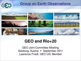
Group on Earth bservations. Discussion Paper on a Framework ———— Dr. Ghassem Asrar August 1, 2003. Our Common Vision. An international comprehensive, coordinated and sustained Earth observation system. Comprehensive : meeting the needs of a variety of science and applications disciplines

E N D
Group on Earth bservations Discussion Paperon a Framework————Dr. Ghassem AsrarAugust 1, 2003
Our Common Vision An international comprehensive, coordinated and sustained Earth observation system • Comprehensive: meeting the needs of a variety of science and applications disciplines • Coordinated: multinational satellite, suborbital and in situ observing capabilities strategically coordinated via agreed standards and data exchange • Sustained: long-term, continued financial and in-kind support from funding authorities
Water Management Agricultural Efficiencies Aviation Safety Coastal Management Disaster Management Scientific Understanding of the Earth System Reducing Loss from Disasters Supporting Sustainable Development Benefits to All Countries Near-term Long-term
Challenges In Creating Such a System • Data policy - assuring full and open data exchange and access • Observing scope - achieving the needed spatial, temporal and spectral coverage • Data quality - producing calibrated data sets in useful formats from multiple sensors and venues • Cost - acquiring sufficient resources to deploy observing systems and manage the resulting data and information • Security - assuring safe operations and peaceful uses of observing systems • Complexity - creating a system equal to the task of delivering useful information about the very complex Earth system
Building on Current Successes • WMO World Weather Watch • International constellation of polar and geostationary operational environmental satellites • International research satellites, including the Earth Observing System • A wide variety of international atmosphere, ocean, continent, and polar region in situ observing networks • Discipline-oriented coordination efforts • Observing (e.g., GCOS, GTOS, GOOS) • Research programs (e.g., World Climate Research Program, International Geosphere/Biosphere Programme)
Discussion on a Framework for Progress • Creation of a decadal implementation plan requires a framework • Architectural dimension: What should a comprehensive, coordinated, and sustained Earth observing system look like? • Organizational dimension: Who will participate, and how will our efforts be orchestrated? (to be discussed later in the agenda)
Architecture • Observing systems • Start with existing systems, enhanced with coordinated calibration and data exchange • Plan future national contributions with the “challenges” (above) in mind • Seek to fill known gaps in today’s systems • Align programs with nations with common interests • Strategically invest in new technologies to close gaps and reduce the cost of future observing capabilities
Architecture • Data Integration • Design and agree on common protocols, policies, formats, standards and metadata • Define data products at various levels, and strategies for producing and managing them based on science and applications requirements • Assure the information architecture incorporates appropriate interfaces with user components external to the architecture (demand-side systems)
Next Steps • Two principal deliverables: • Framework Document by Spring 2004 • Ten-year Implementation Plan by end of 2004 • Key objectives to be addressed: • System requirements • Inventory of relevant observing systems • Data model • Gap analysis • Approach to addressing observing deficiencies • Assess cost of alternatives • Mobilize the required resources
Coordinating Earth Observing Systems Capabilities Vantage Points L1/HEO/GEO TDRSS & Commercial Satellites Far-Space Permanent LEO/MEO Commercial Satellites and Manned Spacecraft Near-Space Airborne Aircraft/Balloon Event Tracking and Campaigns Deployable Terrestrial User Community Forecasts & Predictions