Download
1 / 1
10 likes | 86 Views
NESDIS/ORA SCIENTISTS FIRST WITH SEA LEVEL OBSERVATIONS OF INDIAN OCEAN TSUNAMI FROM SATELLITE ALTIMETRY. Sea level observations from 4 different altimeter missions show multiple wave crests and troughs radiating across the Indian Ocean with amplitudes as large as 60 cm.

E N D
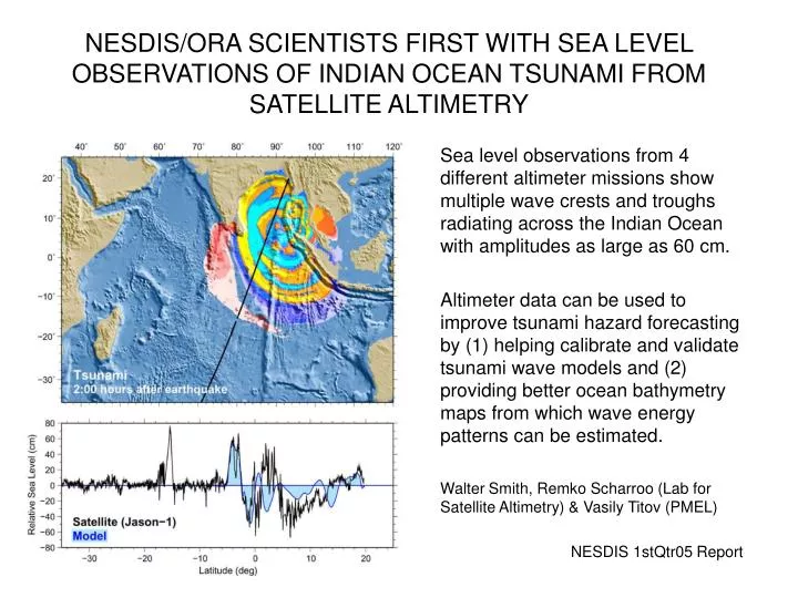
NESDIS/ORA SCIENTISTS FIRST WITH SEA LEVEL OBSERVATIONS OF INDIAN OCEAN TSUNAMI FROM SATELLITE ALTIMETRY Sea level observations from 4 different altimeter missions show multiple wave crests and troughs radiating across the Indian Ocean with amplitudes as large as 60 cm. Altimeter data can be used to improve tsunami hazard forecasting by (1) helping calibrate and validate tsunami wave models and (2) providing better ocean bathymetry maps from which wave energy patterns can be estimated. Walter Smith, Remko Scharroo (Lab for Satellite Altimetry) & Vasily Titov (PMEL) NESDIS 1stQtr05 Report