Download
1 / 26
270 likes | 548 Views
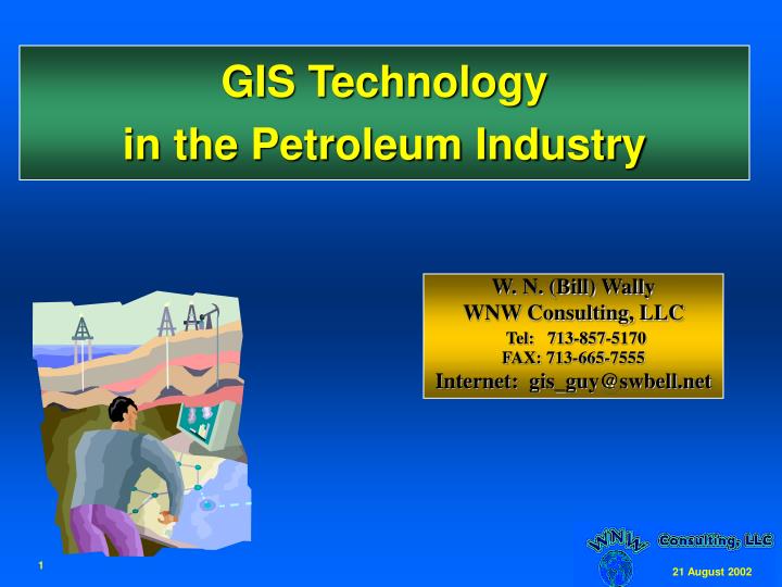
GIS Technology in the Petroleum Industry. W. N. (Bill) Wally WNW Consulting, LLC Tel: 713-857-5170 FAX: 713-665-7555 Internet: gis_guy@swbell.net. GIS Technology in the Petroleum Industry. Background What is a GIS Business drivers Issues Future expectations Summary. Background.

E N D
GIS Technologyin the Petroleum Industry W. N. (Bill) Wally WNW Consulting, LLC Tel: 713-857-5170 FAX: 713-665-7555 Internet: gis_guy@swbell.net
GIS Technologyin the Petroleum Industry • Background • What is a GIS • Business drivers • Issues • Future expectations • Summary
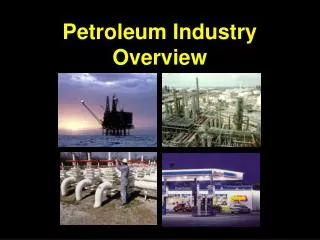
Major oil company operations • International in scope (for over 100 years) • Challenges: • Technical (e.g. deepwater oil production, gas-to-liquids) • Environmental (HCAs, protected habitats, spills) • Economic (volatile oil prices, low profitability) • Legal (royalty payments, reporting requirements) • 49 CFR part 195 • Large volumes of complex data that must be • managed • organized • displayed
Oil industry GIS chronology • Early ~1980’s adopters include Exxon, Shell, Amoco • “It’s the only technology that can manage most of our data -- wells, leases, grids, seismic lines, culture, etc.” • Many competing technologies (mostly VMS/Unix) • in-house, Genasys, Vortex, etc... • Confusion/conflicts between CAD and GIS • 1989 - “Operation Database/GIS” • 1990 - ex-Texaco geologist Bill Slinkard joined ESRI • PUG was formed • 2000 - ESRI becomes the defacto GIS standard for the petroleum industry
$104 billion annual revenues (2001) • ($3.7 billion net) • Operations in 180 countries • ~ 20,000 miles of pipelines • 11.8 billion barrels oil & gas equivalent reserves • 2.7 million BOPD daily production worldwide • (~3% of worldwide consumption) • ~50,000 employees
What is a GIS? • A geographic information system (GIS) is software that uses location to link digital databases, providing users with map-based access to information. • A GIS can also link to data that is not in the GIS: • reports (e.g. environmental hazards, material safety data, contracts) • Safe Operations - Process Safety Information: • PFDs, P&IDs, Safe Charts, Equipment Layouts, Area Classifications, Fire & Safety Layouts, Electrical One Lines, etc.) • other facilities databases for safe operations management practices • Management of Change, Process Hazard Analysis, etc. • images (pictures, scanned drawings, CAD) • videos • other databases (e.g. Oracle) • This is a very powerful feature, since it allows digital data to be accessed geographically, without first copying it into a GIS
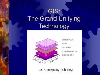
How does a GIS work (1)? • A GIS stores, analyzes, and displays geographic data • and attributes of geographic data • Geographic data is data about things that have a location: • trees (species, age, height,…) • houses (owner, street address, # of rooms, age, ….) • roads (name, # of lanes, surface, quality) • cities (name, population, age, etc.) • countries (name, population, etc.) • wells (id, status, when drilled, current oil production, etc.) • A GIS displays geographic data as if it were a series • of transparent maps, overlain on each other
Example GIS display View (map) Table Themes
What data do we access with a GIS? • wells • pipelines • seismic survey locations • production and refining facilities • engineering drawings • photographs of facilities, wellheads, etc. • safety and environmental reports • land ownership and permits • roads, rivers, village boundaries • digital orthophotos and satellite images
What is different about a GIS? Although the primary GIS “product” is a map, it is different from conventional maps because: • it is a graphical display conveying spatial information • about the underlying data, that can be interactively • modified by the end-user • the map scale is completely variable -- this has • significant implications regarding location data accuracy • GIS data can be shared, i.e. accessed by different users in • different ways at the same time
GIS Business Drivers:Multidisciplinary asset teams • More data sharing among • geophysics • geology • petroleum engineering • facilities engineering • land/legal • safety and environment • One thing in common: • WHERE is the asset? • GIS “spatial window” is the best way to access diverse data
GIS Business Drivers:Expanding IT marketplace • Leverages other industries • Lowers costs “per seat” • 10,000 times as many users - same price • Cost comparison: CompanyIndustryGeneral SpecificSpecificPurpose $ Development $1,000,000$10,000,000$200,000,000 # of sites 11001,000,000 $ per site $1,000,000$100,000$200
Value of GIS Technology GIS technology has a proven performance record: • cutting costs of construction • production facilities - by providing better “as-builts”, and also accurate maps of nearby hazards or other sensitive areas • pipelines - more accurate routing means more accurate estimates of quantities needed for pipe materials • supporting G&G, Engineering, HSE, emergency response, and related reporting requirements • government agencies now require GIS datasets as well as reports • high-grading existing location data • wells • pipelines • facilities ChevronTexaco example: to comply with FTC requests, created ~100 custom maps showing CHV/TX/competitor pipelines, facilities, properties, production, etc. in less than 2 months
GIS Business Drivers:Business Case • Estimated cost savings resulting from better decision-making: • 1% of current worldwide expenditures for • drilling rig positioning • emergency response • offshore flowline construction • tanker truck fuel costs • 1% of $1 billion = $10 million • Estimated cost increases from failing to correctly report operations activities to appropriate government, environmental NGOs, and local stakeholders: • mega$$$$....
etc. HSE Products Upstream GIS data coord .1 FTE GIS data coord .1 FTE GIS data coord .1 FTE GIS data coord .1 FTE GIS Organization Model Corporate Divisions Information Technology GIS Supervisor Corp. GIS Steering Committee/GRT GIS Advisor Technician Analyst Analyst Technician
Enterprise GIS Comment “A GIS/Web combination is the best opportunity to create an enterprise management system that presents technical, financial, HR, and media information in a single interface for complex problem resolution and decision-making. The GIS spatial presentation and analyses capabilities are well suited for organizing complex information in a manner that transcends language barriers. As such, it is an ideal enterprise management system for global companies operating in multiple cultures.” Mark Koelmel - Chief Operating Officer Chevron SASOL Ltd.
Issues and challenges • Data management • Data ownership and responsibility • Metadata standards • Replication between GIS servers and laptops • Backup and tuning of very large GIS databases • General: GIS concepts still not well understood • coordinate systems • location accuracy
Future expectations • Improved “conflation” tools • 3-D GIS • don’t stop at ground level • stratigraphic cross sections • reservoir visualization • GIS technology is still too complicated...
Summary • The petroleum industry already realizes tangible benefits using geographic data and GIS technology to make better operational decisions • New capability in ArcGIS 8.3 significantly expands its value and relevance: • Geodatabase - everything appears in the same place • comprehensive metadata • coordinate transformation “on the fly” • imagery • very high performance • Linear Referencing (esp. for pipelines and seismic) • Survey Analyst - finally addressing conflation • ArcIMS (Internet Map Server) for web-based access • ArcReader for easy distribution of GIS data and maps • For the petroleum industry, GIS technology is now mature enough to warrent world-wide Corporate Level commitment, to insure its proven abilityto assist in capital stewardship is employed to maximum advantage throughout the entire enterprise.
The Ultimate Goal “Geography brings us together” Single database image Etc. Financial Produc- tion Hardcopy Leases Facilities Wells Seismic
ESRI Petroleum User Group (PUG) • ~450 companies/organizations includingAnadarko, BP, ChevronTexaco, ConocoPhillips, ExxonMobil, Landmark Graphics, Marathon, Saudi Aramco, Schlumberger, Shell, Unocal, USGS • Geodatabase - everything appears in the same place • comprehensive metadata • coordinate transformation “on the fly” • imagery • very high performance • ArcIMS - GIS access from any web browser • Overlapping/disjoint polygons (regions) • Overpost resolution (Maplex) • Linear Referencing (esp. for pipelines and seismic)