Download

1 / 46
470 likes | 815 Views
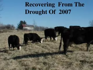
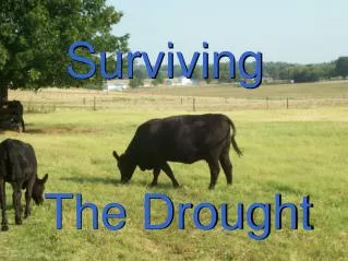
The Making of the Drought Monitor. The U.S. Drought Monitor. Since 1999, NOAA/CPC and NCDC, USDA, and the NDMC have produced a composite drought map--the Drought Monitor—each week with input from numerous federal and non-federal agencies. The Drought Monitor Concept.

E N D
The Making of the Drought Monitor
The U.S. Drought Monitor Since 1999, NOAA/CPC and NCDC, USDA, and the NDMC have produced a composite drought map--the Drought Monitor—each week with input from numerous federal and non-federal agencies
The Drought Monitor Concept • A partnership between the NDMC, USDA and NOAA’s CPC and NCDC • Incorporate relevant information and products from all entities (and levels of government) dealing with drought (RCC’s, SC’s, federal/state agencies, etc.) • The Drought Monitor is updatedweekly and provides a general up-to-date summary of current drought conditions across the 50 states and Puerto Rico
The Drought Monitor Concept • A consolidation of indices and indicators into one comprehensive national drought map • The intent is to provide an assessment product NOT a forecast ! • Trying to capture these characteristics: • the drought’s magnitude (duration + intensity) • spatial extent • probability of occurrence • impacts
The Drought Monitor— A new way of looking at drought in the U.S. • Integratesdaily rainfall reports from thousands of stations • Rates drought intensity by percentile ranks • Uses weekly feedback from local experts to reflect impacts and for “ground truthing” the product
Original Objectives • “Fujita-like” scale
U.S. Drought Monitor Map Drought Intensity Categories D0 Abnormally Dry D1 Drought – Moderate D2 Drought – Severe D3 Drought – Extreme D4 Drought – Exceptional
Original Objectives • “Fujita-like” scale • Identify impacts (A, W, F)
Original Objectives • “Fujita-like” scale • Identify impacts (A, W, F) • Assessment of current conditions—NOT a forecast!
Original Objectives • “Fujita-like” scale • Identify impacts (A, W, F) • Assessment of current conditions—NOT a forecast! • A general assessment—not intended to capture all local details
Original Objectives • “Fujita-like” scale • Identify impacts (A, W, F) • Assessment of current conditions—NOT a forecast! • A general assessment—no local details • Incorporates local expert input
Monitor Development Monday • Draft map sent to local experts Tuesday • Local expert feedback • Draft map sent to local experts • Draft text sent to local experts Wednesday • Local expert feedback • Final map and text sent to local experts Thursday • Map and text released to public on website
Original Objectives • “Fujita-like” scale • Identify impacts (A, W, F) • Assessment of current conditions—NOT a forecast! • A general assessment—no local details • Local expert input • As objective as possible
Creating the Drought Monitor (http://enso.unl.edu/monitor/) • Interagency • Partners: • NWS/CPC • USDA/JAWF • NDMC • Outside Experts: • USGS • State Climos • RCCs • NWS Hydros Posted on the Internet every Thursday morning Newspapers TV Stations Government officials Public
Principal Drought Monitor Inputs CPC Daily Soil Model USGS Streamflow Palmer Drought Index 30-day Precip. USDA Soil Ratings Satellite Veg Health
Blending it all together…the Objective Blend of Drought Indicators (OBDI)
Current Operational OBDI • First attempt at operationally integrating multiple indicators in an • automated weekly update using a • percentile ranking method • Combines and weights the 30-day precipitation (1/6), the Modified Palmer Drought Index (5/12), and the CPC Soil Moisture (5/12)
A New Breed of Experimental Blends “The Short, Long, and Unified of It”
The New Blends • Produced weekly using CPC’s real- time daily and weekly climate division data and NCDC’s monthly archive of indices for 1932-2000 • All parameters are first rendered as percentiles w/ respect to 1932-2000 data using a percent rank method
Indices used in the Blends and their Weights: • Short-term Blend:35% Palmer-derived Z-index; 25% 3-month precipitation; 20% 1-month precipitation; 13% CPC soil moisture model; and 7% Palmer (Modified) Drought Index • Long-term Blend:30% Palmer Hydrologic Index; 20% 12-month precip; 15% 6-month precip; 10% Palmer (Modified); 10% 24-month precip; 10% 60-month precip; and 5% CPC Soil Model
The New Blends • Unified Blend: the “raw” Unified blend is the average of the short- and long-term blends • The “finished” Unified product plots the percentile of the current “raw” values relative to the 1932-2000 distribution of monthly values archived at NCDC • URL: • http://www.cpc.ncep.noaa.gov/products/predictions/experimental/edb/access.html
Next Steps • Support and utilize the development of a western • Implement the new blend products into the process SWSI tool • Incorporate USDA soil measurements (SCAN) • Incorporate USGS groundwater data as real-time data become available • Efforts underway to take daily climate data from NOAA’s Cooperative Network to produce a regional/national coverage of station-based SPI maps on a weekly basis (http://nadss.unl.edu)
The Latest Weekly Assessment From the United States Drought Monitor The Latest Seasonal Outlook • Seasonal Outlooks • Drought Data • Soil Moisture Data • Precipitation and Temperature Data Publication of the web team, Climate Prediction Center.Last Updated: 04/18/2002 www.cpc.ncep.noaa.gov “Drought Assessment”
- Medium-Range Forecasts of T & P - 2-wk Soil Model Forecast (MRF) - 2-wk COLA Soil Model Forecast - 6-wk Experimental Climate Prediction Center (ECPC) Soil Model Forecasts Short-term Tools
Long-term Tools - CPC Long-Lead Outlooks of T and P - ECPC Monthly Soil Model Forecasts - PDI 4-Month Probability Projections - Soil Moisture Model ENSO Composites - Constructed Analogue Soil (CAS) Model Seasonal Forecasts - Correlations/Composites from PDO, Pacific Warm Pool, QBO, NAO, etc.
Main Features of Outlooks • Show changes over next 3 ½ months for large-scale drought areas • Initial areas based on schematic of Drought Monitor D1 areas • Verification criteria based on one-category change in Drought Monitor at end of forecast period • Map colors: green for improvement; brown for no change; hatched for mixed outlook; yellow for expanding drought
Seasonal CAS Soil Moisture Outlooks
Future Plans • Create online archive of past outlook maps • Add a technical discussion of reasoning behind the outlook • Continue research on factors related to drought • Create multiple regression drought forecast models