Download
1 / 35
350 likes | 442 Views
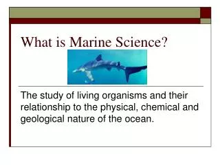
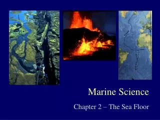
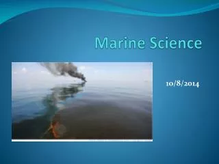
What is Marine Science?. It is the study of living organisms and their relationship to the chemical, physical, and geological nature of the ocean. It has two main divisions. Professional employment opportunities that combine specialties: Education Pollution control

E N D
What is Marine Science? • It is the study of living organisms and their relationship to the chemical, physical, and geological nature of the ocean. It has two main divisions.
Professional employment opportunities that combine specialties: • Education • Pollution control • International policies of the sea • Environmental law • Ocean engineering • World trade - global shipping • Mapping, exploration, research
Biology, chemistry, physics, geology, engineering, and computer science departments will all train people for ocean related careers.
Consider these ideas before you decide: • Many ocean related careers are relatively new and will continue to change. Well-rounded, interdisciplinary backgrounds are preferred. • Ocean careers can be the same as land careers - only in a different setting. With new technology, you do not have to live on a coastline. • Most marine scientists do not spend their days SCUBA diving on coral reefs nor training whales at Sea World. • Supply & demand determine the positions available. Student’s science and math skills should match their career objectives. • There is a shortage of applicants to graduate schools in oceanography, acoustics, and atmospheric chemistry; only marine biology attracts large numbers of applicants. • Marine careers are generally divided into 3 groups: all levels of governmental agencies, military, and academic or educational.
HISTORICAL PERSPECTIVES • Oceanography & Marine Biology began as a neccessity - not a science. Some of the greatest leaders are alive today! • Minoans & Phoenicians used the Mediterranean for trade.
Greeks calculated the Earth’s size, shape, and latitude lines • Vikings led by Leif Erikson, colonized Iceland by 700 AD and North America by 1000 AD.
Arabs & Chinese developed the compass and navigation. • Polynesians used the stars to explore Micronesia in double-hulled canoes.
Voyages of Columbus (1492) and Magellan (1522) began the “Age of Discovery”. • Ponce deLeon found the Gulf Stream by accident enroute to Cuba.
In 1760, John Harrison solved the problem of calculating longitude. • In 1768, Capt. James Cook’s 3 voyages discovered Australia, New Zealand and circumnavigated Antarctica. He and his crew were killed in Hawaii.
Ben Franklin named and mapped the Gulf Stream while serving as Postmaster General for the colonies • Matthew Fountaine Maury is called the “Father of Oceanography”. He published the first oceanography text as a military tool for use during the Civil War.
1872 - HMS Challenger was the first scientific voyage. It lasted only 3 years, but it took 20 years to analyze all the data they collected. • 1900 - Prince Albert of Monaco established the first Oceanographic School.
An expedition on the ship, Meteor, made 14 crossings of the Atlantic Ocean. • William Beebe descended 3,000 ft in the first bathysphere in 1930.
During WWII, Cousteau invented SCUBA and many other devices that opened the oceans to millions. • 1950 - International Geophysical Year (IGY) studied the Indian Ocean.
Trieste (bathyscaphe) descended 36,000 ft. into the Mariana Trench in the Pacific - the deepest ocean depth.
Project FAMOUS (French America Mid-Coean Undersea Study) and Deep Sea Drilling Project researched plate tectonics with the ship, Glomar Challenger. • 1978 - SEASAT satellite launched for measuring global surface temperature, bio-productivity, and wave heights.
1987 - Joint Oceanographic Institutions Deep Earth Sampling (JOIDES) drilled on the ocean floor at a depth of 27,000 ft. and went 1000 ft. into ocean floor sediments. • 1990’s - Global Positioning Satellites (GPS) were opened for public access.
Modern Oceanographic Institutions • Monaco Museum of Oceanography - • Jacques Cousteau was the director for 30 years until his death in 1997. • The Calypso II is the research vessel (R/V) of the Cousteau Society and is joined by the Alycone, a turbo-sail invented by Cousteau. • Its twin 33 ft. towers boost wind speed and save 33% more fuel than regular engines. It completed a 10 year voyage around the world (1885-1995)
2. Wood’s hole Oceanographic Institutions, Mass. • Scientist Dr. Robert Ballard found the titanic, Bismark, and hydrothermal vent communities using “Alvin”. • Alvin is a deep submergence vehicle (DSV) deployed from the R/V Atlantis II. It can transport a crew of 3 to 13,000 ft. • Alvin was built for the Navy in 1964, a year after a second submarine tragedy.
1927 - seven men died in 100 ft. of water in the S-4 near Cape cod. • 1963 - USS Thresher, a nuclear submarine, lost its entire crew off the coast of Maine at 1-2 mile down. We still don’t know what happened. Black boxes were developed after that.
1966 - a US Air force bomber collided with its refueling tanker over Spain, destroying both planes. Four unarmed H-bombs fell out of the wreckage; 3 fell on land, one fell into the ocean. It took Alvin 80 days to find it.
3. Lamont-Doherty Earth Observertory, NY - Marie Tharp is famous for converting sonar scans into bathymetric maps. 4. Scripps Institution of Oceanography, LaJolla, CA. “FLIP” and “Glomar Challenger” are two of their R/Vs.
FLIP is a 3345 ft. vessel, whose stern ballast tanks can be flooded to convert it into a 55 ft. stable platform for research.
1966 - Congress established the National Sea Grant College Program. • Currently, there are sea grant colleges in every coastal state and Puerto Rico, involved in a variety of graduate level studies.
University National Oceanographic Laboratory System (UNOLS) has a fleet of academic research vessels, deep submersible and remote robotic vehicles. • Marine Science is only lacking American science students. The US is only 17th in the world in scientific literacy.
Water Safety • Swim with a buddy • Fly a dive flag • Wear a life jacket in the boat and stay with the boat if capsized. • Know your limits - tired, cold divers make more errors. • Avoid panic and prepare for emergencies. • Let someone on shore know your plans
Water temperature is a big factor for survival that experience, training, and safety procedures cannot overcome. • At 80o indefinite time limit in water • At 60o 2-24 hour time limit • At 50o 30 minutes to 3 hours limit • At 32o less than one hour limit
SCUBA • SCUBA is an acronym for the Self-Contained Underwater Breathing Apparatus invented by Cousteau. • Diver certification is required to avoid the dangers that proper training can prevent.
Decompression sickness (The Bends) • caused by surfacing too rapidly for excess nitrogen in your blood to be eliminated by breathing. • The result is bubbles which expand and damage body tissue ro cause pain. • Divers learn to surface slowly and when to make necessary decompression stops.
2. Nitrogen narcosis (“Martini Effect” or “Rapture of the Deep”) • At depths, nitrogen is forced into the blood stream and has an anesthetic quality that impairs judgement and may cause the diver to become unconscious. • The depth that narcosis occurs depends on the experience of the diver and the length of the dive.
Navigational Aids Left Channel Marker - Green Can Right Channel Marker - red Nun
Left Day Mark Right Day Mark
“Red - Right - Returning” is a phrase used to navigate home Knots = term used for speed in mile/hr 1 land mile = 54,280 ft. 1 nautical mile = 6,076 ft.