Download
1 / 44
440 likes | 518 Views
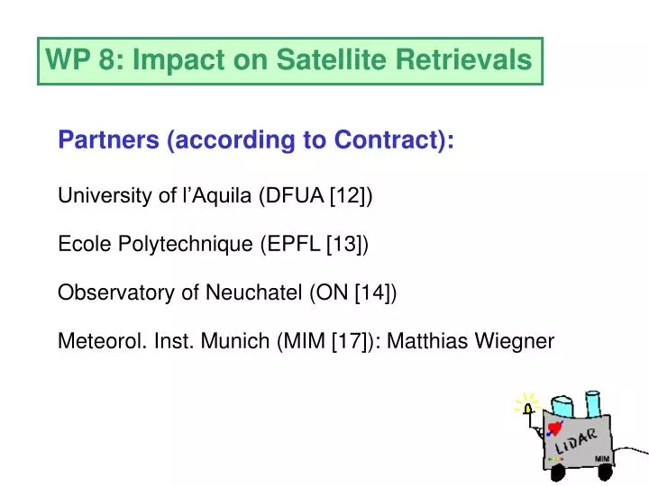
WP 8: Impact on Satellite Retrievals. Partners (according to Contract):. University of l’Aquila (DFUA [12]). Ecole Polytechnique (EPFL [13]). Observatory of Neuchatel (ON [14]). Meteorol. Inst. Munich (MIM [17]): Matthias Wiegner. Overview over Presentation.

E N D
WP 8: Impact on Satellite Retrievals Partners (according to Contract): University of l’Aquila (DFUA [12]) Ecole Polytechnique (EPFL [13]) Observatory of Neuchatel (ON [14]) Meteorol. Inst. Munich (MIM [17]): Matthias Wiegner
Overview over Presentation 1. EARLINET-Contract: Workpackage 8 2. Relevance of WP 8 3. Contributions to WP 8 Definition Examples 4. Conclusions
Contract: Objectives and input of WP8 EARLINET-Contract: 1. Quantify the sensitivity of radiances at the top of the atmosphere (toa) to variations of the aerosol distribution [...]. This will be used to provide an estimate of the impact of aerosols on retrievals [...] from spaceborne platforms. 2. Provide aerosol distributions for calibration purposes upon request [...].
Contract: Description of work This is done by running adequate radiative transfer models using the aerosol data [...]. As a result, inversion algorithms [...] can be critically reviewed and improved. Additional lidar measurements [...] will be performed at special occasions when satellite overpasses close to an EARLINET station occurs [...]. For this part to stay within the limits of the available resources it will be done only on request.
Relevance of WP 8 multispectral and multiangular radiances from satellites used to retrieve aerosol optical depth critical over land surfaces (albedo, orography) complex retrieval algorithms require validation „Validation of atmospheric parameters“
Relevance of WP 8 multispectral and multiangular radiances from satellites used to retrieve surface properties (e.g. precision farming) determine atmospheric influence (unknown aerosol effect) corrections of atmospheric masking require input and validation „Validation of surface parameters“
Relevance of WP 8 Radiative transfer calculations required to understand satellite data aerosol distribution is one controlling parameter contribution of lidar data to be assessed „Improvement of aerosol understanding“
Three contributions to WP 8 Offer our datasets to the satellite community for validation purposes Demonstrate the benefit of lidar data on the basis of dedicated experiments Identify cases where lidar data are useful Note: WP‘s ordered by „time allocated“: WP8 is 15. out of 20.
First contribution Goal: Support validation of satellite retrievals by supplying lidar data (possible candidates: Envisat, MSG community) Actions proposed: Supply survey of available aerosol extinction profiles (site, time, wavelength) Data dissemination: On request (Webpage)
First contribution Results/Conclusions: Aerosol extinction profiles from more than 20 lidar stations, two times a week and for more than two years, are available. Validation of aerosol retrievals requires a careful selection of time and place, and averaging over reasonable periods. Envisat and MSG are still at the beginning of their operation times. Final success requires extra funding (also for the satellite community), time horizon: 2003/04 “Seed is set, but harvesting takes time”
Three contributions to WP 8 Offer our datasets to the satellite community for validation purposes Demonstrate the benefit of lidar data on the basis of dedicated experiments Identify cases where lidar data are useful Note: WP‘s ordered by „time allocated“: WP8 is 15. out of 20.
Second contribution Goal: Full characterization of surface and atmosphere of exactly the same scene (for calibration of satellite sensor and algorithms) Requirements: co-incidence and co-location and very small satellite pixelrequired. Time and Place: May, June, July and August 2002 in Gilching Acquisition mode: CHRIS: 18 km swath, 25 m resolution, 19 spectral bands, along track (5 angles) In co-operation with:
Second contribution Results/Conclusions: Satellite PROBA encountered severe problems: no data are available up to now. First data are announced for fall this year. A new special field campaign is difficult to be organised.
Three contributions to WP 8 Offer our datasets to the satellite community for validation purposes Demonstrate the benefit of lidar data on the basis of dedicated experiments Identify cases where lidar data are useful Note: WP‘s ordered by „time allocated“: WP8 is 15. out of 20.
Third contribution Goal: Support model development by supplying lidar data Actions: Performing model calculations with realistic aerosol extinction profiles to investigate the influence of aerosols on toa-radiances
Radiative transfer calculations Variation of aerosol optical depth Variation of aerosol type Variation of aerosol (vertical) distribution Variation of surface albedo Variation of solar zenith angle Fixed wavelength (532 nm)
Model calculations Vertical aerosol distribution: 5 cases (1) (2)(3)(4)(5)
Radiances at top of atmosphere Normalized to isotropic radiance „Anisotropy-Function“
Radiance/flux at toa as a function of surface albedo for different aerosol optical depths fixed aerosol type, aerosol profile and solar zenith angle
Radiance/flux at toa different aerosol type
Radiance/flux at toa different aerosol type
Radiance/flux at toa different aerosol type
Radiance/flux at toa different aerosol type
Radiance/flux at toa same as before: 32.50
Radiance/flux at toa now: 62.50
Radiance/flux at toa as a function of surface albedo for different aerosol types fixed optical depth, aerosol profile and solar zenith angle
Radiance/flux at toa Different optical depth
Radiance/flux at toa Different optical depth
Radiance/flux at toa Different optical depth
Radiance/flux at toa Different optical depth
Radiance/flux at toa as a function of surface albedo for different aerosol profiles fixed optical depth, aerosol type and solar zenith angle
Radiance/flux at toa Different aerosol type
Radiance/flux at toa Different aerosol type
Radiance/flux at toa Different aerosol type
Radiance/flux at toa Different aerosol type
Radiance/flux at toa as a function of surface albedo for different aerosol mixtures fixed optical depth, aerosol types and solar zenith angle
Radiance/flux at toa Different aerosol type
Radiance/flux at toa Different aerosol type
Radiance/flux at toa Different aerosol type
Radiance/flux at toa Different aerosol type
Radiance/flux at toa Different layer width
Conclusions from the model simulations Satellite radiances are significantly influenced by aerosols: -- optical depth -- aerosol type -- aerosol profile
Conclusions from WP 8 Validation campaigns of aerosol parameters with lidar data require extra efforts Model simulations show that the aerosol vertical distribution is a second order effect for satellite remote sensing, but should be provided together with a aerosol classification („aerosol type“)