Download
1 / 15
150 likes | 302 Views
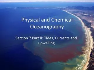
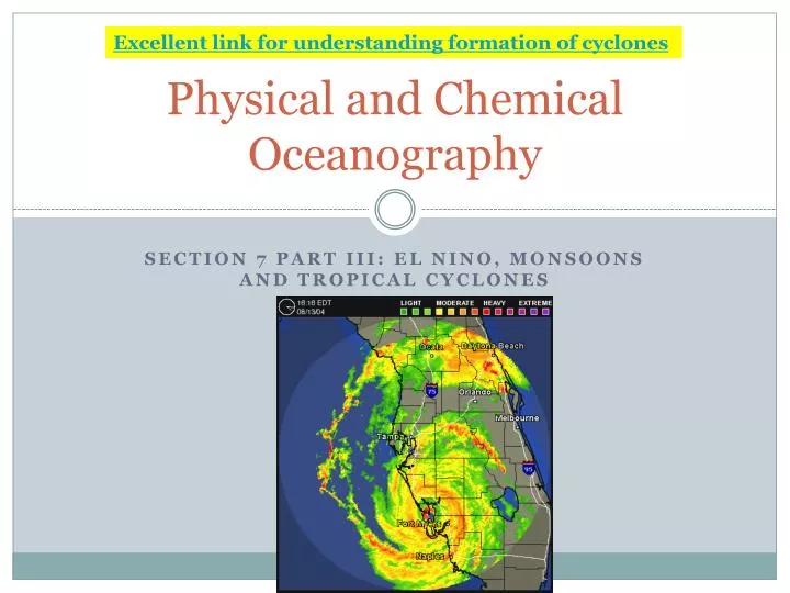
Excellent link for understanding formation of cyclones. Physical and Chemical Oceanography. Section 7 Part III: El Nino, Monsoons and Tropical Cyclones. Normal Wind Pattern. El Nino (southern oscillation). sequence of events occurring in southern Pacific Ocean Normal conditions

E N D
Excellent link for understanding formation of cyclones Physical and Chemical Oceanography Section 7 Part III: El Nino, Monsoons and Tropical Cyclones
El Nino (southern oscillation) • sequence of events occurring in southern Pacific Ocean • Normal conditions • cold nutrient-rich water flows North along west coast of S. America. • Upwelling of nutrients due to winds from the South • High productivity • large numbers of: Anchovies Sardines • Supports: substantial fisheries industry various sea bird species plankton-rich water
El Nino Conditions • Every ~7-10 years • Winds stop blowing from East or SE • Warm equatorial water is blown by abnormal winds from the West. • Pressure gradients in East and West Pacific are reversed • Reverse in wind direction and equatorial currents • Large area of warm water forms = cold-water species death • Upwelling stops • Nutrient supply to surface is reduced = lack of nutrients = primary production rapidly decreases • Affects higher trophic levels • Collapse of commercial fish stocks
El Nino Example • Major event in 1982-83 • Surface temps decreased by 5⁰C • Heavy rain in normally dry eastern Pacific • Cause not known: possibly global warming?
Monsoons • Asia = largest continent • Climate swing: hot/wet to cold/dry • Monsoon (rainy season)- seasonal shift in wind of the Indian Ocean • Land absorbs heat faster than sea, so it heats up faster • In winter, sea is warmed but not land • Warm air over sea rises and is less dense • Draws in cooler northeasterly air from land • India: occurs during post-monsoon season: October - December
Monsoon • Summer (May-August) = land quickly heats and there is big temp. difference between Central Asia and Indian Ocean • Land air warms, is less dense, rises • Saturated air (water vapor) from southwest over Indian Ocean • Thunderstorms • Very heavy rain (80% of India’s annual) • September, land mass cools, monsoon weakens & replaced with a dry, northeast post-monsoon
Tropical Cyclone Formation • A low-pressure storm system • Thunderstorms, strong winds, heavy rain • Develop over warm sea (26.5°C), low-pressure, high evaporation • Water vapor rises, cools, condenses and releases large amount of heat energy • Latent heat of condensation • Further increases evaporation = stronger development Click on link! HOW TROPICAL CYCLONES FORM
Tropical Cyclone Formation • Earth rotation + Coriolis Effect = cyclonic spin • North hemis. – counterclockwise • South hemis. – clockwise • Move across surface in direction of prevailing winds • Path = track
Hurricanes (Typhoons) Multiple names around the world: • Indian, S. Pacific (other) = tropical cyclone • North Atlantic = hurricane • NW Pacific = typhoon JAPAN CHINA FLORIDA AUSTRALIA
Hurricanes (Typhoons) • Destructive to coastal communities • High winds • Can exceed 90 km/hr (56 mph) • Gusts: 280 km/hr (174 mph) • Erosion of shore, damage to moored boats • Heavy rain • Widespread flooding (extends inland when cyclone moves in) • Can benefit arid (dry) areas • Storm Surges (sea level increase) • Flooding of low-lying areas (drowning) • Replenish nutrients in coastal water (increased productivity)
ACTIVITY: On the Map • The three names (where they are found) • Coriolis deflects to the right (arrows) • Cyclonic rotation • North hemisphere • South hemisphere