Download
1 / 15
150 likes | 306 Views
Ecoregion typing. Ecological classification or typing will allow the grouping of rivers according to similarities based on a top-down nested hierarchical approach. The purpose of this approach is to simplify assessments and statements on ecological water requirements.

E N D
Ecoregion typing • Ecological classification or typing will allow the grouping of rivers according to similarities based on a top-down nested hierarchical approach. • The purpose of this approach is to simplify assessments and statements on ecological water requirements. • One of the advantages of such a system is the extrapolation of information from data rich rivers to data poor rivers within the same hierarchical typing context. Taken from: Dr N. Kleynhans
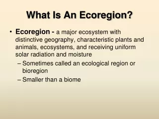
Ecoregions In this approach, ecoregions are regions of relative homogeneity in ecological characteristics or in relationships between organisms and their environments.
Level I: This level of typing is based on the premise that ecosystems and their components display regional patterns that are reflected in spatially variable combinations of causal factors such as climate, mineral availability (soils and geology), vegetation and physiography (Omernik, 1987). In South Africa, physiography, climate, geology, soils and potential natural vegetation, have been used as the delineators of Level I. Level II: The same characteristics as for the Level I typing is used, but in more detail. Level II typing will produce regional or sub-catchment scale ecotypes. Level II will be a suitable stage to link to stream classification. Taken from: Dr N. Kleynhans
Omernik's (1987) approach is based on patterns of terrestrial RIVER TYPING ECOREGION TYPING LEVEL I ECOREGION ATTRIBUTES PHYSIOGRAPHY CLIMATE GEOLOGY AND SOILS POTENTIAL NATURAL VEGETATION HYDROLOGY LEVEL II ECOREGION ATTRIBUTES: SAME AS LEVEL I, BUT MORE DETAIL PHYSIOGRAPHY (Terrain morphology, relief altitude) CLIMATE (Rainfall (MAP), Rainfall seasonality and variation, Temperature) GEOLOGY AND SOILS (Lithology, Rock types, Soils) POTENTIAL NATURAL VEGETATION (Vegetation types (Low & Rebelo) HYDROLOGY (MAR, Median runoff, variation) STREAM CLASSIFICATION GEOMORPHOLOGICAL SEGMENTS LONGITUDINAL ZONES BIOLOGICAL SEGMENTS: Fish Habitat Segments Invertebrate Habitat Segments Riparian Vegetation Taken from: Dr N. Kleynhans
geomorphology botany hydrology zoology ecology River Complexity physical system biological system Chemical system (adapted from Dollar et al. 2004)
Species distribution Abundance Community structure Resource use Consumption Distribution Cultural value Beauty “sense of place” Management of aquatic systems Evironmental protection Social/ human welfare Economic development Adapted from Roux, 1999
Fish as bio-indicators • The relative health of fish communities are sensitive indicators of direct & indirect stresses on the entire aquatic ecosystem (Karr, 1981). • Fish are useful indicators for biomonitoring and flow assessment studies. (See Karr, 1981; Fausch et al., 1990; Karr & Chu, 1999, Kleynhans, 2003; Louw, 2003). • A biological index integrates and summarises the biological data within an indicator group. • Biological indices therefore quantify the condition of river health with a numeric output(Karr, 1999).
Fish Assemblage Integrity Index (FAII) • Karr’s Index of Biotic Integrity (IBI) detects divergence from biological integrity caused by human actions by using fish community parameters. • FAII developed by Kleynhans (1999) for SA rivers. • Compares aspects of expected & observed fish assemblages • This index categorises fish populations according to an intolerance rating which takes into account trophic preference and specialisation,flow requirements and association with specific habitats and unmodified water quality.
FAII cont. • Results of the FAII expresses as a ratio of observed vs. expected conditions • FAII(EXP)=IT((F+H)/2; FAII(OBS)=IT((F+H)/2 • Relative FAII=FAII(OBS)/FAII(EXP) x 100 • Interpretation of FAII score