Download

1 / 35
350 likes | 555 Views
ERFS Project Workshop Collaborating Centre : Anand Gujarat (Surendranagar district). Dr. Vyas Pandey Department of Agricultural Meteorology Anand Agricultural University Anand, Gujarat. International Agriculture Risk Management workshop, ERFS Project, 27-30 April 2009.

E N D
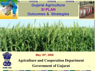
ERFS Project Workshop Collaborating Centre : AnandGujarat (Surendranagar district) Dr. Vyas Pandey Department of Agricultural Meteorology Anand Agricultural University Anand, Gujarat International Agriculture Risk Management workshop, ERFS Project, 27-30 April 2009
GUJARAT- Four Agricultural Universities Dantiwada Agricultural University Anand Agricultural University Junagadh Agricultural University Navsari Agricultural University
Department of Agricultural Meteorology The B A College of Agriculture at Anand is the pioneer institute in the country in respect of operating academic and concurrent research programme in the area of Agricultural Meteorology since 1964 under guidance of Prof. P. D. Mistry. On recommendations of National Commission on Agriculture in 1976, a full fledge Department of Agricultural Meteorology at Anand was setup by the ICAR in 1983. The department was further strengthened in terms of manpower and infrastructure by funding through various schemes by ICAR/ DST/ISRO.
Departmental set up and Faculty Positions • Department of Agril Meteorology • Professor (1) • Associate Professor (1) • Assistant Professor (2) • B.A College Establishment • Professor (1) • Asst Professors (5) (Engg, Maths, Physics) • AICRP on Agrometeorology (ICAR Research Scheme) • Associate Professor (1) • Agronomist (1) • Centre for Weather Forecasting and climate change • Assistant Professor (1) • Agromet Advisory Service (IMD) • Asst. Professor (1)
Academic Programmes • Master's Degree Two academic years (Foursemesters) (i) 35 credit hours (major 15 credits minimum, minor 9 credits minimum, a seminar of 1 credit) plus credits of allied and/or special problems other than pre-requisite and/or supporting course, adjudged necessary by the Advisory Committee. (ii) Research project of 15 credit. (B) Ph.D Degree Three Academic Years (Six semesters) • 25 credit hours (major 10 credits, minor six credits, seminar one credit in major and one in minor field) plus credits of allied and / or special problems. • Research project of 25 credit
PG Curriculum in Agricultural Meteorology Core Courses Optional Courses Supporting Courses
Core Courses Ag. Met.601 Fundamentals of meteorology 2+1 Ag. Met.602. Fundamentals of climatology 3+0 Ag. Met.603. Micrometeorology 2+1 Ag. Met.604 Agro meteorological instrumentation 1+2. Optional Courses Ag. Met.701 Evapotranspiration 2+1 Ag. Met.702 Agroclimatic analysis 2+2 Ag. Met.703 Crop weather models 1+2 Ag. Met.704 Water budgeting and drought meteorology 2+1 Ag. Met.705 Applied agrometeorology 3+0 Ag. Met.706 Weather and agriculture 2+1 Ag. Met.707 Hydrometeorology 2+1 Ag. Met.708 Weather modification 2+0 Ag. Met.709 Principles of Remote Sensing and its applications in agriculture 2+1 Ag. Met.710 Air Pollution Meteorology 2+1 Ag. Met.711 Mathematics in agriculture and biology 2+1 Ag. Met.712 Animal and Farm House Meteorology 3+0
Research Problems undertaken in Agricultural Meteorology • Agroclimatic Resource characterization • Rainfall probability analysis • Evapotranspiration and irrigation scheduling • Water Balance and crop planning • Drought analysis • Crop Weather relationship • Crop growth simulation modelling • Impact of climate change on crop production • Development of Yield Prediction models • Micrometeorological studies • Weather- pest-disease relationship and forewarning • Application of remote sensing techniques in agriculture • Weather prediction and climate change/variability studies • Effect of air pollutants on crops
Other Activities • Agromet data bank of 30 stations • 14 AWS with satellite communication link • Soil health card programme • Extension activities • Climate change awareness programme • Earth day celebration • Association of Agrometeorologists- Journal of Agrometeorology
GUJARAT DISTRICT MAP SURENDRANAGAR
Vulnerability • Drought prone areas & arid areas forms more then 50 % of District • Soil erosion is increasing due to advancement of Desert land, Deforestation • Depletion Of Water Table • Sea Water Ingress • Deterioration of Soil and Water conditions due to salinity ingress • Irregular rainfall affecting productivity in agriculture • Agriculture affected due to recurrent drought • Inadequate Fodder Resource • Inadequate trained human resource for modern agricultural research and education Source: Gujarat Institute of Disaster Management, ,Gujarat State Disaster Management Authority, Government of Gujarat
During last 15 years : • Reduction in quantity of ground water by 26% • Water table going down by almost 3 m every year • 27% of villages have water quality problems – excess fluoride & nitrate • Recurrence of drought every three years Source: Gujarat Institute of Disaster Management, ,Gujarat State Disaster Management Authority, Government of Gujarat
DROUGHT Originates from deficiency of precipitation resulting in water shortages for human, cattle and agricultural consumption 16 % of District’s total area is drought prone 68% of total sown area can be drought affected 50 000 people are expected to be annually affected. Source: Gujarat Institute of Disaster Management, ,Gujarat State Disaster Management Authority, Government of Gujarat
IMPACT OF DROUGHT • Actual impact and vulnerability may be quite different depending on the soils, irrigation, infrastructure, crop types and socio-economic factors like backwardness of the people, poverty, size of land holdings, rural industries of the area and access to other inputs. • Economic • Environment • Social Source: Gujarat Institute of Disaster Management, ,Gujarat State Disaster Management Authority, Government of Gujarat
Drought - Spread in Surendranagar • Average Rainfall of Surendranagar is 550 mm which varies from 200 mm to 900 mm in the District. • Due to agro-climatic diversity, there are extreme climatic conditions in Surendranagar. • Once in every 3 year, there is drought in Surendranagar. • The drought was declared in the years 1985, 1986, 1987, 1998, 1999, 2000, 2001, 2002 and 2003. • In Surendranagar, many parts are affected by Hydrological Drought. Source: Gujarat Institute of Disaster Management, ,Gujarat State Disaster Management Authority, Government of Gujarat
Specific Problems of Surendranagar • Because of excessive use of chemical fertilizers and pesticides farmer faces problem of yield reduction in crop. • Water availability is a major problem, If water available, then they are ready for cotton crop only. • Increase in ground water salinity is main problem faced by Surendranagar farmers in Sayla, Limbadi, Halvad, Muli and Wadhvan Talukas. • Non-availability of power supply in certain areas is a severe problem (at present). Farmers are not interested in cotton crop (farming) but compelled to undertake the same due to pressing economic reasons. Source: Gujarat Institute of Disaster Management, ,Gujarat State Disaster Management Authority, Government of Gujarat
The major food crops in the Surendranagar are • Rice, Wheat, Jowar, Bajra, Maize, Tur, Gram, Groundnut while major non food crops are Cotton, Tobacco. • In the year 2004-05, the gross cropped area and net cropped area were reported to be 7.341 lakh ha. , the total net area irrigated was 1.528 lakh ha. in the District. • The production of total cotton during the year 2007-08 was estimated at 11.699 lakh bales. The production of cotton and total oil seeds was at 8.72 lakh bales (each of 100 kgs.) and 9.833 lakh tones during the year 2005-06 respectively. • As per triennium average ending the year 2007-08, the production of the total food grains, cotton and total oilseeds was estimated to be 46.78 lakh tones, 11.699 lakh bales (each of 100 kg.). Source: Agriculture & co-operative department Government of Gujarat
AGRICULTURAL AT GLANCE ….. LAND USAGE & IRRIGATION CLASSIFICATION OF SURENDRANAGAR LAND USAGE Total land held by Operational Holders 7.341 lakh hectors Actual cultivated area 7.043 lakh hectors Total cultivated area 7.043 lakh hectors Area under irrigation Irrigation Potential through canal irrigation: 1.359lakh ha. With Sardar Sarovar Dam: 3.41 lakh ha. No. of Check dams & Boribands constructed: 500 No. of Farm Ponds created: 1370 No. of Village Ponds deepened: 308 A major Watershed Programme under implementation Source: Agriculture & co-oprative department Government of Gujarat
8 DISTRIBUTION OF IRRIGATED COTTON CROP AS A PERCENTAGE OF GEOGRAPHICAL AREA AT TALUKA LEVEL (MEAN OF 1998-99 TO 2000-08
DISTRIBUTION OF UNIRRIGATED COTTON CROP AS A PERCENTAGE OF GEOGRAPHICAL AREA AT TALUKA LEVEL (MEAN OF 1998-99 TO 2000-08)
Irrigated land and Un irrigated Land Cotton area and yield Source: Agriculture & co-operative department Government of Gujarat
COTTON YIELD PREDICTION Cotton yield prediction models were developed for Ahmedabad , Mehasana, Surendranagar, Rajkot, Junagadh, Amreli, Bhavnagar and Bharuch districts. The available daily weather data (Rainfall, maximum temperature, minimum temperature, relative humidity, wind speed and bright sunshine hours) obtained from Agrometeorological observatory situated in each district was used to calculate weekly/fortnightly/monthly or crop stage wise. Regression models were developed and best model was selected having maximum R2 values. These models were used to predict the cotton yield for year 2008-09.
Y = 1091.346- 0.022 x July RF – 23.323 x SEP RH1 + 4.850 x OCT RH1 R2 = 0.84
Y = -106.53-39.504 x AUG TMAX + 0.385 x JUL RAIN + 62.077 x AUG TMIN R2 = 0.67
AGRICULTURAL INFRASTRUCTURE AGRICULTURAL MARKETING ORGANISATIONS
ADVANTAGE SURENDRANAGAR • Diversified Crops and Cropping systems • Climatic diversities • Biodiversities • Good transport facilities -- Situated near by PORTS & AIRPORTS • Strong Agri Marketing system, Agro based Industries & Co-operatives • Enterprising Farmers having business instincts • Geographical Location Source: Agriculture & co-oprative department Government of Gujarat