Download
1 / 24
240 likes | 362 Views
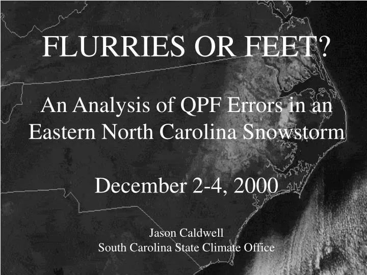
FLURRIES OR FEET? An Analysis of QPF Errors in an Eastern North Carolina Snowstorm December 2-4, 2000 Jason Caldwell South Carolina State Climate Office. WINTER WEATHER FORECASTING. CSTAR Project National Weather Service Offices (NC, SC, VA)

E N D
FLURRIES OR FEET?An Analysis of QPF Errors in an Eastern North Carolina SnowstormDecember 2-4, 2000Jason CaldwellSouth Carolina State Climate Office
WINTER WEATHER FORECASTING CSTAR Project National Weather Service Offices (NC, SC, VA) Focus on improving forecast skill in CAD, CF Evaluation of the MM5 Real-Time Forecast System NCSU, NC SCO, NCSC, Capitol Broadcasting Focus on sources of model error on the synoptic and mesoscale related to CAD, CF Examine model performance relative to Eta
SYNOPTIC SET-UP EDAS Surface Analysis EDAS 850mb Analysis EDAS 500mb Analysis EDAS 250mb Analysis VALID 12Z 2 DECEMBER 2000
MM5 vs. ETA Quantitative Precipitation Forecasts(24-30 hour forecasts valid 12-18 Z on 3 December 2000) Insert MM5 24h Forecast here
TOTAL ACCUMULATED SNOWFALL2-4 DECEMBER 2000 (graphics courtesy NWS Raleigh)
What we know: • Model forecasts missed a precursor vorticity maximum at 500 mb • Models predicted coastal front too close to coast (site for surface cyclone formation) • Models under-predicted intensity of cold-air damming • Models produced heavy precipitation with a thermodynamic profile that was characterized by shallow cloud • Operational sea-surface temperature analyses were too warm according to NCEP, could have been tied to coastal front errors
HYPOTHESIS A Lead vorticity disturbance at 500 mb(under-forecast by models) pushed the coastal front seaward, strengthened CAD, dried atmosphere over central NC before main vorticity maximum arrived through evaporative processes and subsidence • EVALUATE MODEL ERRORS IN 500mb VORTICITY • COMPARE VERTICAL CHARACTERISTICS BEFORE & AFTER VORT PASSAGE • TEST FOR EVIDENCE OF SURFACE BASED RESPONSE • HOW DOES THIS AFFECT QPF?
ETA 500mb Height/Vorticity 12h Forecast EDAS 500mb Height/Vorticity Analysis valid 00Z 3 December 2000 MM5 500mb Height/Vorticity 12h Forecast valid 00Z 3 December 2000 valid 00Z 3 December 2000
VERTICAL CROSS-SECTION DIAGRAM Yellow section indicates Central NC region; Black dot indicates location at max QPF gradient
EDAS Vertical Analysis (Omega,RH) EDAS Vertical Analysis (TAdv,Theta) valid 00Z 3 Dec 2000 valid 00Z 3 Dec 2000 EDAS Vertical Analysis (Omega,RH) EDAS Vertical Analysis (TAdv,Theta) Drying aloft due to Subsidence CAA increasing w/time Temperatures rapidly decreasing w/height UVV as response to DiffThermAdv Low-level drying as CAD strengthens CAA increasing w/time valid 06Z 3 Dec 2000 valid 06Z 3 Dec 2000
PRE-VORT POST-VORT EDAS FRONTOGENESIS AND SLP ANALYSES(PRE- & POST- 500mb VORT MAX) valid 00Z 3 Dec 2000 valid 06Z 3 Dec 2000 valid 00Z 3 Dec 2000 valid 12Z 3 Dec 2000
The strength and southern extent of the cold air damming was under-predicted by model forecasts and led to errors in QPF. HOW DOES THIS AFFECT THE QPF? The decreased magnitude of CAD shifts the location of the coastal front and affects low-level thermal and moisture profiles inland - thermal gradient (baroclinic zone) is positioned farther west due to restricted areal coverage of cold dome - moisture availability is higher due to less airmass intrusion from parent high - lower atmosphere is less stable and more conducive to vertical motion - coastal front more likely to propagate inland as WAA overtakes weaker CAD
Model forecasts predicted the placement of the coastal front west of the actual location off the coast of North Carolina and resulted in QPF errors HOW DOES THIS AFFECT THE QPF? Low pressure forms closer to the coast which extends the western boundary of precipitation into the Triad region - enhanced upward vertical motion inland due to surface convergence at CF - increased moisture transport with stronger and more easterly winds at low-levels - prolonged duration of precipitation as a result of proximity - prolific isentropic lift as warm air advection associated with cyclogenesis moves into NC over CAD at mid-levels
HYPOTHESIS B Model microphysics were overactive in producing precipitation with dry air aloft and a shallow cloud • EVALUATE PRECIPITATION MECHANISMS PRESENT • DIAGNOSE VERTICAL TEMPERATURE/MOISTURE PROFILE OVER CENTRAL NC • HOW DOES THIS AFFECT QPF?
INGREDIENTS FOR WINTER PRECIPITATION FORECASTS FORCING FOR ASCENT Low/mid- level convergence Upper-level divergence/diffluence Differential Temperature Advection AVAILABLE MOISTURE *Skew-T profiles*Satellite Imagery INSTABILITY Temperatures decreasing w/height Thermal and Moisture Advection TEMPERATURE Determines p-type and snow/water ratio EFFICIENCY Based on cloud Temperature and ice generation *Max occurs at –15C w/strong forcing for ascent
Cross-section of Omega/RH EDAS Analysis valid 12Z 3 December 2000 MUCH DRIER THAN FORECAST MUCH DRIER THAN FORECAST Cross-section of Omega/RH ETA 24h Forecast valid 12Z 3 December 2000
24-hour MM5 and ETA Forecast Soundings and EDAS RAOB Raleigh-Durham International, NC (valid 12Z 3 December 2000) Cloud top T ~ -10C Shallow Cloud Layer Models too moist below 850 mb Cloud depth over-predicted by models Less drying above 600 mb than in models
The ETA model microphysics scheme allowed ice crystal growth at –10 degrees C which allowed precipitation generation to occur in shallow, super-cooled water droplet clouds. HOW DOES THIS AFFECT THE QPF? Dendrite growth occurred in an non-conducive thermal environment generating spurious precipitation Increased moisture availability in the models through an extended depth over-quantified precipitation totals, when in reality the atmosphere was dry above 700mb
SUMMARY AND CONCLUSIONS Classification of QPF Error Sources (1) Synoptic-scale features (i.e. 500 mb vorticity) (2) Circular feedbacks from multiple factors (3) Model parameterizations Model Inter-comparison + MM5 achieved better QPF forecasts than Eta yet MM5 also under-estimated the CAD and vort max + MM5 also out-performed the Eta in coastal front location, strength of CAD, and track of the cyclone
DIRECTIONS FOR FUTURE RESEARCH ( & OTHER CONSIDERATIONS) Sensitivity experiments using: - High-resolution SST - PBL and Microphysics options Examine low-level moisture influx in model forecasts - Relationship to latent heat release Statistically quantify the relative weight of each proposed hypothesis in generating model QPF errors
Vertical Motion & Moisture Cross-SectionEDAS vs. ETA 12h Forecast valid 00Z 3 Dec 2000 Low-level drier air as a result of subsidence in CAD region over central NC RH values increase over eastern NC around 700mb in region of ascent where OMEGA= -7mb/s Model indicates region of subsidence isolated west of RDU adjacent to the mountains To the east, upward vertical motion (up to -11mb/s) predominates in the entire 850-500mb layer RH too low over central NC at 500mb indicating drying and instability between 700-500mb RH too high around 700mb level continues mid-level instability
Vertical Motion & Moisture Cross-SectionEDAS vs. ETA 18h Forecast valid 06Z 3 Dec 2000 Positive values of OMEGA indicates subsidence at low-levels over central NC and offshore Upward vertical motion (OMEGA=-9mb/s) strengthens near 700mb over eastern NC RH values increased in the 850-700mb layer across all of NC Substantial drying below 850mb and aloft above 700mb Model indicates upward motion from SFC-500mb Two OMEGA maxima (-12mb/s, -16mb/s) over central/eastern NC in the 700-500mb layer RH too high at low-levels in CAD region (possibly due to erroneous precipitation) Dry air at 500mb too far west over mountains; RH too high above 700mb east of mountains