Download
1 / 34
340 likes | 425 Views
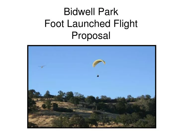
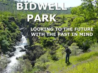
Bidwell Park Foot Launched Flight Proposal. Overview. Introductions What is Paragliding Proposal Impacts Monitoring Launch and Landing Sites Risk Assessment Insurance Pilot Rating Requirements Pilot Regulation Management and Oversight Areas Of Use Time of Use Park Usage Estimation

E N D
Overview • Introductions • What is Paragliding • Proposal • Impacts • Monitoring • Launch and Landing Sites • Risk Assessment • Insurance • Pilot Rating Requirements • Pilot Regulation • Management and Oversight • Areas Of Use • Time of Use • Park Usage Estimation • Video Clip Click on a link to see details.
Proposal Introduction • Use permit for Bidwell Park • 3 year implementation plan • Special use guidelines • Monitoring and Oversight by local club and national organization • Impact reports annually
Overview • Bidwell Park Fliers would like to propose a progressive implementation plan for a use permit for Foot Launched Flight in Upper Bidwell Park. • 1st year- a select test group, paragliders, North Rim only- 2008 season • Test group to determine feasibility of foot launched paraglider flight • Permit issued for one year from March to October • Report issued and reviewed for permit renewal in 2009 season • 2nd year- a monitored group and guests, paragliders only- 2009 season • Bidwell Park Fliers members and guests only • Permit issued for one year from March to October • Report issued and reviewed for permit renewal in 2010 season • 3rd year- evaluation incorporating other forms of foot launched flight- Continued use permit for Paragliders- 2010 season • Evaluation for Hang-glider use in the park and other site opportunities should they exist • Reissue of permit for 2011 season with updated guidelines and regulations incorporating new considerations
Our proposal: • Paraglider Foot Launched Flight Use Permit • Over View of Proposal • Liability Release and Insurance Provided to City by National Organization • Governed by an Organized, Specialized Club- Bidwell Park Fliers • Designated Zones of Flight, Take off, and Landing • Pilot Use Guidelines • Reporting and Impact Planning • Frequency of usage
Basics of ParaglidingSee abstract Appendix A • Slow and soft aircraft type. • Easy to control • Lands very slow • Takes off in a short distance (about 10 ft.) • Requires very little area to take off and land • Aircraft have an excellent proven safety record. • No major parts and pieces- all fits into a back pack on the pilots back for hiking.
Site Insurance • The United States Hang-gliding and Paragliding Association • Provides site insurance and liability release for pilot and landowner (see attached Policy Details) • California’s Civil Code Section 831.7 protects landowners
Governing Body • Oversight of all flying activities monitored by an organized and specialized group solely formed to monitor Bidwell Park flying activities- Bidwell Park Fliers Club • An USHPA certified and insured club • Provides oversight, monitoring, and reporting to USHPA and Park Commission • Monitors pilot qualifications
Pilot Guidelines • All pilots are USHPA Certified and Rated Pilots • All pilots to fly in the park must be members of Bidwell Park Fliers • Pilot waiver must be on file (see appendix- waiver) • All Pilots will receive site intro including: • Park rules • Park safety • Flight rules • Terrain awareness All pilots will provide proof of registration (sticker on helmet or club card) when requested by authorities or site monitor.
Upper Bidwell Park Outlined In Green North Rim South Rim Fly Zones • Flying areas • Take off Zones • Landing Zones
Hiking Trails in Purple Access TrailsAll access is from existing trail networks.Launching and landing zones indicated in red are from intersections of trails- indicated in purple. This provides a low impact launch and landing Hiking Trails in Purple
N ---Typical Flight Area ---Take off and Landing Zones Upper Zone North Rim Bear Hole Lower Zone South Rim Overview of Zones Blue Zones indicate flying areas below 200 feet above ground Level. Paragliders often can catch thermals and rise up to 5,000 ft where we adhere to FAA airspace rules and regulations according to FAR Part 103.
Lower Site Details*The Lower Site is one of two locations typically fly-able. This provides a safe region for pilots to take off, fly, and land with respect to park visitors, environment, and rules. *This site is fly-able 10% of the year from March until October with south wind only.*Launching and Landing occur from existing trails --Typical Flight Path Area North Rim --Take Off and Landing Zones Horseshoe Lake Parking Area
--Potential Flight Area --Typical Flight Area --Take Off and Landing Zones --Sled Ride Path North Rim Bear Hole Parking South Rim Upper Site Details*The Upper Site provides fantastic flying with great opportunities for Cross Country and High Altitudes. * All Access, Launching, and Landing Areas are from existing trails*This is a low profile site with open terrain*This site is fly-able 10% of the year from March to October with south wind only. --Potential Flight Area Photos: Launch #1 Launch #2 Landing --Typical Flight Area --Take Off and Landing Zones --Sled Ride Path North Rim Bear Hole Parking South Rim
Pilot Guidelines • All Pilots must be members of the oversite club- Bidwell Fliers • All Pilots must be USHPA rated P-2 with site administrator or P-3. • All Pilots must have a current membership to USHPA and have a waiver on file with Bidwell Fliers and USHPA. • Have site intro and have written acknowledgment of park rules and site regulations on file with Bidwell Fliers. Not a training area
Monitoring and Reporting • Enivronmental Review Currently In Progress • Bidwell Fliers president will monitor and develop a report to issue to the Park Commission for review. • Report will contain: • Frequency of use • Launch and Landing environmental impacts • Study, review, and photos annually
Frequency of Use Estimation • Flying in the park is a limited opportunity: • Paragliding in Bidwell Park requires hiking a great distance to get to the launch zones. • Paragliding gear fits in a backpack and weighs 40+ pounds (not heavy but strenuous to hike great distances with) • Weather must be right- Wind must be from 130-180 degrees to be soar-able. • Winds only line up during the months of March to October. At this time, wind comes from the south about 50% of the time. • There are very few paraglider pilots (less than 20) north of the Bay Area. • Locally (Chico) there are only three pilots all USHPA Rated and Insured • Many pilots do not like to hike distances with their gear • Usage of the park is estimated to be used by very local pilots that are physically fit and understand local conditions for soaring. There will be no advertising of this area as a flying site!!!
Appendix • Abstract- Paragliding Info • United States Hang Gliding and Paragliding Insurance Policy • Pilot Waiver • Civil Code 831.7 • Mt. Tam State Park Sample
References • USHPA- National Organization Providing Insurance and Regulation • http://www.ushpa.aero/default.asp • Fly Above All- General Information and Education • http://www.flyaboveall.com/paragliding_faq.htm
When once you have tasted flight, you will forever walk the earth with your eyes turned skyward, for there you have been, and there you will always long to return. - Leonardo da Vinci
North Rim Rattle Snake Launch • South-South-East Wind- 140-170 deg. • 5-15 mph • Thermic-Ridge Combination • Convergence Site From Light South Wind With Late Day West Heating Of The Lee (North West) Side Of North Rim. Heated Up Canyon Lee Side Flow Meets Prevailing South Wind Results In Mild Convergence
Julian’s Launch North Rim Rattle Snake Launch Looking South To Julians Launch and City of Chico
Rattle Snake Launch The Hook North Rim- Julian’s LaunchJulian’s Launch Looking North East to Rattle Snake Launch
Rattle Snake Launch North Rim- Julian’s LaunchJulian’s Looking North-East Up To Rattle Snake Launch (Far Ground)
Bear Hole LZ North Rim- Julian’s LaunchJulian’s Looking Down To Bear Hole
South Rim 008 Launch (Not In Permit Proposal) North Rim- Julian’s LaunchJulian’s Looking East to Thermal Hill (low foreground) and Distant View of South Rim- 008 LaunchWith The Edge Of Bear Hole LZ on Picture Left
Rattle Snake Launch North Rim- Julian’s LaunchJulian’s Looking Up Canyon To Rattle Snake Launch (Far Ground)
North Rim- Julian’s LaunchJulians Looking Down Canyon To ChicoSouth Wind Bluff Line- 170-180 Deg 10-15 mphConvergence and Glass Off Location
North Rim- Julian’s LaunchJulians Looking Down At The Landing Zone.From Parking Lot J There is A Trail Heading Up To The Rim.Bear Hole Up Canyon With Parking J LZ On The Right (trail)
North Rim- Hike Up To Julian’s LaunchLeft Picture: Looking up at Julian’s LaunchRight Picture: Looking Down At Parking J LZ
North Rim- Parking J Landing Zone Left Picture: Looking up at Julian’s LaunchRight Picture: Looking Through The LZ Up To North Rim At Julians
North Rim- Bear Hole Landing Zone Bear Entrance and parking Area- Left Of The Car Is LZNote: Emergency Call Box


![Downes v. Bidwell (1901) [Insular Cases]](https://cdn1.slideserve.com/2052337/slide1-dt.jpg)