Download
1 / 44
470 likes | 696 Views
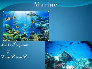
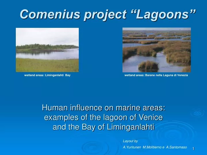
Human influence on marine areas: examples of the lagoon of Venice and the Bay of Liminganlahti. Comenius project “Lagoons”. wetland areas: Liminganlahti Bay. wetland areas: Barene nella Laguna di Venezia. Layout by A.Yuntunen M.Molitierno e A.Santomaso. Contents:. Lagoon ecosystem

E N D
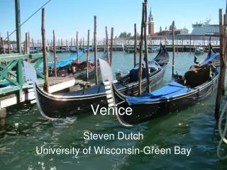
Human influence on marine areas:examples of the lagoon of Venice and the Bay of Liminganlahti Comenius project “Lagoons” wetland areas: Liminganlahti Bay wetland areas: Barene nella Laguna di Venezia Layout by A.Yuntunen M.Molitierno e A.Santomaso
Contents: • Lagoon ecosystem • Lagoon Environment • Lagoon drainage basin • Water pollution • Pollution prevention • Morphological degrade • Nature Conservation • High tide
The Ecosystem Of Venice Lagoon Federica , Arttu and Taavetti
Ecosystem: • It is a complex formed by a specific physical part (air, water and soil) which is called "biotopo" and a living part (vegetables and animals) called "biocenosi", united in many ways. Its characteristics are: • Complexity of the relations • Equilibrium in the time (it means that the number of the organisms remains always the same in the time) • Dependence by the natural and artificial environment If you modify the environment or you change something in the complex relations, the total ecosystem will be affected.
Lagoon Ecosystem • About 78% of the lagoon surface is covered by great expanses of water which are cut by a dense network of channels of varying depth. • Of the 550 square kilometres of lagoon, 420 square kilometres are open to the tides of the Upper Adriatic; which is the highest in all of the Mediterranian. • There are 3 inlets to the lagoon: Lido, Malamocco and Chioggia. • Fresh water for the lagoon comes from the territory of the drainage basin.
Lagoon Ecosystem • The lagoon is a place where the land and sea meet. The lagoon is changing its farm all the time because of the changing equilibrium between the siltingup and the erosion. • Sediments from the river are floating to the lagoon and are blocking the sea currents and at the same time sea currents are removing the sediments away from the lagoon. • Sea currents and river sediments both are very important parts of lagoon ecosystem and they must be in equilibrium. • If there are more sea currents than river sediments the lagoon changes to sea. If there are more sediments from the river, the lagoon changes to land.
Lagoon Ecosystem "Opponesi elemento a elemento" (element opposes element). This is how Bernardo Trevisan described the nature around the lagoon of Venice in 1715, considering it as a transition enviroment between land and sea. In this way the lagoon of Venice is no different from other lagoons, but still it is the last of a series of lagoons which once ran along the Upper Adriatic from Ravenna to Monfalcone. It's also the place where one of the greatest cities in history remained powerful for centuries. In this latter respect, the lagoon of Venice is not just the fruit of spontaneous evolution, but a natural environment which has been defended artificially since the 14° century by the continual and incessant interventions of man.
Lagoon environments Lasse, Brando and Irene
Lagoon environments Shoals: • Salt marshes perform some fundamental functions for the lagoon equilibrium, acting as breakwaters cushioning wave motion and inducing considerable benefits form the hydrodynamics in the lagoon. • In fact, they determine the course of the water currents during the ebb and flow of the tide. • Finally, salt marshes are an ideal habitat for halophytic vegetation, which acts as a purifying element of the water.
Lagoon environment • Salt marshes, together with mud flats and shallows, are part of the most characteristic and fragile environments of the lagoon ecosystem. • Their surface areas vary according to the quantities of silt, sand and other sediments that are washed away or accumulated. • If there is no longer an equilibrium between accumulation and erosion, the salt marshes will disappear. • For more than a century this equilibrium has been in danger. In the last decades, the total area of salt marshes has decreased from 72 km² to 47.5 km².
Lagoon inlets Lagoon environment The tide flows in and out of the lagoon through the lagoon inlets. For the most part, the propagation of tides within the lagoon is influenced by shape of the lagoon basin: its shape is determined by the depth and routes of the channels, the depth and expanse of the lagoon, and the nature of the lagoon bed. The lagoon inlets are the openings along the coastline where lagoon water is in continual contact with sea water. In the past, there were more inlets, Today, there are three inlets defined by jetties: in the north, the Lido inlet; in the centre, the Malamacco inlet; and in the south, the Chioggia inlet. The maximum tidal water volume of all three of the inlets is 20,000 m³ of water per second; 350 million m³ of water are exchanged during spring tide and 175 million m³ of water are exchanged during neap tide. At Malamacco, the inlet in which the greatest volume of water moves, the maximum tidal volume during spring tide cycles is 8,000 m³ a second.
Coastlines Lagoon environment • In recent times, beaches along the littorals have suffered serious erosion and dune areas have for the most part disappeared owning to the extensive development of the territory. The Venetian coast, which runs from the Sile river to the Brenta river, is currently made up of four stretches: Cavallino, Lido, Pellestrina and Sottomarina. These stretches are divided by the three lagoon inlets. The littoral strips are unstable stretches of earth that separate the lagoon from the sea. They are subject to evolutionary processes which modify their physical structure and appearance; these processes can be destructive (erosion caused by currents and wave motion) or constructive (the replenishing of beaches with new sand). The overall coast is 46.6 km long and covers an area of 58 km².
Lagoon drainage basin Marco C. , Anna J. , Maria K. and Stefania
The drainage basin is all the region that gives the water, collected in rivers or in underground water, to the lagoon of Venice. The problems of the lagoon of Venice are highly connected with the human presence in the drainage basin. This big area (1800 km²)is very crowed: towns, village, agricultural activities and factories are spread fill almost all over the region.
The drainage basin is very large and belougs to 3 provinces: 52% of it is in the province of Venice, 40% is in the province of Padova and 9% in the province of Treviso. In total there are 101 commons. • The area is full of rivers. From the north: Piave, Sile, Zero, Dese, Marzenego, Muson, Brenta. Many of them have been diverted from the lagoon since the 15th century, to avaid the apport of sediments and the disappearing of the lagoon. • There are still 29 outlets into the lagoon from the drainage systems and the industrial purification plants. • All parts of drainage basin produces pollution which is the sum of all the activities within it (es. Industry and agriculture)
AGRICOLTURE: Agricultural area covers 1100 km². Production is very high in this area. The farmers use pesticides and nutrients. Which can watch into the rivers or contaminate the water-bearing stratum. There are 2500 factories and 160 000 people work there. The factories are concentrated in Marghera (big area in the lagoon) and also spread in all the region. Ferlack of technical expedients these factories are responsible for the pollution that goes direct into the lagoon across hydro-graphical net. • FACTORIES: • URBAN AREAS: There live 1.400.000 people. They live some in big villages and towns (for example Treviso, S.Donà, Padova) and also in the country.
INDUSTRIAL POLLUTION • Between 1950 and 1970, without specific legislative controls and with a fast industrial development, the port systems of Marghera (chemical, iron and steel works and refineries of petrol ) drained their waste into partly the lagoon and partly into dumps. • The situation was improved in the1980s, with the constructions of purification plants which are the 80% of the industrial drainages of Marghera and Mestre. The effect of industrial pollutants dumped in the past, still remains as you can see in the map.
Nitrogen 53% Agriculture31% Office-habitant-school8% Industry8% OtherPhosphor39% Office-habitant-school38% For animal8% Agriculture8% Industry AGRICULTURE POLLUTION Agriculture is responsible for many nutrients in the lagoon; some others derives from other human activities. URBAN POLLUTION The water pollution in historic centre of the lagoon caused by tourism and the people who live in Venice and throw their garbage to the lagoon. There was no controlling how much waste was coming from the houses through the waste pipes.
POLLUTION FROM OLD DUMPS There are 17 abandoned dumps and 5.000.000 cubic metres of waste material in the lagoon. Some of the dumps where used until 1960s without control. Rains and tides contributed to the diffusion of material and pollutant substances into the lagoon. Dangerous for swimming!
Pollution Prevention Maija, Niina, Carlo and Marco
POLLUTION PREVENTION • In order to reduce pollution in the lagoon, some different interventions are necessary: • To intercept and purify pollutants loads coming from the drainage basin, and from the industrial areas at the edge of the lagoon or even within it. • To insulate the refuse, to avoid the pollution coming from abandoned dumps. • To clean us polluted areas of the lagoon bed, as the industrial channels. • To eliminate the risk of an ecological disaster caused by oil (tanker traffic). • To avoid excessive changing of the environment, like the use of bright lamps in the channels.
1-REDUCTION OF POLLUTANT LOADS COMING FROM THE DRAINAGE BASIN • A lot more parts of urban areas have been connected to the purification plants; in many of them phyto purification plants have been built. • The region works to obtain the reduction of the use of nutriments and pesticides in agriculture. Many agricultural areas have been diverted from agriculture and covered with forest or at least planted with trees at the edge of the fields, to intercept nutriments from the water.
2-SECURITY INTERVENTIONS FOR DUMPS • In the area lagoon there are many dumps. • In order to avoid the water pollution from dumps there have been same interventions; which have isolated the deposited materials avoiding the contamination in the water: • Sides and bottom waterproofing • Biogas collection • Topsoil and vegetation • Protection from waves At the end, it is possible to reconvert the areas of the dumps for public use.
3-CLEANING UP THE INDUSTRIAL CANAL 30% of mud of the Rii of Venice and 50 % of mud of the inner channels of Marghera are full of dangerous substances. In order to eliminate these pollutant substances from the bottom of the channel interventions for selected removal of 500000 cubic metres of polluted sediments were carried out in this area. All mud drained into dumps was dehydrated first in appropriate plants (and carried to special deposit destinations classified).
4-DISTANCING OIL -TANKER TRAFFIC The slips full of petrol are dangerous for the lagoon. Because they can lose it in the water in case of accident. Since the morphology of the lagoon and the slow changing of the water, the risk of an ecological disaster is enormous. The hypothesis traced in the plan of 1992 is to move the oil-tanker traffic from Venice to Trieste, in order to defend the lagoon. To bring back the oil to Marghera there can be used other means (for example underground pipelines, or train transport). - risks connected to oil-tanker traffic - distancing oil-tanker traffic from the intervention areas.
5-NAVIGATION PATH To permit the ships to enter the lagoon during the night or in case of fog, there have been placed 300 bright lamps on both sides of the oil-tanker channel for a total of 15 km, so changing the environment. It is proposed to choose another way to bring the petrol to Marghera, the ships could go to Trieste.
Morphological degradation Toni , Cinzia and Alessandro O.
The lagoon loses every year approximately 1.100.000 m³ of solid materials; with this rhythm of erosion shoals and marshlands will disappear in 50 years. • The lagoon loses its shape and stretches into a flat configuration in which the current of the tides can expand in a uniform way.
THE LAGOON LOSES 1100000 m³ OF SOLID MATERIALS EVERY YEAR: • 30.000 m³ of the sediments come from the entrance of the rivers. • 70.000 m³ of the sediments come from the erosion of salt marshes. • 2.100.000 m³ sediments derive from the re-suspension of the lagoon bed sediments. • 700.000 m³ of the sediments are go out through the port mouths. • 400.000 m³ of the dredged sediments are re-deposited in the lagoon for the reconstruction of marshlands and mudflats. • 1.100.000 m³ of sediments flow into the lagoon and canals
THE LAGOON LOSES ITS SHAPE Causes: • Wave motion is caused by currents, winds and motor vessels. Waves increase the erosion process of salt marshes and islands. • Silt, sand and others solid material no longer reach the lagoon and deposit on lagoon beds. • Loss of sands (the digging out of big artificial channels has quickened the erosion process) • Eelgrass disappearing: The pollution and the consequent disappearing of the eelgrass put to risk the vegetation of marshlands, diminishing their enrichment of organic matter in the underwater land). • Some fishing techniques have a divesting effect on lagoon beds, turning them into barren areas.
CONSEQUENCES • Erosion of salt marshes • Flattening of marshland • Disappearance of vegetation • At the end (50 years) transformation of the lagoon into a flat inner sea
Actions to avoid morphological degradation: • Channel dredging and reconstruction of mud flats and salt marshes • Re-naturalising of reclaimed areas • Restoration of the lagoon bed • Re-opening of fish farms • Protection plan for salt marshes • Macro algae harvesting • Restoration of minor islands
Channel dredging and reconstruction of mud flats and salt marshes New elements of the landscape have thus been created, compensating for those that have disappeared. With the dredged sediment, 400 hectares of salt marshes and mud flats were created. 2. Re-naturalising of reclaimed areas A total of over 10 km have been dredged in four channels and three tidal creeks have been created (1,3 km). The material dredged during channel restoration was used in the construction of nine salt marshes and an artificial island.
3. Restoration of the lagoon bed Palude Della Rosa is a typical transition environment between mainland and the sea protected from human influence. 4. Re-opening of fish farms Valle Figheri is a fish farm that was chosen as an experimental field to assess the environmental and productive effects involved in a systematic opening of all fish farms. The fishery was divided into two parts: one part remained closed, the other part, is open and regulated by gate.
Protection plan for salt marshes Both replenishing techniques and the construction of faggots are used to restore salt marshes. Replenishing consists of extracting limited amounts of sand from shallows or nearby channels. The sand is then sprayed over the surface of a salt marsh. 6. Macro algae harvesting Many times a year the macro algae has been collected and used for the agriculture and for making paper.
7. Restoration of minor islands The restoration of minor islands can be broken down into two different categories: on the one hand morphological restoration, and on the other, architectural and functional interventions.
High tide Laura B. , Michele and Joni
THE PROBLEM OF HIGH TIDE • The objective of the legislation to safeguard Venice is to guarantee the complete defence of all built-up areas in the lagoon from high waters of all levels, including extreme events. Ever more frequently, Venice, Chioggia and other historic towns and villages in the lagoon are flooded with water and the lowest lying zones - usually the oldest and most valuable - are now flooded almost daily, particularly during the winter. • The risk of an event representing a danger to the city, such as that of 1966, is ever greater. To protect cities and towns in the lagoon, a solution safeguarding them not just from "exceptional" tides, but also from the most frequent flooding had to be identified.
Subsidence in the lagoon area is caused by two factors: one natural and one induced by man. The natural process is not constant in time and space: the average rate of natural lowering in the Venice area and its hinterland at the beginning of the century was about 0.4 mm per year. • Overall, in this century natural subsidence has been 4 cm. The man-induced factor above all is made up of the exploiting of underground liquid resources for industrial uses, beginning in the 30's. • The tapping of the underground water supply caused a reduction in pressure in the subsoil and, therefore, a contraction of the ground itself, with consequent lowering.
THE ACTIONS TO SAVE THE LAGOON • Local protection is obtained by raising the lowest lying parts of urban areas by means of complex measures including the raising and structural consolidation of quay-sides, embankments and public paved areas; protection of ground floor property and rear-lying private and public areas such as courtyards and gardens from flooding and reorganisation and adaptation of the network of underground infrastructure and the drainage system to avoid flow-back through drains. • However, raising has precise limits beyond which it is impossible to proceed. Local protection is thus integrated with the mobile barriers, capable of temporarily isolating the lagoon from the sea and blocking the flow of the highest tides. • To oppose deterioration of banks, canal walls and quay-sides in the lagoon and inhabited areas, long section of these structures (that have either deteriorated or are too low in relation to the water level) have been consolidated and at times restructured. Defence from high waters: intervention areas (works completed and underway)
Mo.S.E PROJECT The mobile flood barriers are made up of lines of flap-gates built into the inlet canal beds. They are "mobile" because in normal tide conditions they are full of water and lie flat in their housings built into the inlet canal bed. Each oscillating buoyant floodgate consists of a box-shaped metal 'flap' attached to its housing by two hinges. A gate is 20 m wide and varies in height (20-30 m) and thickness (4-5 m) depending on the depth of the inlet. The floodgates at rest are "folded-away" into their housings buried at the bottom of the lagoon inlets. The housing consists of prefabricated concrete caissons which are dug into the lagoon bed so that they do not appear above the floor of the bed. The housing also contains the service tunnels and machinery. Section and simulation of a floodgate in the three phases: at rest, intermediate, in action.
When they are at rest, the floodgates are full of water and lie in special housings dug into the inlet canal bed. When a tide exceeding +100 cm is expected, compressed air is pumped into the gates. This empties them of water and make them rise, until they emerge above sea level and block the flow of the tide. Undulating with wave motion, the line of floodgates temporarily divides the lagoon From the sea. Small boats can come back into the lagoon through the haven. All the machinery for the management and monitoring of operations is housed in buildings at the side of inlet canal. When the tide ebbs and the lagoon and the sea reach the same level, the floodgates are once again filled with water and return to their housings on the canal bed.