Download
1 / 41
420 likes | 510 Views
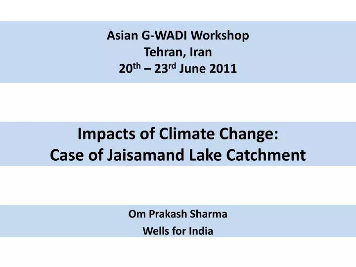
Asian G-WADI Workshop Tehran, Iran 20 th – 23 rd June 2011. Impacts of Climate Change: Case of Jaisamand Lake Catchment. Om Prakash Sharma Wells for India. Completed 23 years of working in Rajasthan, India. 11 Semi Arid and Arid districts of Rajasthan.

E N D
Asian G-WADI Workshop Tehran, Iran 20th – 23rd June 2011 Impacts of Climate Change: Case of Jaisamand Lake Catchment Om Prakash Sharma Wells for India
Completed 23 years of working in Rajasthan, India 11 Semi Arid and Arid districts of Rajasthan 24 Non Governmental Organizations – NGOs partner agency Over 23 years we have worked in more than 900 villages of Rajasthan, India
Drylands are inhabited by approximately 2 billion people globally accounting for nearly 40% of the world’s population.
Wells for India supporting Rainwater Harvesting, Livelihood Enhancement, Women Empowerment, Health and Education Projects Emergency Responses ( Drought, Flood and Earthquake)
Challenges 63 million people, 75 % population is rural, High population growth rate, 61 % of the land area is sandy desert. Rainfall 100 mm to less than 400 mm. Summer temperature may be high as 49 to 50 deg. Semi arid region – rainfall 500 to 650 mm. Approximately, 40% of Rajasthan (eastern part) is occupied by hard rock. Limited fresh water zones. Women suffers a most, walk 8 – 10 Km daily. Underground salinity and high level of fluoride. Due to surface water scarcity there is a large dependency on groundwater yet recharge characteristics are poorly understood. Rajasthan has a strong tradition of water harvesting Low Literacy rate of the state is, in desert and semi desert areas, Female: 44 4% Recurrent drought Water, food and Fodder shortage. Distress Migration is common.
G-WADI Pilot Basin : Jaisamand Lake Catchment
Legend WATER BODIES GANGESHWAR WATERSHED DHARIAWAD BLOCK GIRWA BLOCK SALUMBAR BLOCK SARADA BLOCK VALLABHNAGAR BLOCK BARISADRI (CHITTOR) BLOCK DUNGLA (CHITTOR) BLOCK Jaisamand Lake Catchment Jaisamand Lake
The Lake was originally created in the early 18th century to enhance the conservation of wildlife. Jaisamand Lake with a gross capacity of 414.6 Mm3 and live storage of 296.14 Mm3, is the Asia’s second largest artificial water storage reservoir. The gross basin area up to the Jaisamand dam site is 1787 km2
Main features of Jaisamand Lake Catchment Ground elevations ranges between 300 m to 650 m above mean sea level. Mean Rainfall 650 mm. Falls during months of June – September (94%) and typically as several intense storms and light showers The rainfall is spread over a period of about 20-30 days The rocks form part of the ArchaeanAravalli and Delhi Super group – a complex series of highly metamorphic igneous, volcanic and sedimentary rocks. These are weathered along joints and fractures to form an overlying regolith aquifer of varying thickness. Out of total Lake Catchment area only 27 % is cultivable area and rest 57 % is under no arable, 19 % is under forest land and just 7 % is under pasture land. Wells are the major source of irrigation covering more than ¾ of the total irrigated area Maize, Wheat, Gram and Mustard are the major crops grown in the area The Lake Catchment area is composed of 5 main “blocks” with 419 villages. The basin is predominantly inhabited by tribal communities and some 30% currently live below the poverty line.
Main issues Lack of sustainable food and fodder security system and non-availability of non-farm based economic activity, problems of tribal living in the catchment gets aggravated during droughts there are main issues relating to people and livelihoods in this area where the improved scientific knowledge and understanding around water can provide lasting benefit; Related to water resources there is a need for more (and more reliable) hydrological and environmental data, There are also important management issues relating to water resources and capacity development. Traditional methods of rainwater harvesting are an important factor in management in the basin.
Climate Change / Variability • RAINFALL • TEMPRATURE • WIND VELOCITY AND DIRECTION • HUMIDITY • ATMOSPHARIC PARAMETERS
The analysis of rainfall data in drylands indicates that drought occurs once in every 2 to 3 years which is leading to promotion of the idea of transportation of water from large distances and completely neglecting the need to improve the responses of small scale water harvesting systems. Poor families living in drylands are already struggling to cope with the changing and unpredictable weather pattern and this will be worsened by climate change / variability. According to the Indian Institute of Tropical Meteorology, Pune, rainfall has been increasing in the Rajasthan desert since 1973, though marginally. What has also made a difference is the decreasing rain spells, not just in Rajasthan but in Punjab and Gujarat. As a result, the intensity of showers is greater. Less rainfall and longer dry spells mean soil water conservation measures may fail to increase soil moisture sufficiently for crops. Ground water recharge may reduce if infiltration decreases. Ponds, tanks and reservoirs may not fill up enough to support agriculture and drinking demand. Or many may be at risk of damage from more floods. Larger, more intense floods could also cause catastrophic large dam failures.
Climate Change and Adaptations • TRADITIONAL WATER HARNESSING SYSTEMS • MIXED FARMING SYSTEM • MIGRATION
Wells for India work – a beginning Developed a simple scientific monitoring system to gauge the impact of water harvesting works. Regular monitoring of water level data in wells, crops production, income etc. by local villagers (initial training to village people given by NGO partners)
Local village youth measuring the rainfall in Savana Watershed Local village youth measuring the rainfall in Savana Watershed Local village youth measuring the rainfall in Savana Watershed
Measurement of water levels in open wells by village youth in Savana Watershed
Estimates of groundwater recharge within the Gangeshwar Watershed were determined using Chloride Mass Balance.. Recharge rates estimates in the Gangeshwar ranged from 1.1 to 49.6 mm/yr All of the recharge rates calculated within the Gangeshwar are under 10% of the total annual rainfall and coincide with other recharge rates from Rajasthan
Need for Adapting Water Harvesting / Management to Climatic Change / Variability A. Revisit water storage options B. Manage water demand C. Increase water productivity D. Transform water governance
With the UNESCO-GWADI initiative in the lake catchment, the overall understanding of the hydrological aspects has been enhanced. The initiative has motivated Wells for India and partner organizations staff to consider the issues in a more logical way and to use scientific information within the society. The water level monitoring for last 6 years has led to an increase in the awareness of local youth in the villages to see the significant inter annual changes. Along with this there has been a growing awareness of the impacts of small water harvesting works on local surroundings. Other scientific monitoring such as infiltration test, geological surveys and stream gauging has involved the local villagers and helped them in broadening their outlook and understanding of the natural environment. It has been impressive to record that the local communities became enthusiastically involved in all the survey work Some effort was made to explain what was being carried out in simple language and to have good discussion Wells for India and its partners have adopted some simplification of scientific monitoring systems so that many of the tasks can be understood and possibly carried out by the local community who actually are the main beneficiary of all works.