Download

1 / 19
190 likes | 293 Views
Shared Knowledge for Decision-Making on Environment and Health Issues in the Arctic. Nancy G. Maynard, Ph.D. Associate Director, Environment & Health NASA Goddard Space Flight Center Boris S. Yurchak, Ph.D. Senior Research Scientist, Goddard Earth Sciences & Technology Center

E N D
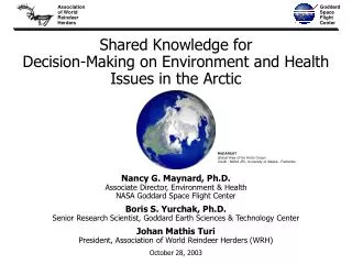
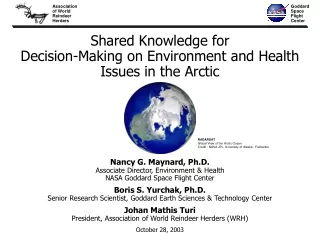
Shared Knowledge for Decision-Making on Environment and Health Issues in the Arctic Nancy G. Maynard, Ph.D. Associate Director, Environment & Health NASA Goddard Space Flight Center Boris S. Yurchak, Ph.D. Senior Research Scientist, Goddard Earth Sciences & Technology Center Johan Mathis Turi President, Association of World Reindeer Herders (WRH) October 28, 2003 RADARSAT Global View of the Arctic Ocean Credit : NASA JPL, University of Alaska - Fairbanks
“…to promote a new kind of science where traditional knowledge is integrated into the management of the natural environment in the Arctic.” Johan Mathis Turi President, Association of World Reindeer Herders 2002
Outline of Talk • Integrating Traditional Knowledge into the Management of the Natural Environment in the Arctic • The Issue • Primary Factors Impacting Health of Indigenous Peoples of the North • What is “Reindeer Mapper” (RM) • Why NASA • The RM System for Shared Knowledge for Decision-making • Reindeer Mapper Project – Status
The Issue • Drastic changes in the economy, climate and environment creating critical situations in reindeer husbandry • The health and well-being of indigenous peoples (reindeer herders) of the Russian North are directly dependent upon the state of reindeer husbandry • Social: Economic & Cultural Impacts – Reindeer Herders • Health Care Problems: Lack of access to healthcare and other services (country economics) • Climate/Environment Impact – Reindeer and Herders • Changes in snow/ice cover/permafrost/freeze-thaw and availability/quality of pastures and forage; interrupted migration routes; increased insect harassment • Loss of pasture land due to industrial developments (e.g. oil and gas pipelines) • Contamination of pastures, snow, ground, lakes, river waters (mining, pollution) • Increasing number of predators • Education Issues • Lack of access to education/schools/materials for reindeer herders’ children so that they can remain with family/herders but still obtain education (policies, resources)
Remote Sensing (RS) Indicators of Human Health Related Problems Caused by Environmental Factors Caused by Social Factors Human Health Human Health • Family • Employment • Habitation • Food • Healthcare • Spare time • Rest Physical Biological Conditions of Life Environmental Factor(s) Social Factor(s) Indicator Phenomena Indicator Phenomena RS Detection RS detection
Main Factors Impacting the Health of Indigenous Peoples of the Russian North Access to Healthcare Health of Indigenous Peoples of Russian North Life Style Diet Style and Social-Culture Behavior VeterinaryServices Reindeer Husbandry state Social-Economic State of People Anthropogenic Factors Forms of Ownership and Management Ecological Factors Climate Change Area of NASA’s possible contribution
What Is ReindeerMapper? Management Support System for Sustainable Reindeer Husbandry Purpose of ReindeerMapper This system is to bring indigenous traditional and local knowledge together with scientific and engineering knowledge, remote sensing and information technologies to address environment, weather, climate, pollution and land use change issues for improved decision making for sustainable reindeer husbandry and as a bottom line - to improve the quality of life of reindeer herders.
Decision Support Making Subsystem (DMSS) Management Support System ”ReindeerMapper” Other related information Remote Sensing Information Traditional Ecological Knowledge GIS Decision Maker
Management Support System “ReindeerMapper“(Remote Sensing Components) • Land observing satellites • Platforms: circular, sun-synchronous orbit • Sensors: multispectral radiometers with middle/high spatial resolution; passive microwave radiometer; synthetic aperture radar • Satellite Telemetry System RS Measurement -GIS - DMSS Information-analytical Educational - Communication system • LEVELS OF REINDEER HUSBANDRY MANAGEMENT • - LOCAL • REGIONAL • FEDERAL Reindeer Husbandry Management
Management Data Gaps for Domesticated Reindeers of Northern Russia • Condition of pastures • Forage stock • Overgrazing • Contamination • Fire scars • Snow cover parameters • Permafrost • State of annual migration pathways • Ice conditions, lakes, rivers, etc. • Anthropogenic disturbances (e.g. oil and gas infrastructure- pipelines, drill sites; oil/contaminants spills; fire scars etc.) • Meteorological conditions • Wild reindeer herds locations
WhyNASA? – Technology Possibilities NASA could provide user-friendly, regularly-updated, remotely sensed, information on a number of critical parameters and changes (to be combined with TK and local information) for more informed herd management: • Depth and characteristics of snow cover in traditional and new migration routes of herds • Condition of ice on rivers and other water bodies in migratory routes • Ecological characterization of traditional summer and winter pastures and annual migration routes – and assessment of their ecological suitability as pasture • Assessment of anthropogenic impacts on migration routes and pasture lands of interest, including environmental contamination and infrastructure development • Detection, monitoring, and status of annual forest fires and associated burned areas in pasture and migration areas of interest • Development of techniques for monitoring favorable conditions for growth of mosquitoes (and other blood-sucking insects) relevant to potential for reindeer harassment and spread of infectious diseases • Seasonal assessment of migratory routes for herds
Satellite & Sensor: Terra- MODIS Example of Fire Detection by MODIS Moderate Resolution Imaging Spectroradiometer (MODIS) composite of western Russia, 4 September 2002 Heat signatures (red) and smoke plumes (light blue haze) are visible from the fires. True-color image by Moderate-resolution Imaging Spectroradiometer (MODIS), resolution 250m. Source: NASA Earth Observatory http://earthobservatory.nasa.gov/NaturalHazards/natural_hazards_v2.php3?img_id=4743 Credit: Image by Jesse Allen, based on data from the MODIS Rapid Response Team at NASA-GSFC
Example of SAR Detection of a Forest Fire Scar ERS-1 SAR scene (08/23/91) of the Bettles region, located about 290 km NNW of Fairbanks. A forest fire scar resulting from a fire in 1990 is visible due to its strong backscatter/bright tone. (Alaska SAR Facility ERS-1 SAR Image Sampler, 2001)
Credit: Eric R. Conrad, Deputy, Field Operations Pennsylvania Department of Environmental Protection
GIS Research Centre, Institute of Geography, Russian Academy of Sciences Goddard Space Flight Center Association of World Reindeer Herders Data Acquisition Reindeer Mapper System Concept Partner Web • Reindeer Herder Data/Knowledge • Remote Sensing/Science and Technology, Data and Information • Other Information/Sources • Reindeer Mapper Team Reindeer Mapper GIS Database Conference “Center” • World Center for Sustainable Reindeer Herding • Teleconferences Data Integration Communication/Outreach Traditional/Local Knowledge/Data Maps/Reports and Analysis NASA/ Remote Sensing Data Knowledge transfer between traditional/ local knowledge and scientific knowledge • Historical • Real Time Arctic Data Archives Arctic Science Institutions
Reindeer Mapper (RM): Initial Steps in Creating a Shared Knowledge System for Decision-Making • Selection of Highest Priority Pilot Project Test Sites • Acquisition of data from all sources (field observations, RS, etc.) • Development of GIS for Pilot Project Test Sites • Integration of information from all RM partners into common GIS • Reindeer Herders • NASA and other remote sensing sources • Other data sources • Adaptation of existing NASA GIS based system which facilitates the sharing the diverse data sets by all participants which also allows real time access and interconnectivity with remote sites • Develop data base and archive for current and historical data, observations, and knowledge for parameters of interest
For further information: Dr. Nancy G. Maynard Associate Director NASA Goddard Space Flight Center Mail Code 900 Greenbelt, MD 20771 Tel: (301) 614-6572 email: Nancy.G. Maynard@nasa.gov Dr. Boris Yurchak Senior Research ScientistGoddard Earth Sciences & Technology Center (GEST), Mail Code 900 NASA Goddard Space Flight CenterGreenbelt, MD 20771 USATel:(301) 614-5898 email: boris_yurchak@hotmail.com Johan Mathis Turi,President Association of World Reindeer Herders Gronnegata 23 P.O. Box 508 N-9255 Tromsø, Norway Tel: +47 77 656 400 email: wrh.jmt@online.no RADARSAT Global View of the Arctic Ocean Credit : NASA JPL, University of Alaska - Fairbanks