Download
1 / 23
230 likes | 349 Views
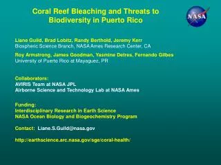
Imaging Spectroscopy and Field Data in Support of Coral Reef Ecosystem Biodiversity Research in Puerto Rico. Liane Guild, Brad Lobitz, Randy Berthold, Jeremy Kerr Biospheric Science Branch, NASA Ames Research Center, CA

E N D
Imaging Spectroscopy and Field Data in Support of Coral Reef Ecosystem Biodiversity Research in Puerto Rico Liane Guild, Brad Lobitz, Randy Berthold, Jeremy Kerr Biospheric Science Branch, NASA Ames Research Center, CA Roy Armstrong, James Goodman, Juan Torres, Yasmin Detres, Fernando Gilbes, Stacey Williams University of Puerto Rico at Mayaguez, PR Collaborators: AVIRIS Team at NASA JPL Airborne Sensor Facility at NASA Ames Fireball Information Technologies Funding: NASA Interdisciplinary Research in Earth Science NASA Ocean Biology and Biogeochemistry Program Contact: Liane.S.Guild@nasa.gov http://earthscience.arc.nasa.gov/sge/coral-health/
Science Objectives • Use NASA’s 2005 AVIRIS imagery over La Parguera, PR to map coral reef benthic types and variability • Establish permanent reef monitoring transects to track change annually • Quantify biodiversity at patch reef transect sites from field measurements to assess the ecosystem state following the 2005 coral bleaching event in Southwestern Puerto Rico • Hurricane Dean in August 2007 • Improve the interpretation of reef habitat variability and biodiversity from airborne imaging spectroscopy (hyperspectral) data
NASA Airborne Missions of Coral Reefs Using AVIRIS and DCS • AVIRIS (Airborne Visible Infrared Imaging Spectrometer): • Operated by NASA Jet Propulsion Lab • NASA Wallops Twin Otter • 224 contiguous spectral channels (370-2500 nm) • Visible range: 410-700 nm (31 bands) • 10 nm nominal channel bandwidth • High signal to noise ratio • Altitude: ~ 3.5 km (Twin Otter) • AVIRIS spatial resolution: ~ 3 m (Twin Otter), ~16 m (ER-2 flown at ~14 km) • Cirrus and Kodak DCS(Digital Camera System) on low altitude aircraft • Cirrus: Operated by UC Santa Cruz Airborne Sensor Facility at NASA Ames • Kodak: Operated by NASA Ames and Fireball Information Technologies • Spatial resolution: <1 m
AVIRIS Kodak DCS Imagery of San Cristobal, La Parguera 3 m resolution Altitude 3000 ft ~15 cm resolution ETM+ Fire coral ~8 cm resolution ~30 m resolution
Kodak DCS Imagery of Cayo Enrique, La Parguera Altitude 3000 ft ~15 cm resolution ETM+ ~30 m resolution AVIRIS AVIRIS 17 m resolution 3 m resolution
NASA Airborne Mission of the 2005 Caribbean Coral Reef Bleaching Event Using AVIRIS and DCS 0 10km AVIRIS flight lines over La Parguera, PR • December 12-13, 2005 • Twin Otter Platform, Altitude ~3.5 km • Pixel Size ~3 m
Field Measurements • Reef benthic type spectra • Photogrids • GPS • Spectra of calibration targets • Aeronet station – AOD atmospheric correction • Water optical profiler • Upwelling radiance, Lu • Downwelling irradiance, Ed • Surface Ed, Es
Coral Reef Ecosystem Benthic Types Coral Rubble Acropora cervicornis Acropora palmata Montastraea annularis Siderastrea siderea Porites spp. Dictyota spp. Thalassia testudinum Gorgonians
AVIRIS Dec. 2005 (3 m Resolution) Mosaic of La Parguera, PR 0 10km
LiDAR Bathymetry and Field Measurement Locations >10m < 2m • Airborne data collection 2006 • Bathymetry 50m • 4m spatial resolution
J. Goodman (UPRM) Raw AVIRIS Imagery Image Geometry Explicit pixel by pixel subsurface angles Illumination (solar) View (AVIRIS) 2005 AVIRIS: Preprocessing and Inversion Model Image Preprocessing Correct Stray Light Anomaly Hedley Glint Removal Tafkaa Atmospheric Correction Inversion Output Water Properties Spectral Input Parameters Aquatic Absorption Properties Generic Bottom Reflectance Inversion Model Bathymetry Bottom Albedo (550 nm)
J. Goodman (UPRM) Preprocessed AVIRIS Imagery Inversion Output Water Properties Bathymetry Spectral Input Parameters Aquatic Absorption Properties Generic Bottom Reflectance Image Geometry Explicit pixel by pixel subsurface angles Illumination (solar) View (AVIRIS) 2005 AVIRIS: Unmixing Model Spectral Endmembers Unmixing Output Benthic Composition Forward Model Sand Unmixing Model Coral Algae/ Seagrass
Preprocessed AVIRIS Imagery Spectral Endmembers 2005 AVIRIS: Hydrolight Water-column Correction Water-column corrected and unmixed spectra for sand locations Table of benthic spectra at depths Hydrolight RT Modeling Table Lookup Sand locations at depths • Input Parameters • Minerals, chl-a, CDOM • Depth • Sand, coral, SAV mixed spectra
Coral, sand, SAV Fraction Imagery Sand Benthic Composition Coral Algae/ Seagrass Hydrolight Water-column Correction (cont.) Spectral Endmembers Preprocessed AVIRIS Imagery Water-column corrected AVIRIS Imagery Linear transform Linear unmixing • Input Parameters • Water-column corrected and unmixed spectra for sand locations • Depth • Sand, coral, SAV mixed spectra
2005 AVIRIS: From Imagery to Information Sand Coral Algae/ Seagrass Preprocessed AVIRIS Image 0 100m Inversion and Unmixing Hydrolight transformation and ENVI unmixing
2005 AVIRIS: From Imagery to Information Sand Coral Algae/ Seagrass San Cristobal Reef Hydrolight transformation and ENVI unmixing
2005 AVIRIS: From Imagery to Information Sand Enrique Reef Hydrolight transformation and ENVI unmixing Coral Algae/ Seagrass
2005 AVIRIS: From Imagery to Information Media Luna Reef Hydrolight transformation and ENVI unmixing Sand Coral Algae/ Seagrass
Acropora cervicornis (staghorn coral) Transects 2004-2007 2006 2005 2004 2007 2008 2009
Reef Bottom Type Biodiversity (Percent Cover) Coral Point Count with Excel Extensions (CPCe)
Reef Bottom Type Biodiversity (Percent Cover) • Coral and gorgonian cover was not significantly different from 2007 to 2009 • Sponge cover has increased • Macroalgae increased in 2008 then decreased in 2009 • Sand cover decreased from 2007 to 2008 and 2009 level • Recovery possibly beginning in benthic communities at some sites • Results are similar to other studies following disturbances in coral reefs • Need at least two more years of monitoring to confirm occurrence of recovery
Summary and Next Steps • Spectral unmixing • Generalized spectral categories (coral, sand, and SAV) used as inputs to the models still allowed for detailed output of fractional cover (e.g., coral, sand, SAV ecological zones) • Traditional classification over simplifies what is on the bottom • Spectral unmixing provides details of fractional cover of bottom types on a per pixel basis • Effect of water column apparent in the unmixing output? • Biodiversity analysis, based on percent cover within photogrids acquired in 2007-2009, showed recovery possibly beginning in benthic communities at some sites • Macroalgae dominated sites • Complete photogrid analysis for other patch reefs and relate 2005 transects with 2005 AVIRIS unmixing output • Complete assessment of changes in biodiversity, perhaps related to recovery from 2005 bleaching event and 2007 hurricane • Utility for high spatial and spectral data (airborne hyperspectral) for studies of shallow ecosystems http://earthscience.arc.nasa.gov/sge/coral-health/