Download
1 / 36
390 likes | 823 Views
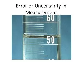
Lecture 13 Error and uncertainty. Outline terminology, types and sources why is it important? handling error and uncertainty. Introduction. GIS, great tool but what about error? data quality, error and uncertainty? error propagation? confidence in GIS outputs? NCGIA Initiative I- 1

E N D
Lecture 13Error and uncertainty • Outline • terminology, types and sources • why is it important? • handling error and uncertainty GEOG2750 – Earth Observation and GIS of the Physical Environment
Introduction • GIS, great tool but what about error? • data quality, error and uncertainty? • error propagation? • confidence in GIS outputs? • NCGIA Initiative I-1 • major research initiative? • dropped because too hard? • Be careful, be aware, be upfront... GEOG2750 – Earth Observation and GIS of the Physical Environment
Terminology • Various (often confused terms) in use: • error • uncertainty • accuracy • precision • data quality GEOG2750 – Earth Observation and GIS of the Physical Environment
Error and uncertainty • Error • wrong or mistaken • degree of inaccuracy in a calculation • e.g. 2% error • Uncertainty • lack of knowledge about level of error • unreliable GEOG2750 – Earth Observation and GIS of the Physical Environment
4 YO! Accuracy vs. Precision Inaccurate Accurate 1 2 Imprecise 3 4 Precise GEOG2750 – Earth Observation and GIS of the Physical Environment
Question… • What does accuracy and precision mean for GIS co-ordinate systems? GEOG2750 – Earth Observation and GIS of the Physical Environment
Quality • Data quality • degree of excellence • general term for how good the data is • takes all other definitions into account • error • uncertainty • precision • accuracy GEOG2750 – Earth Observation and GIS of the Physical Environment
Types and sources of error • Group 1 - obvious sources: • age of data and areal coverage • map scale and density of observations • Group 2 - variation and measurement: • positional error • attribute uncertainty • generalisation • Group 3 - processing errors: • numerical computing errors • faulty topological analyses • interpolation errors GEOG2750 – Earth Observation and GIS of the Physical Environment
Age of data Northallerton circa 1999 Northallerton circa 1867 GEOG2750 – Earth Observation and GIS of the Physical Environment
Global DEM National DEM European DEM Scale of data Local DEM GEOG2750 – Earth Observation and GIS of the Physical Environment
Digitiser error • Manual digitising • significant source of positional error • Source map error • scale related generalisation • line thickness • Operator error • under/overshoot • time related boredom factor GEOG2750 – Earth Observation and GIS of the Physical Environment
Regular shift original digitised GEOG2750 – Earth Observation and GIS of the Physical Environment
Distortion and edge-effects original digitised GEOG2750 – Earth Observation and GIS of the Physical Environment
Systematic and random errors original digitised GEOG2750 – Earth Observation and GIS of the Physical Environment
Obvious and hidden errors original digitised GEOG2750 – Earth Observation and GIS of the Physical Environment
Vector to raster conversion error • coding errors • cell size • majority class • central point • grid orientation • topological mismatch errors • cell size • grid orientation GEOG2750 – Earth Observation and GIS of the Physical Environment
Effects of raster size Fine raster Coarse raster GEOG2750 – Earth Observation and GIS of the Physical Environment
Effects of grid orientation Original Original raster Tilted Shifted GEOG2750 – Earth Observation and GIS of the Physical Environment
Attribute uncertainty • Uncertainty regarding characteristics (descriptors, attributes, etc.) of geographical entities • Types: • imprecise (numeric) or vague (descriptive) • mixed up • plain wrong! • Sources: • source document • misinterpretation (human error) • database error GEOG2750 – Earth Observation and GIS of the Physical Environment
Imprecise and vague 505.9 500 500-510 238.4 240 230-240 GEOG2750 – Earth Observation and GIS of the Physical Environment
Mixed up 505.9 238.4 238.4 505.9 GEOG2750 – Earth Observation and GIS of the Physical Environment
Just plain wrong...! 505.9 100.3 238.4 982.3 GEOG2750 – Earth Observation and GIS of the Physical Environment
Generalisation • Scale-related cartographic generalisation • simplification of reality by cartographer to meet restrictions of: • map scale and physical size • effective communication and message • can result in: • reduction, alteration, omission and simplification of map elements • passed on to GIS through digitising GEOG2750 – Earth Observation and GIS of the Physical Environment
Cartographic generalisation 1:3M 1:10,000 1:500,000 1:25,000 City of Sapporo, Japan GEOG2750 – Earth Observation and GIS of the Physical Environment
Question… • An appreciation of error and uncertainty is important because… GEOG2750 – Earth Observation and GIS of the Physical Environment
Handling error and uncertainty • Must learn to cope with error and uncertainty in GIS applications • minimise risk of erroneous results • minimise risk to life/property/environment • More research needed: • mathematical models • procedures for handling data error and propagation • empirical investigation of data error and effects • procedures for using output data uncertainty estimates • incorporation as standard GIS tools GEOG2750 – Earth Observation and GIS of the Physical Environment
Question… • What error handling facilities are their in proprietary GIS packages like ArcGIS? GEOG2750 – Earth Observation and GIS of the Physical Environment
Basic error handling • Awareness • knowledge of types, sources and effects • Minimisation • use of best available data • correct choices of data model/method • Communication • to end user! GEOG2750 – Earth Observation and GIS of the Physical Environment
Question… • How can error be communicated to end users? GEOG2750 – Earth Observation and GIS of the Physical Environment
Quantifying error • Sensitivity analyses • Jacknifing • leave-one-out analysis • repeat analysis leaving out one data layer • test for the significance of each data layer • Bootstrapping • Monte Carlo simulation • adds random noise to data layers • Simulates the effect error/uncertainty GEOG2750 – Earth Observation and GIS of the Physical Environment
Conclusions • Many types and sources of error that we need to be aware of • Environmental data is particularly prone because of high spatio-temporal variability • Few GIS tools for handling error and uncertainty… and fewer still in proprietary packages • Need to communicate potential error and uncertainty to end users GEOG2750 – Earth Observation and GIS of the Physical Environment
Practical • Error in off-the-shelf datasets • Task: Assess the error in land cover data • Data: The following datasets are provided for the Leeds area… • Streets and buildings (1:10,000 OS LandLine data) • 25m resolution land cover data (ITE LCM90) GEOG2750 – Earth Observation and GIS of the Physical Environment
Practical • Steps: • Display OS LandLine data over ITE LCM90 data using ArcMap. You can also add the OS 1:50,000 colour raster image and set transparency = 70%. • From your knowledge of the area identify areas of erroneous classification • What might these errors be due to? GEOG2750 – Earth Observation and GIS of the Physical Environment
Learning outcomes • Familiarity with error in classified satellite imagery • Familiarity with ITE land cover map 1990 (LCM90) data • Experience with new GRID functions GEOG2750 – Earth Observation and GIS of the Physical Environment
Useful web links • The Geographer’s Craft – lecture on error • http://www.colorado.edu/geography/gcraft/notes/error/error_f.html • GIGO • http://www.geoplace.com/gw/2000/1000/1000gar.asp • Disaster waiting to happen • http://www.osmose.com/utilities/articles_press_releases/data_quality/ GEOG2750 – Earth Observation and GIS of the Physical Environment
Next week… • Interpolating environmental datasets • creating surfaces from points • interpolation basics • interpolation methods • common problems • Practical: Interpolating surfaces from point data GEOG2750 – Earth Observation and GIS of the Physical Environment