Download
1 / 1
10 likes | 114 Views
Minnesota Interactive Internet Mapping Web Mapping in K-16 Education Steven Manson / Brenda Kayzar. Try MIIM maps.umn.edu. ABSTRACT

E N D
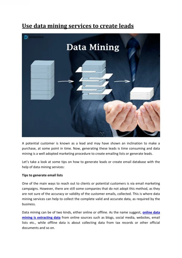
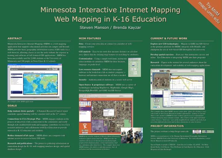
Minnesota Interactive Internet MappingWeb Mapping in K-16 EducationSteven Manson / Brenda Kayzar Try MIIM maps.umn.edu ABSTRACT Minnesota Interactive Internet Mapping (MIIM) is a web-mapping application that supports educational activities on campus and beyond. MIIM provides basic geographic information science (GIS) tools via a web browser, allowing classes to use the tools without the expense in training and software of full featured GIS applications. MIIM has been successfully used by 2,000 students at the University of Minnesota and 300 pupils in Twin Cities K-12 schools. MIIM FEATURES Data - Create your own data or connect to a number of web mapping services. GIS analysis - Easy to use tools that measure distance or calculate area. Query data by clicking map features or searching by attributes. CURRENT & FUTURE WORK Explore new GIS technologies – Migrate to ESRI ArcGIS Server as the primary platform for MIIM, integrate with Moodle, and champion the use of web-based GIS throughout the university. Develop spatial exercises – Exercises that instructors can use and refine. Eco Education is integrating MIIM into their programs. Research – Papers to be written for several audiences about the curriculum development and usability of web mapping applications. Customization - Using a simple web form, instructors select modules to customize MIIM for their location, language, or grade level. Low resource demands - MIIM does not require software to be loaded on a lab or student computer, a browser and internet connection are all that is needed. Security - Authentication of students on a secure web server. Open Source & proprietary software – MIIM uses a variety of technologies including MapServer, Mapbender, Google Maps, PostgreSQL/PostGIS, and ESRI ArcGIS Server . An example of the MIIM application GOALS Help students think spatially – A National Research Council report concludes spatial thinking will be a needed skill in the 21st century. Connections to CLA Strategic Plan – MIIM engages students in the process of discovery with a connection to the community and world through web-enabled field work and mapping; contributes to two CLA research initiatives; and collaborates with Eco Education to provide outreach to K-12 educators and students. Reduce demand of lab space – MIIM allows any computer with internet access to access to basic GIS tools. Research and publications – The project is gathering information on curriculum design for K-16, web mapping interface design, and spatial database design. This example shows how MIIM can use census data. Query by clicking a tract, which links to the Census Bureau for further information. Linking to external data is a key feature of MIIM because it allows quick access to information without managing large amounts of data. The window in the upper left-hand corner shows a “bird’s eye” view of the neighborhood; students can look at an area from different directions and in three dimensions at some locations. PROJECT INFORMATION The project website is http://maps.umn.edu MIIM is a research project of the Human-Environment Geographic Information Science (HEGIS) Lab at the University of Minnesota. For more information, contact Steven Manson at manson@umn.edu. Special thanks to people of HEGIS – Sami Eria & Len Kne; CLA/OIT - Jen Mein, KemalBadur, Josh Buysse, Tony Drollinger & Jude Higdon; Eco Education –Faith Krogstad & Callie Recknagel. MIIM being used by students of Horace Mann Elementary School to explore future land use. MIIM provides the students with access to historical aerial photographs, proposed development plans, census information, land use, and many other data layers. The example shows two MIIM features, the ability to add data (points, lines & polygons) and the measurement of distance.