Download
1 / 13
140 likes | 272 Views
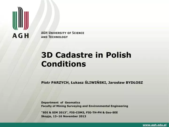
3D Cadastre in Polish Conditions. Piotr PARZYCH, Łukasz ŚLIWIŃSKI, Jarosław BYDŁOSZ. Department of Geomatics Faculty of Mining Surveying and Environmental Engineering “SDI & SIM 2013” , FIG-COM3, FIG-TH-PH & Geo-SEE Skopje, 13–16 November 2013. www.agh.edu.pl. Introduction.

E N D
3D Cadastre in Polish Conditions Piotr PARZYCH, Łukasz ŚLIWIŃSKI, Jarosław BYDŁOSZ Department of Geomatics Faculty of Mining Surveying and Environmental Engineering “SDI & SIM 2013”, FIG-COM3, FIG-TH-PH & Geo-SEE Skopje, 13–16 November 2013 www.agh.edu.pl
Introduction • Looking through the prism of social and economic changes taking place in Poland, we shouldconsider the future role of cadastral information and ideas and directions for further development of cadastral systems. • Such development should primarily follow the spatial changes which occur as a result of the investments and give the opportunity to register the increasingly complicated situations concerning property rights, that are dealt with on the basis of already existing or planned legislation. Moreover, this development should be directed at the use of the collected data to all kinds of social activities in the spirit of spatially active society. • Given the binding legal provisions of Poland and the factual circumstances, we can now speak of a system comprising cadastral information only concerning land parcels, buildings and premises. • This necessitates undertaking modernization activities both on a continuous basis, within the scope of the current update of the ground and building cadastre, as well as in a comprehensive manner. www.agh.edu.pl
Multidimensional Registration of Cadastral Objects • The boundaries of land ownership are regulated differently in the case where, according to the provisions of Art. 143 of the Civil Code, the property extends to the space above and below the surface, within the limits set by the socio-economic zoning. • In turn, according to Art. 191 of the Civil Code, property of immovables extends to movable things, which was connected with the property in such a way that it became a part of it. Therefore, land real estate includes also land with components, with the exception of buildings and premises, if it is a separate property. • Thus, the separation of land as a real estate parcel is conducted in two dimensions - horizontal and vertical. In the first case, the range of ownership is showed in the land and building, by geometric description of the plot boundaries or parcels with flat rectangular coordinates. • The second case is more complicated, because the vertical extent of ownership depends on the socio-economic zoning. • This range is not geometrically defined and only indicates the owner’s right to use the property at the height and depth generally available, limited only by specific provisions.
Restriction Resulting from the Water Law • One of those provisions, which directly indicate the provisions of the Civil Code is the Water Law, particularly in relation to protected zones and areas set up for the purpose of ensuring the quality of water grasped for public supply prescribed for consumption and supply companies that require high-quality water, and due to the protection of water resources. • Within such zones or protected areas prohibition or restrictions apply to any actions which could lead to reduction of water grasped suitability or performance of the shot. • Protection zone is established, by means of local law, by the regional director of the water management board, at the request and expense of the owner of the water intake, indicating injunctions, prohibitions, restrictions and the areas in which they apply.
Restriction Resulting from the Geological and Mining Law • The regulations of Geological and Mining Law are relevant for the purpose of subterranean real estate. These provisions are regulated by the concept of mining ownership, that concerns mineral deposits. This right is granted to the State Treasury. • The current rules, under Art. 125 of the Law on real estate management, also force the owner to reduce the use of property on behalf of a trader using it for prospecting, exploration, extraction of minerals of mining property. • Such a restriction may be made only to a company that has obtained a license to perform such activities, for a period no longer than the term of the concession. Due to restrictions the property owner is to be paid compensation by the entrepreneur. • The provisions of Geological and Mining Law also apply accordingly to construction works in mining or underground tunnelling by means of mining technology.
Restriction Resulting from the Aviation Law On the other hand, in the case of restrictions on use of property of land, the provisions of the Aviation Law are applied. According to them, obstacles to aviation are subject to the notification to the President of the Civil Aviation Authority, in particular: • permanent or temporary building structures and natural objects, or parts thereof, for altitudes exceeding boundary surfaces, as defined in the regulations on the conditions to be met by structures and natural objects in the vicinity of the airport, • structures with height of 100 m or more above the level of the surrounding ground or water, located on Polish territory, including the territorial waters of the Polish Baltic Sea, • building structures and natural objects or parts thereof that are hard to see from the air on the surrounding background because of their colour, location or construction and other building structures and natural land objects or parts thereof located in the inlet zone to the airport and departure, particularly in hilly and mountainous territories, considered aviation obstacles by the competent supervisory authority in military aviation.
The Layered Structure of Ownership of Land • From the analysis of the provisions stated above it follows that the ownership of the property cannot be explicitly limited in the amount or depth and given a geometric features described in the adopted coordinates of the system, as shown in Figure . • In the figure the level of a "traditional" parcel is determined by the altitude coordinate Z0, in turn, coordinate Zn for above ground level and underground level coordinate is respectively designated as Zp.
The Layered Structure of the Adjacent Plots of Land in a Vertical Section
The Multi Layers 3D Cadastre R & D Project • Because of these difficulties registration of spatial objects could then be achieved by splitting the "over" and "under" the surface of the land in spatial objects - the so-called sub- plots. • This solution was proposed in Israel during the project, "The Multi Layers 3D Cadastre R & D Project". In accordance with the principles elaborated then each sub- plot would have to be defined by spatial boundaries and by providing volume figures created by them. In case of linear space this would consist of a few or a few dozen figures in the individual parcels that could be merged into one piece of space within the precincts of the registration. It should be noted that the rectangular projection on the plane of each of the separate sub- plots does not coincide with the lines demarcating the "traditional" plot as it was in the example of the layered structure of the ownership of the land. • The Israeli solution causes primarily a technical problem associated with the registration process of sub-plots because of their complex structure. This solution also takes no notice of the problem of spatial objects whose boundaries do not necessarily have to be defined only in vertical and horizontal directions.
Establishing a Buffer Zone Forming a Sub- Plot and Its Development Thus, rules should be established for determining the shapes of the figures forming the sub-plot, which would be provided within the recorded spatial objects of different shapes. These rules would also have to take into account the limits of sub-plots to be set along the edges of spatial objects or at some distance from them, creating the so-called buffer zone.
Boundaries in 3D –is that possible? • Considering the spatial structure of land ownership, one must take into account the problems related to the activities of geodetic positioning of boundary points that set up sub-plots. • The problem would be a way of obtaining spatial points with the required accuracy. While accepting some principles of generalization, this would be possible for the sub-plots on the ground, in sub-plots below the surface, in most cases, it would be impossible toacquire coordinates by direct measurement. • Thus, against this background it would be difficult to implement procedures for establishing, re-designation, separation or adoption for division of property boundaries. • According to the existing legislation it is not possible; therefore, it would be appropriate to amend the legislation. Such amendments would also introduce a new attribute of spatial plot referring to its volume. Theses would also influence the rules for determining the value of land, which would have to take into account the spatial limitations of plots.
RECAPITULATION • The introduction of multi-dimensional registration of cadastral objects in the Polish reality is difficult and costly. • This requires first of all, after the stage of technical analysis, new legal solutions. • It is certain, however, that the development of the cadastre should be in line with general interests of social and economic life, mainly by balancing the costs of the new cadastral systems to the fitness of the data they collected. • The fulfilment of this rule will depend on the effectiveness of the cadastre, which can be understood as a source of reliable and timely information fully used in all kinds of activities related to spatial and legal processes.
Thank you very much Łukasz Śliwiński, M.Sc. Email: lukasz_sl@poczta.onet.pl County Surveyor Department of Geodesy, Cartography and Cadastre County Office in Ostrowiec Świętokrzyski Poland Dr. Piotr Parzych, Associate Professor Email: parzych@agh.edu.pl Dr. Jarosław Bydłosz Email: bydlosz@agh.edu.pl AGH University of Science and Technology Al. Mickiewicza 30 30-059 Kraków Poland