Download
1 / 51
510 likes | 637 Views
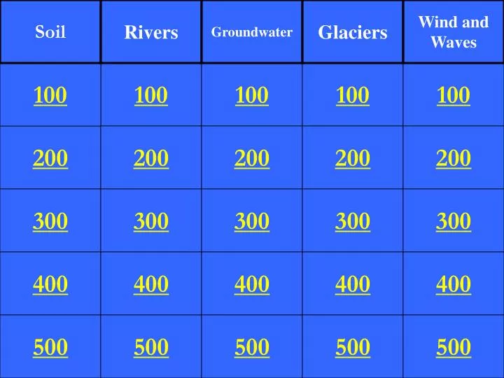
Soil. Rivers. Groundwater. Glaciers. Wind and Waves. 100. 100. 100. 100. 100. 200. 200. 200. 200. 200. 300. 300. 300. 300. 300. 400. 400. 400. 400. 400. 500. 500. 500. 500. 500. The largest soil texture which drains water rapidly is ________. Sand.

E N D
Soil Rivers Groundwater Glaciers Wind and Waves 100 100 100 100 100 200 200 200 200 200 300 300 300 300 300 400 400 400 400 400 500 500 500 500 500
The largest soil texture which drains water rapidly is ________.
The soil texture which is a combination of the other three textures is ________.
Acid precipitation would be an example of which type of weathering?
Weathering is the breaking down of rock into sediment, and erosion means that the sediment has been moved to a different location.
In addition to organic material, rocks, and sediment, soil contains what other two major components?
The high point that separates watersheds is called a ______.
Which river system is responsible for draining most of the United States?
Alluvial fans are river deposits on land, and deltas are river deposits found in water.
A cone-shaped deposit on the ceiling of a cavern is called a _______.
The type of topography in which you find sinkholes, caverns, and disappearing streams is called ________.
The layer below the water table in which the pore space is completely filled with water is the zone of _____.
A layer of in the ground in which water is stored or in which water can easily pass through is called a(n) ______.
When gravity forces groundwater between two impermeable layers so that water rises to the surface, the result is a(n) _____.
Large boulders transported great distances by glaciers are called _____.
A ridge of glacial till deposited by the glacial ice sheet forms a _____.
A round bowl-shaped depression formed where a glacier starts eroding the land is called a _____.
Cirque, Horn, Arete, U-shaped Valley, Roche Moutonees, or Hanging Valley
Till, Moraine, Outwash Plain, Kettle, Esker, Drumlin, or Erratic
The leeward side of a sand dune is (more or less) steep than the windward side.
A crescent-shaped dune with the tips pointing downwind is called a _____ dune.
A dune where sand is plentiful, forming long series of ridges and troughs, and where the wind is blowing across the ridges, forms a _________ dune.